Sunday, July 26, 2020

Paradise Park, Lookout Mt. and Umbrella Falls, Oregon

Well this short trip over to the Mt. Hood area was beautiful, and frustrating/stressful, in equal measures. It's amazing how many things can happen in just three days!

It all started on a Tuesday as I drove over to Timberline Lodge, to ride the PCT south over to Paradise Park. Last year I had tried to do this ride from the Paradise Park Trailhead, but the trail had not been cleared after a big storm, and I was not able to make it the whole way, so this was another option of getting to the same area.

On the PCT looking at Mt. Hood.

For anyone not familiar, Timberline is a ski hill and in late July one would think it would be relatively quiet, with maybe a few hikers cars. Not so much...... I drove into an absolutely packed parking area, as busy as if it were a winter ski day. Which it turns out it was, since they had a chairlift running and were taking people up the mountain with skis and snowboards. I've since learned that this hill has the longest ski season in the country, lasting all summer.

A guy manning a makeshift booth informed me that I would have to pull a U-ey, and try to find parking in the lower lot. I informed him that pulling a U-ey with his booth in the way was not going to work, so he moved his booth. The lower parking area was actually the best place to be since I could just ride from there right onto the nearby slopes. The entire time I was grooming and tacking up, a guy that worked there, was putting packing tape around a box, loud screeching noises that went on and on and on. He was very thorough, not an inch of cardboard was left unscathed.

I started riding towards where I knew the PCT was, but then I encountered what was a first for me, riding a horse under a moving chair lift. My pony actually handled it fairly well, on the way back a slightly different version of events occurred, which I will expand on shortly.

Moving chairlift, a first for my pony.

On the PCT heading south.

On the PCT.

Eventually I switchbacked down into Zigzag Canyon and crossed the river. On the other side, the trail has eroded a lot, so there is a tricky section to navigate, a bit of a rocky narrow catwalk, and then I climbed up to the junction with the Paradise Park Trail. This is the time of year to see the copious amounts of wildflowers, and the trail takes you to a great viewpoint of Mt. Hood. Then I looped back down to the PCT, and returned the same way. There were considerably more people on the trail by this time. A lady who said she had had bad experiences with horses, asked if she could pass me, so I stood there and watched her walk by. I thought if she was nervous, she would give my horse a wide berth, but she went by a millimeter away, and put her hiking poles directly under my horse's body. That might explain some of the bad experiences she has had, but luckily my horse didn't even flinch. I'm not especially looking forward to the day when I have to train a young horse again, to handle all the well meaning hikers lurking uphill behind trees, not speaking, and these days, wearing masks. Nothing phases Rina anymore, when it comes to what people do, she always sees them, and knows what they are.

Zigzag Canyon from above.

Zigzag River in  Zigzag Canyon.

On the trail to Paradise Park.

Getting closer to Mt. Hood.

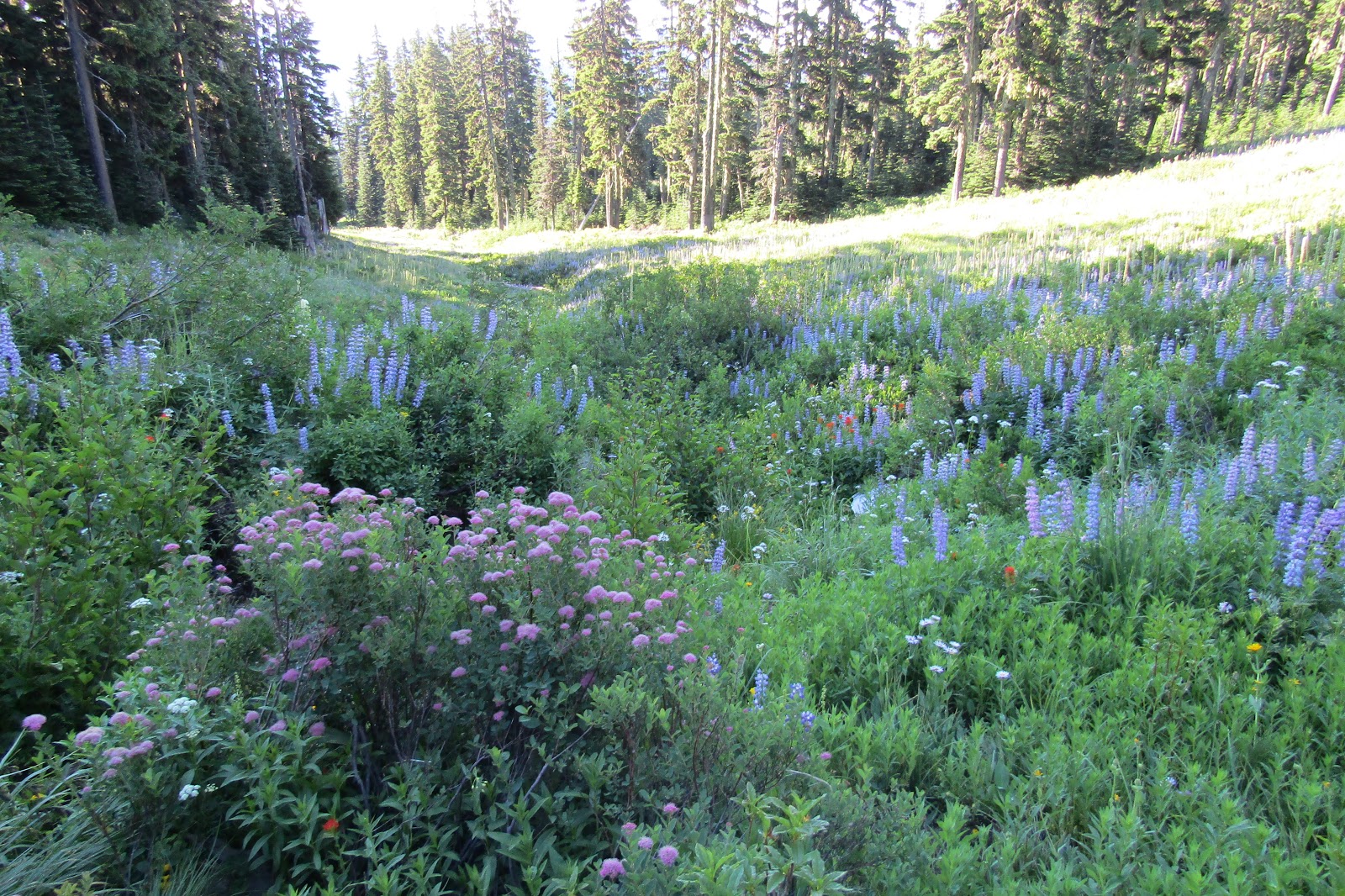
So many wildflowers.

Awesome Mt Hood view.

Heading back down the Paradise Park Trail.

Bear grass on the Paradise Park Trail.

Moving chairlifts on the other hand are another matter, on the way back the sun had changed, and there were now large chairlift shaped shadows racing across the ground right at us.
I saw them coming, knew my pony would have a reaction, and sure enough she scrambled backward pretty quickly. That got her a little bit wired up, and as I was riding along a bike trail, she was busy spooking at the same bridge she had just seen earlier in the day, when a bike came racing up behind us, giving her another fright. Surviving all of that, we were back at the trailer when some kids drove past. They had not tied down their snowboards correctly and two of the boards came flying off the top of the car, making an unholy noise as they landed on the pavement directly in front of my horse, who was not tied. She stayed put, as she does, there was no harm done, but I ended up with the giggles after all of that drama at the very end of our ride.

My plan for the rest of the day was to drive over to Road 44 and try to find a dispersed camping spot somewhere fairly close to where the Lookout Mt.Trail crosses over the road. Easier said than done. I spent a while driving around, and either finding spots already taken, or in one case driving to a forest camp that I thought might work, but getting there and finding out it was the worlds smallest campground, and then having to turn around in tight quarters. This was getting frustrating and even though I had completely new trailer brakes installed on my trailer last year, I had at this point done one too many steep hills, and my trailer brakes were done working. A common theme since I got this LQ, and my truck doesn't have an exhaust brake. Also I am notorious for driving on roads that no one in their right mind would attempt. Finally at the last minute I saw a rutted dirt track leading off to the left and found my spot for the next two nights.

Finally found a nice dispersed camping spot.

This ended up being the perfect location, with the trail being just a mere half mile or so up the road.
In the morning I rode the Lookout Mt.Trail up to the top of Lookout Mt. This trail is shared with mountain bikes, although I never saw any. This year in particular with everything going on I actually was delighted to ride on a trail that was shared with cyclists, because I knew it would be cleared.

On the Lookout Mt. Trail.

Almost to the top of the Lookout Mt. Trail.

On top of Lookout Mt. Mt Hood Views.

July is the time for flowers.

Some hikers enjoy the view from Lookout Mt.

There is a way to make this into a loop, taking another trail that heads steeply downhill towards a couple of lakes, but I went about 3/4 of a mile and noticed that there were quite a few trees down. I ran into a nice hiker couple and asked if they knew if the trail was okay the rest of the way, and they said they weren't sure past a certain point. It was a hot day and it was too risky to continue in case I had to turn around after dropping 1000 feet or more in elevation. I took a road back, instead of the last part of the trail, so it was a partial loop after all. On the way, I checked out the High Prairie Survival Shelter, stocked with candles, wood and a stove, in case anyone ever gets into trouble out there in the winter.

The High Prairie Survival Shelter.

The next day I gathered up my things and drove over to the Elk Meadows Trailhead. I had woken up extremely early and so I was all ready to ride at 7:15 am. This ended up being a very good thing for several reasons, one I got there when there were only a few cars parked, so I could turn around and get situated. Secondly I only saw two people on the first part of my ride, and lastly this day ended up being quite the adventure, not necessarily in a good way, so I was very happy to have the extra time.

Elk Meadows TH before the crowds arrived.

Things were weird right away, my plan had been to do the out and back Elk Meadows Trail, which I knew was cleared, but on the way, I wanted do a small loop detour to see two waterfalls. The problem was the brand spanking new map I had of this area was not detailed, and it just showed the trail leaving to the right from the parking area. In reality after I was able to see a zoomed in version of the same map, there is another trailhead just a little farther up the road, where I was supposed to start the loop, so instead I followed the first left I came to, thinking I was on a different side of the loop than I actually was. This caused some confusion when I got to the second waterfall. I continued on the marked Umbrella Falls Trail, but it eventually met up with the Timberline Trail, which is not a horse trail.

But by that time I did not want to go back, I had already had quite a few obstacles to deal with on the part of the trail that horses were allowed on. Very deep holes, so deep that if my horse's leg had gone in to them, her foot wouldn't have even touched the bottom, skinny trail sections where water had eroded the earth, with drop offs on both sides, very un horse friendly creek crossings. I was either leading her over bridges that were a foot wide, meant for people, or leaping across ditches, since there were no horse fords, as there usually are in that type of situation. And yet another moving chairlift to contend with, which at this point was starting to be one of my horse's least favorite things. So actually once I forded a couple more nasty creek crossings, the rest of the TimberlineTrail that I was not supposed to be on, was easy in comparison.

On the Umbrella Falls Trail.

On the Umbrella Falls Trail.

The foot wide bridges were plentiful.

Sahalie Falls.

After riding awhile under more chairlifts, that were blessedly not moving, and flower filled ski slopes, the topography changed drastically as we came to a large canyon. The worst part of this section was having to cross over the top of a waterfall with slippery rocks, then we forded Clark Creek at the bottom and scrambled up the loose pea gravel ridge on the other side. When I got to the junction with the Newton Creek Trail I knew I was on the homestretch, however I also knew that it had not been cleared. I had to try it anyway, since the alternative was going around another way that was longer, trickier, and who knows what would have awaited me in that direction. I've been riding my entire life and I am used to encountering tricky terrain, on certain rides, but at this point, it just never let up, it was one thing after the other, for the entire day, so I was just ready to be done.

Going into the canyon, you can see the trail I climbed on the other side.

An unnamed waterfall on the Timberline Trail.

Down at Clark Creek.

Heading up the Pea Gravel Ridge.

Almost to the junction, looking at Gnarl Ridge.

Unfortunately, I still had some challenges ahead of me, the trail was clear at first, but then I encountered several bad areas of downfall. Needless to say I found a way around it all, making long detours through dense forest, squeezing my horse between logs etc. Unfortunately my brand new saddle bags now have a couple of rips in them.
Got back to the truck, and then had the two hour drive home with no trailer brakes, to enjoy.
Made it!


GPS COORDINATES TO TIMBERLINE LODGE

GPS COORDINATES TO LOOKOUT MT. TH ON RD 44

GPS COORDINATES TO ELK MEADOWS TH

Saturday, July 18, 2020

Indian Prairie and Allen Creek Horse Camp, Oregon

The Ochoco National Forest is quite large and has more than a few horse camps and/or dispersed areas to camp and explore. The first time I rode into Indian Prairie was in 2011 and I did the 18 mile out and back ride, from a well known parking/ camping area called Corral Flat. I did the ride a second time in 2016, but both times when I arrived at the prairie, I would then have to turn around and go back, and I always wanted to continue exploring, so on this trip I drove over to Indian Prairie, and started from there.
I will be using the word "prairie" a lot in this blog, for some reason it's one of my least favorite words to type!.... but here goes.

Allen Creek Reservoir, and an extremely cute pony.

There is a meadow across the road from the prairie and I was planning to pull in there and camp, but even though the timing was right, and it was no longer a muddy mess, it was very rutted and lumpy. I was watching my trailer get uncomfortably close to losing an important part, the grey water tank, so I backed out and just parked in the little loop area at the unofficial trailhead.

Indian Prairie.

I proceeded to then ride across the prairie south following a trail, until I ended up on a road that just led downhill back toward areas I have already been, so I turned around, and headed up into the Bridge Creek Wilderness towards Mt. Pisgah. I would have liked to have ridden up to the top where there is a fire lookout, but I got distracted following other roads, and then was running low on time. At that point, there had been some grey clouds hanging over my head for awhile, and it was a little chilly, so rather than bundle up and spend the evening shivering in July, when I knew the weather was much nicer lower down in elevation, I decided to drive over to Allen Creek Horse Camp that night instead.
If anyone does want to camp at Indian Prairie there are no amenities, but you can get stock water either from a pond in the prairie, not too far from the parking area, or from a spring fed water trough just past the Bridge Creek Wilderness sign on Summit Rd.

Corn Lilies in bloom.

The warming shelter at Indian Prairie.

Inside the warming shelter at Indian Prairie.

Riding back towards Indian Prairie.

The Bridge Creek Wilderness.

The water trough, close to Indian Prairie.

The Bridge Creek Wilderness.

Allen Creek has some interesting memories for me from back in 2012, it was the first time I decided to do a solo camping trip, (just one night) and it also got me started with the first blog that I ever wrote, about an experience that I had with the Ochoco Mustangs. This time I wanted to ride a couple more days in other directions.

Allen Creek Horse Camp has eight spots, but only four have corrals. They used to be the dilapidated log variety but have been revamped with brand new shiny pipe corrals. Several of the sites are plenty big enough for larger rigs. There are two bathrooms, but no garbage, manure bin, or potable water. Allen Creek is available nearby for stock water. It does take some effort to haul the water from the creek, but as another option there is a dispersed camping site you could drive to across the road that has easier access to fill water containers. This camp is free, but has no developed trails. Update: As of 2022 there have been some designated trails made, that are flagged and marked.

Allen Creek Horse Camp.

Only four of the eight spots have corrals.

The following day I rode uphill to the east until I reached a junction, where I followed Rd. 2630 for several hours. This was nice because it ran along a ridge with views back over to Mt. Pisgah in the Bridge Creek Wilderness and also down onto Big Summit Prairie. It alternated between trees and shade, or opening up into occasional meadows. I chose to follow roads and not do any cross country riding because the majority of the land in this area is strewn liberally with rocks.

Big Summit Prairie from afar.

On Rd. 2630.

One of the meadows along Rd. 2630.

Lots of Lupines.

That evening a couple of non horse people came and spent the night at the far side of the camp, but other than a few lookie loo's driving through on occasion, it was very quiet.

On the last day it was my mission to ride to the Allen Creek Reservoir, and maybe even further south, but since Big Summit Prairie is private property, I wasn't sure if any roads kept going past the reservoir. I didn't find any, so I just headed back to camp afterwards, making my day a little shorter than usual.

Allen Creek Reservoir.

What once was a fancy house on Big Summit Prairie.

As I was bumping along on the washboard heading home, a lone cyclist lady was standing in the middle of the road and flagging me down. I thought I was going to have to toss her bike in the back and perform a rescue mission, but it turns out she just wanted to know how far it was to the town of Mitchell.
I told her it was "a ways" with a couple of big hill climbs in her future, so she wisely decided to turn around!


GPS COORDINATES TO INDIAN PRAIRIE


GPS COORDINATES TO ALLEN CREEK


Friday, June 12, 2020

Post Meadows Horse Camp, Hart Mountain Antelope Refuge, Oregon

I had always wondered about the horse camp in the Hart Mountain National Antelope Refuge since there was no information anywhere to be found about it. The only thing I had ever heard from someone was that the road to get to it was crappy. But since I enjoy finding new places, and I like to get off the beaten path, I decided to check it out. I called ahead to make sure it was open, but unfortunately the girl I talked to knew nothing, and ended up giving me conflicting information. It turns out this camp is always open, as long as the roads to get to it are passable. It is in a remote area 65 miles from the nearest town with services, (Lakeview) and 24 of those miles are gravel.

Sunset at Hart Mountain Antelope Refuge.

I spent the first day just driving, but once I got to the refuge and the road turned to gravel, I heard a loud noise and realized right away what had happened, my spare tire had fallen out from underneath my truck...again. This had happened once before in California, and I had already had a stern talk with Les Schwab about putting it back under there correctly, anyway this time the metal bracket was half on and half off, so I dealt with that situation, threw the tire into the back of the truck, and continued on. There is a steep climb to get up onto the rim, and then another long drive to get to the horse camp. The gravel roads are mostly okay, with some washboard sections, but the last 14 miles are on the more rustic Blue Sky Rd.
The horse camp is situated another half of a mile off of Blue Sky, and it is not a road you should attempt if it is at all muddy. I could see the corrals from afar and that no one was there, and when I finally arrived I thought I had died and gone to heaven.

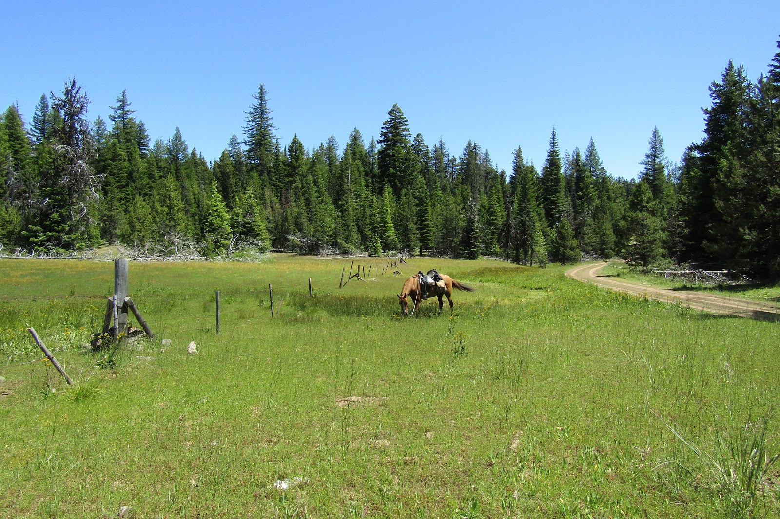
Post Meadows has a very big cow corral that is divided into three separate areas, which is also attached to a large fully fenced pasture. There was lush green grass in the corrals and in the parking area. Although I brought a bale of hay, I never opened it during my stay. There is stock water available from Guano Creek, but it is about 300 feet away. There is also a bathroom, and there is no fee for camping, or to enter the refuge. You are not allowed to dispersed camp, so this is the only place to camp with horses. There are no picnic tables, and you are not allowed to have campfires.

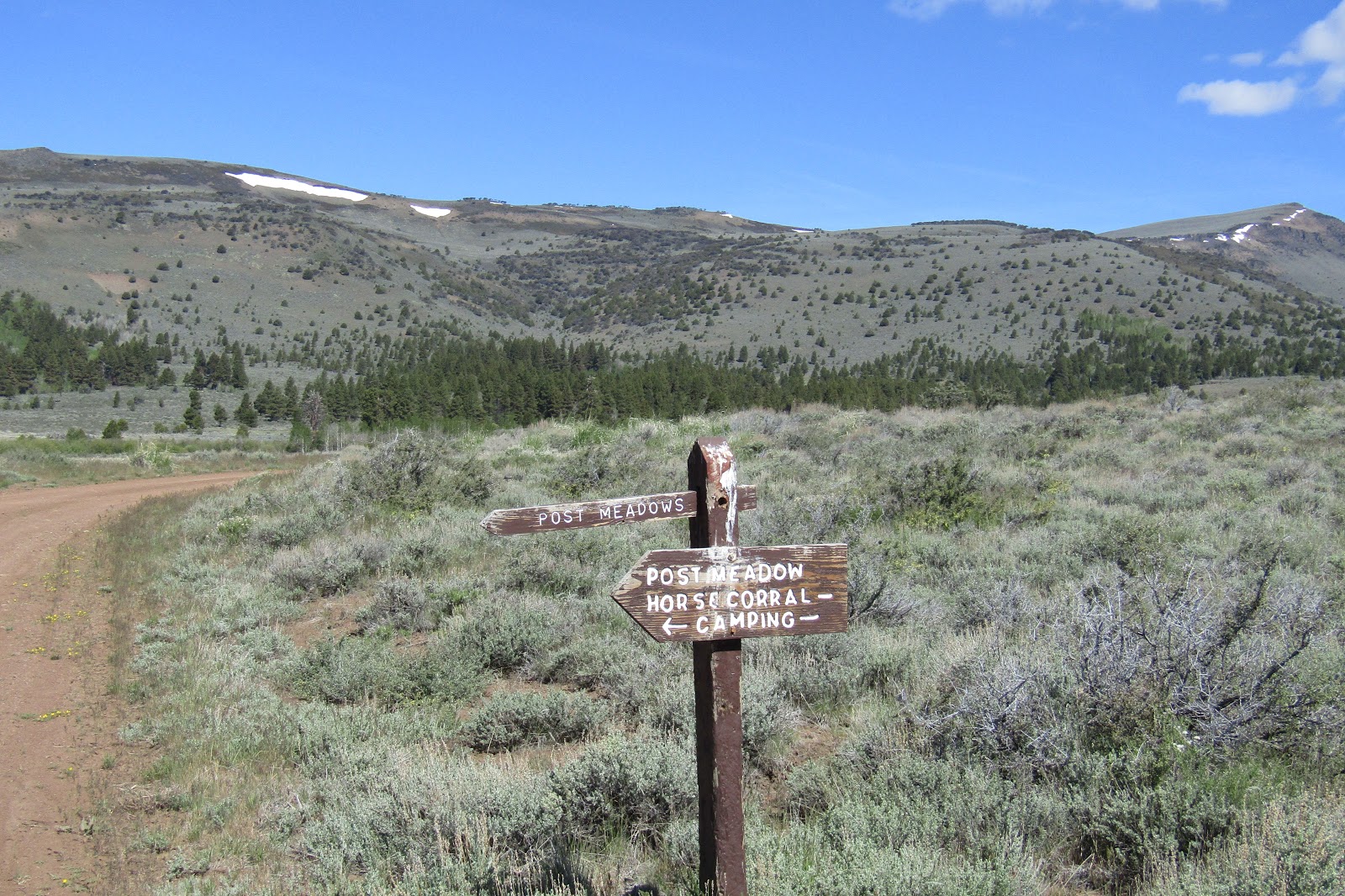
The sign on Blue Sky Rd., the camp is half a mile from here.

The refuge is huge at 278,000 acres and is very spread out. It has one campground down on the flat land before climbing up in elevation, then there is Hot Springs Campground which is closer to the refuge headquarters, and then the horse camp is much farther away, all alone, but it in my opinion it has the best location and scenery. Lastly there is Guano Creek Campground, a hunters camp that is only open between August 1st to November 1st. Update: In 2024 I returned to Hart Mountain, this time without my horse. I drove over to see the horse camp again and was surprised to see that it has had a major remodel. The corrals are still there but the pasture area has been turned into a loop drive area with six gravel back in spots. They also added quite a few hitching rails, several water troughs and an extra bathroom.

Post Meadows Horse Camp in 2020

Post Meadows in 2024

New hitching rails, in 2024

I had printed out a map from the refuge web page before I left, and so I planned a large loop for my first ride. But I got distracted from that plan because I saw a road going up into the hills, that was not on the map. I soon figured out that besides the few maintained main roads, they have a lot of secondary roads, like the one the camp is on, which are closed to motorized vehicles during the winter, and in fact were not even opening until June 15th, presumably to make sure everything had dried out appropriately. So although all the secondary roads which are great for riding, are on the map, there are what I started calling "secondary secondary" roads which continue on forever, some you could take a high clearance vehicle on, and some that are just for foot and horse traffic. There are no real rules about horse travel, you can just go wherever you want, which worked for me. So I started by continuing to follow Blue Sky Rd. to where it ends at the Old Camp Warner Historic Grave Site.

The grave site.

The trees ahead are a large grove of Ponderosa's.

Then I climbed up onto the ridge, otherwise known as Hart Mountain. Once up on top there are views for days. I followed one road a pretty long time, and then looped back over past Warner Peak and was looking down onto the tiny town of Plush, and the Hart Lake area.

I had already seen a few antelope at this point, one while driving, and one that was peeking over a hill at me the evening before, but I flushed out a few more on this ride. There are a lot of single bucks, and since I don't think hardly anyone ever rides on the refuge, they were pretty astonished to see a horse. I didn't even try to get pictures of them at that point, they would bounce away and then get to where they were just far enough to be out of good camera range, then stop and stare at me, and snort like a horse does when they don't know what the heck they are seeing.

Looking down onto Hart Lake.

On top of Hart Mountain.

On top of Hart Mountain.

Hart Lake.

The road ended at this view to the west, amazing how many lakes there are.

That evening an older fellow with a dog came and camped near me, he was at the refuge looking for Sandhill Cranes, but he left early in the morning. He told me there were Bighorn Sheep up in the hills I had just been that day, but unfortunately I had not spotted any.

After our rides my pony would have her nap next to me.

The third day, I decided to ride Barnhardy Rd, which goes through the hunters camp first, and then continues on to the popular Hot Springs Campground. The map I had wasn't really great for trying to judge mileage, but I rode down through a valley with rolling hills and aspen groves until I got to the Barnhardy Cabin. Then I turned back and went along Skyliner Rd/Trail to a couple of the lookouts. I did not want to continue on what could have been a loop from there, since I would have had to do a lot of riding on the main road to get back to camp, so I went cross country instead and dropped down out of the hills. On this ride I encountered a male and female antelope pair having a siesta, the male was very curious, and so I finally got my first chance at some decent pictures. They eventually ran off in front of me for awhile, but then doubled back, so they were in the same area when I returned. Much to their chagrin, I returned at top speed over a hill at a canter, and interrupted their nap for the second time in one day.

Where Blue Sky Rd. ends and Barnhardy Rd. starts.

Riding up Barnhardy Rd. towards Guano Creek Campground.

Beneath Warner Peak on Barnhardy Rd.

An Aspen grove on Barnhardy Rd.

Barnhardy Cabin.

I had no idea what this was, but it turns out it measures snow depth.

Interrupted a herd of deer that were bedded down.

Views from a lookout. The miniscule white dot with a black line next to it,  is my rig and the corrals.

The first antelope I got a picture of.

That evening I had antelope trotting by, coyotes yapping, and birds singing, what more could I want.
Ahhhh...solitude.... until, another man in a van decided to spend the night, he was from California, and was there to photograph wildlife. He wasn't having any luck getting pictures of the antelope yet, but he told me he was also going to get up in the middle of the night to shoot the milky way.

The horse camp is on Post Meadows Rd. and I wanted to follow it and see where it continued on to, so I did just that on day four. After awhile I came across Big Flat Ranch...I actually have no idea what it is called, I made that up, but it is an old abandoned ranch in an area called Big Flat, so it seems appropriate. This road gets pretty rocky after awhile, climbs up a hill, and then I had views down to Crump Lake and what I assume was a dried up version of Reservoir Lake. This was an especially hot day, but it clouded over eventually, which was much appreciated.

On Post Meadows Rd.

Warner Creek crosses Post Meadows Rd.

Big Flat Ranch, so named by yours truly.

Looking down onto Crump Lake.

I had had three lovely nights thus far, but on the fourth night a few mosquitoes meandered by, then a few more, until all hell broke loose. I ran for cover and had to leave my poor horse outside, my entire truck and trailer were covered in mosquitoes and they were all staring at me through the screens with an obvious amount of blood lust. I assumed once it got dark they would disappear, but it was a warm night and they stuck around. That night was not a restful one, I would be sleeping and all of a sudden there would be a buzzing in my ear, or one would land one my nose. I couldn't figure out how they were getting in, but in the morning the mystery was solved as I saw that one of my screens had a slight gap between it and the window frame. My horse despises mosquitoes and at 5 am when I looked out, she was either walking very quickly, or trotting around the field, and I have a feeling that was how her entire night went.  Although I had planned one more ride and another night's stay, that was all out the window, I had to get out of there ASAP. I ran around throwing everything into the truck, grabbed my horse, threw her into the trailer along with a cloud of mosquitoes, and started driving. Once we got away from the creek, proximity to water being the culprit, I stopped and checked on the situation inside the trailer, it turned out that once I had started driving, they all panicked and clung to the windows, so at least they were leaving my horse alone.

We were both pretty bedraggled by then, I had a headache and my horse looked droopy, but I decided just to do a short ride on my way out of the refuge, so I stopped near the headquarters and rode to Petroglyph Lake and along Poker Jim Rd. I was able to find room to park along the side of Hart Mountain Rd., most of the secondary roads don't have parking areas at all, so it is not easy to stop at very many places, at least with a truck and trailer. As I was getting ready three young antelope came right past the truck and did their usual gawking thing. At one point I looked over and a buck was just across the road from me. Finally, some good pictures!

Curious youngsters check out me and my horse.

A buck gets quite close.

Petroglyph Lake.

There are quite a few petroglyphs at the lake.

Petroglyph Lake.

On the way back, on Poker Jim Rd.

One would think after this ride, that would be the end of my story, but this was a Saturday and a friend had texted me about an upcoming storm that was supposed to hit Central OR. I told her it was not forecast to come near where I was, which ended up being true, but as I attempted to drive off the refuge, I got hit by heavy, heavy winds. The truck was struggling, and I had no idea how bad the wind was until a lid blew off one of my water barrels, and I pulled over and I had to wrestle with the door to even get out of the truck. As I was driving through the Summer Lake area, tree branches were breaking and being flung out onto the highway. I remembered seeing a good looking dispersed spot just outside of Summer Lake and so I got that far, and was done driving for the day. In the meantime Central OR had got the brunt of heavy rain, huge hail, and quite a lot of property damage, as well as power outages. The sky had turned an odd shade of green, and the word "tornado" was being thrown around. When I did get home on Sunday, my place was unscathed, in a way I am glad I missed it, but in another way, I imagine it would have been a pretty interesting experience.

Total antelope count for the whole trip: 44


GPS COORDINATES TO POST MEADOWS