Saturday, March 27, 2021

Catalina State Park, Oracle State Park, and Bumblebee, Arizona

 This is a continuation of my six week trip to Arizona: After leaving Apache Springs:

I didn't know what to expect at Catalina State Park. I figured I would actually be camping with other horse people for once, but I wasn't sure how busy it would be. Although the other campgrounds in the park need to be reserved, and are consistently packed full of people, the horse camp is first come first serve. As it turned out, there were just a few other campers during the four nights that I stayed there.

Catalina State Park.

This is a great place to stop, whether you want to stay for awhile to ride, or just as a brief overnight to get water and/or do some shopping, laundry etc. since it is right in the city limits of Tucson.

You pay at the ranger station at the entrance of the park, and they will give you a map of the trails. They call the horse area, the equestrian center, and it is at the end of the road past all of the other campgrounds. It is also a trailhead, where cars park on the left and horse trailers park on the right. It is not a traditional camp with designated spots, you just pull in and park wherever you want in a large flat gravel area. Be prepared for hikers and bikers to walk through the corral area to gawk at and pet the horses.

Park anywhere at Catalina State Park's Equestrian Center.

The Equestrian Center has a large grid of 16 individual and fairly roomy steel corrals. Four of those are under cover and consequently have shade. There is a bathroom, potable water hydrants, some with hoses, a manure bin, with a wheelbarrow and rakes, and a picnic area, with grills, garbage cans and recycling bins. There is also a water trough and mounting blocks. The camp and entire state park is kept spotlessly clean, someone drove in to restock and clean the bathroom twice a day. Next door is people campground B, which is within walking distance, where you can have a delightful hot shower for free. After all of the dispersed, "roughing it" camping I had been doing, it was like a vacation from my vacation! Everyone that stayed there really liked it, and since it is only $20 a night, a lot of people who had been camping at private facilities were also thrilled with the lower cost. 

The Equestrian Center.

It was finally consistently warm during the day, and the nights were far nicer weather wise than what I had been experiencing previously. As soon as I arrived I met a couple from Idaho and we became friendly, exchanging notes about where we had been and where we were going next. They had been to some of the same places, and talked to some of the same people I had along the way. As I was chatting with them a bobcat nonchalantly wandered by in pursuit of some prey, and later I also saw a coyote stroll through camp.

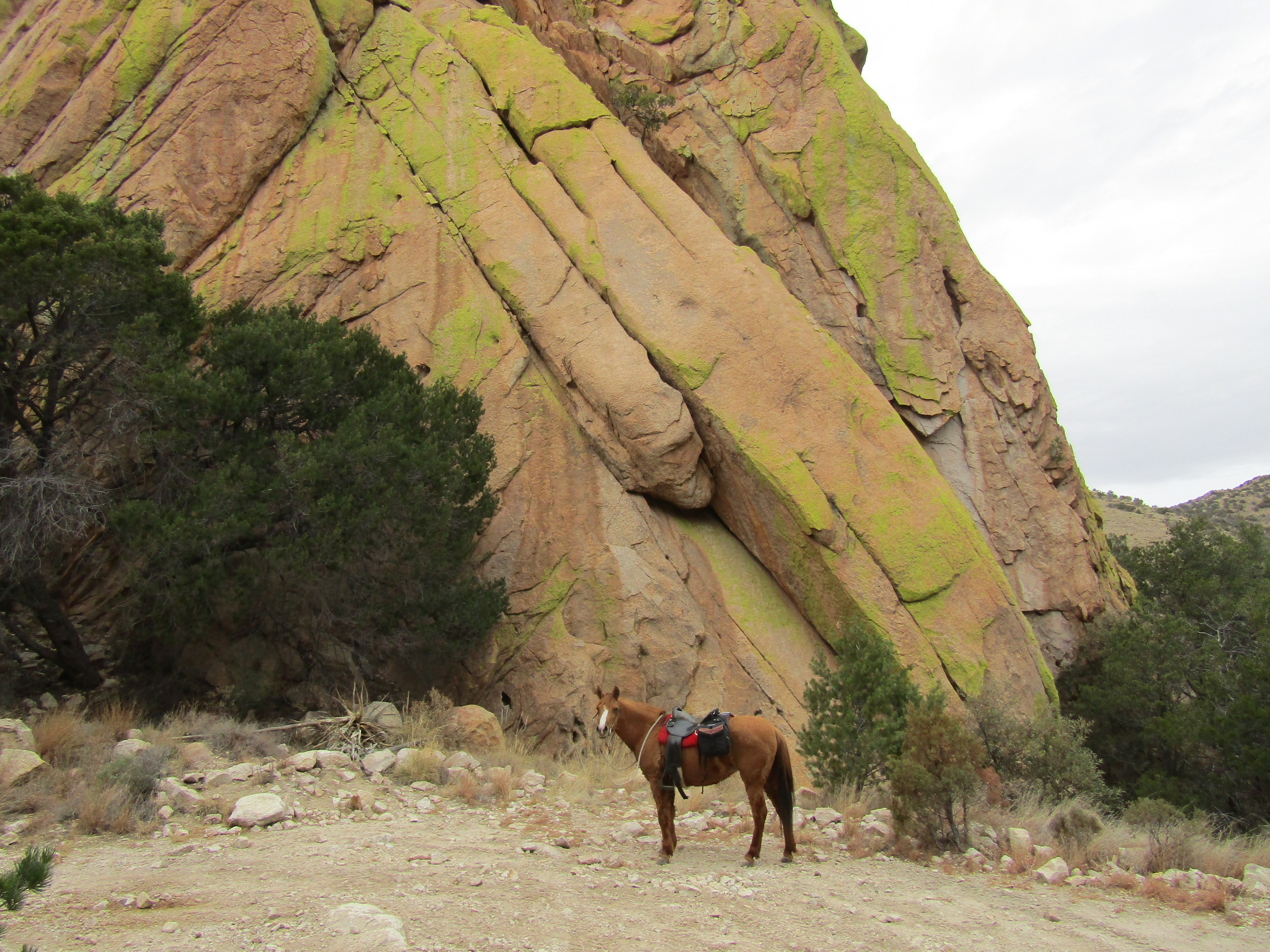
The following day I decided to do a loop along the trail which leaves from camp. Once it splits, you can either follow the 50 Year Trail, or the Bridle Trail, which runs along the perimeter of the other campgrounds, eventually arriving at another hiker trailhead. There are also other obvious horse trails veering off every which way, and so I kept riding until I got to a viewpoint of the creek.

Along the Bridle Trail at Catalina State Park.

Looking down on part of the Canyon Loop.

I then did the Canyon Loop which is a short 2.5 miles and popular with hikers, who were mostly all delighted to see a horse, and were taking pictures and videos as I was riding by. One couple took two videos, thinking I was a different person the second time they saw me!

I also took a little detour over towards Romero Pools, but it was eventually blocked off and closed due to a recent fire. It is supposed to reopen in May of 2021.

On the Canyon Loop, in the burned area.

Kitty! This little bobcat thought I couldn't see her/him.

I then followed the Trail Link Trail which joins up with the 50 Year Trail. As another option you could continue up into the Santa Catalina Hills for awhile on the 50 Year Trail, to make a much longer ride.

On the 50 Year Trail.

Since this park is located close to other riding areas, I trailered out the second day and went over to Oracle State Park. There is no horse camp in this park, but there is a parking area on American Ave. that is suitable for horse trailers. You can ride either on a variety of trails, including the Arizona Trail, or through various washes or a combination of both, which is what I did. There is a porta potty and a self pay station, and it costs $7.00 for the day.

Parking at Oracle State Park.

At Oracle State Park.

There's a spigot at the windmill, but no water.

Instead canned water was provided.

As I was riding I noticed what looked like a little smoke above a nearby mountain range, but I thought I was mistaken, and it was probably just a cloud. Sure enough, as I kept an eye on it, it became a full blown plume, and it was obvious a fire had started.

Fire in the nearby mountains.

The Arizona Trail at Oracle State Park.

Kannally Wash.

On my way back to camp I stopped at a feed store to get propane, some more senior equine, and I wanted to look at what kind of hay they might have. There were three stores in the area to choose from and I chose Ranchers Supply. I knew hay would not be cheap in Arizona, but it was pretty shocking, alfalfa was $17.00 a bale and the only other option was Bermuda Grass which was $20.00 a bale. I just ended up buying one bale to tide me over. It was a fairly comical transaction, the man at the cash register was not really equipped to deal with the public, consequently I wasn't really able to communicate with him, so I was there for quite awhile, but finally got everything I needed. ( I bought more hay in Wickenburg, later on in my trip, at a much cheaper place called Texas Hay Co... only $14.25 a bale, for the same hay.) Turns out my horse doesn't really like Bermuda Grass, I still have some to this day, that she will not eat, and I've heard about other people's horses not caring much for it either.

When I arrived back at camp, the Idaho people had left and a new couple from Washington were parked in the same spot, which was close to me. They invited me to hang out with them over at their "house" and we talked for quite awhile. Pretty much everybody was on the road a lot longer than I was, my six weeks was a short trip in comparison.

The next day I hiked around the rest of the state park in the morning, visiting the Romero Ruins, and then in the afternoon I unhitched and went into town to do laundry and more shopping. That evening I went across the street to Red Lobster for dinner. Ah, the luxury!

Sunset at Catalina State Park.

After leaving Tucson my plan was to head to Sedona, stopping at Bumblebee along the way. I had no idea what Bumblebee was going to be like, until I got there. It is 5 miles off of Hwy 17 in the middle of nowhere, and it is tiny, and I do mean tiny, consisting of a few houses and the Bumblebee Ranch. You can camp with horses at the ranch, but there is also dispersed camping nearby, so I went ahead and grabbed a spot. Even though this is a fairly isolated area, there are cell towers up on a nearby hill, so I had plenty of service. There are no amenities, but it is possible to get stock water from a creek, if you want to go for a long walk. It's good for watering your horse on the way back from a ride, but it is not conveniently located for hauling. The GPS coordinates at the bottom of the blog are for the ranch, not the exact spot I camped.

Bumblebee, AZ.

My dispersed spot in Bumblebee.

As I was doing some last minute planning about where to camp in Sedona, I noticed the weather was not looking so great during the time I was supposed to be there. I hadn't ultimately had the best luck with weather during the whole trip, so I was definitely not looking forward to more frigid temperatures. And as soon as I was going to leave Sedona, it was going to go right back to being nice weather again. Figures.

My first ride in the Bumblebee area was just following the road/trail that I was camped off of. This is part of The Black Canyon Trail which is apparently 80 miles long, but in this area it is a pretty rugged narrow road that ATVers use. After awhile I was running into a few too many ATVers ( it was a weekend) so I veered off onto some less used two tracks. There were some pretty nice views along the way, and at one point my horse spotted an unidentified creature up on a hill. I also found a hermit type of shack, someone was actually living in so I skirted that, did some more exploring, and then followed another road which led me to a gate that I could not open, where I finally turned around. I also came across quite a few active mining claims along the creek.

Part of the Black Canyon Trail.

A long line of ATVers.

I turned around at this gate.

This road is cut through the rock.

A mining claim.

After my ride I walked into the town of Bumblebee. There was a trail running race/event going on, so it was probably a little busier than normal. There is a solid well used trail directly across from the ranch driveway, but since that was being used for the race, I did not end up exploring it.

The next day I followed The Black Canyon Trail in the other direction, but I didn't stay on it very long, since a steady stream of trail runners kept coming up behind me. Instead I went cross country, which was easier said than done, there were a lot of small but deep washes to cross and thick bushes, but eventually I skirted around the backside of Bumblebee Ranch, and followed a gas pipeline until I got back into more open country. I ended up checking out a small canyon, and then instead of going back the same way, I took the road right through Bumblebee.

Riding near Bumblebee.

Found this little canyon.

That's all there is to Bumblebee, AZ!

That concluded my stay at Bumblebee, and at that point I had decided that I was going to have to skip Sedona, which was a big bummer, but I had thought up a couple of new places to go, one being on the way back towards Nevada, (which did not end up working out)... more about that in my next and final blog about this trip.

Next stop: Lake Mead and Valley of Fire.

To be continued....


GPS COORDINATES TO CATALINA STATE PARK

GPS COORDINATES TO ORACLE STATE PARK

GPS COORDINATES TO BUMBLEBEE RANCH


Saturday, March 20, 2021

Las Cienegas National Conservation Area (Empire Ranch) and Apache Springs, Arizona

This is a continuation of my six week trip to Arizona: After leaving Council Rocks:

Empire Ranch is a place that I had checked out on a previous trip to Arizona, without my horse, and so I always knew that I was going to add this area to my trip. I love the grasslands, and much prefer them to the dirt and cactus laden parts of Arizona.

Apache Springs Trailhead.

As you drive into this area the ranch headquarters are on a marked road off to the left, and that is where I went first, to get filled up with water. There is a bathroom, a potable water hydrant with a hose, and the old ranch house and outbuildings that you can take a self guided tour through.

After that I went back to the main road, which eventually comes to a T. There is a kiosk that you can stop and look at, with a map of the dispersed camping zones. You can drive either left or right and camping is mostly just anywhere except right close to the ranch headquarters. 

I went left and ended up camping at Oak Tree Canyon, which is a pretty nice spot, it even has a bathroom and another water hydrant, although that water is not currently potable. This is a wide open space with plenty of room for any sized rig, and it is free. As per usual there were quite a few RVers and one horse camper from Wisconsin, who came over to introduce herself. The only down side to this area was the stiff wind that picked up right around the same time every day.

Empire Ranch

Oak Tree Canyon camping area.

My camp spot at Oak Tree Canyon.

There are over 42,000 acres to explore, and so on my first day I rode up into the rolling hills and just meandered about checking out various areas, eventually reaching the fence line that borders state land. I rode out into the state land briefly, just to get a view, but there weren't any trails or roads to follow from there.

Even though the grasslands are not known for cactus, I did see a few of these.

Riding through the rolling hills at Empire Ranch.

Views of the Santa Rita's, where I would be camping next.

I decided to stay and do another ride the following day, this time I started riding towards the Mustang Mountains, but kept coming upon dead ends or fence lines with no gates, so finally I followed some power lines for awhile, came across a water hole, and then ended up in yet another camping area off of the main road.

Riding towards the Mustang Mountains.

An oasis.

At another side road with camping areas.

I cut this ride a little bit short, went back to camp, and then hiked over into Empire Gulch and then continued to the ranch headquarters. There is a short trail to follow along the creek, and then I did a quick tour of the ranch house.

Empire Gulch.

Inside the ranch house.

If anyone has ever heard of Kentucky Camp and thinks it is actually somewhere you can camp, at least with a horse, you would be mistaken, as was I.

Here's how this day went. I left around noon thinking I only needed to drive just a few miles back up the highway towards Sonoita, then about 6 more miles on gravel. I proceeded to follow the signs pointing towards Kentucky Camp. Right before the road heads up a very steep hill there are plenty of dispersed camping areas on the flat lands, and perhaps horse people do camp there, but everything was chock full of RVers, so I drove on up the hill to the road that goes to the camp. I quickly learned that it is gated and locked, so I then had to back my rig out of there and continue up the road, which became narrower and less trailer friendly, and I was still not finding any places to camp. Finally the road splits and turns into a jeep track. I needed to turn around, but I didn't really have anywhere that was big enough to do so. I spent some more time backing up, including over a cattle guard, with an occasional ATVer or other vehicle getting stuck behind me, there was no room for them to pass.... until I was FINALLY able to get the hell out of there.

This whole journey took quite a bit of time since the road is slow going, bumpy, potholed etc. I had a book that described riding from the Gardner Canyon Trailhead, so I figured I would try to camp there instead. I followed the exact directions, and had no more problems, but the trailhead is actually called Apache Springs. Sigh.

Once there I was surprised and relieved to find that the one and only camp spot at this trailhead was available. What was supposed to be only a 10 mile drive took nearly 3 hours. 
It is free to camp there, but there are no amenities, no bathroom, and no cell service, except for when I clambered up a small hill.
A nearby creek does have water, but it is not close enough to be convenient.

The Arizona Trail runs through this trailhead, so the next day I rode it back over towards Kentucky Camp.

Looking back over to my trailer from the Arizona Trail.

On the Arizona Trail.

Soaptree Yucca on the Arizona Trail.

Kentucky Camp is an old mining area with a few intact buildings, one of which is a cabin that can be rented. There is also a headquarters which can be used for gatherings, weddings, and what have you. There is a hydrant with a hose, a water trough and a couple of hitching rails. There was no one around at the time, but I saw an RV where a caretaker stays on site.

One of the outbuildings at Kentucky Camp.

I continued on the trail for awhile, running into a couple of ladies on horseback, who lived in the area and were coming back down.
This is grazing land and there were quite a few livestock water tanks along this route as it climbs up towards Melendrez Pass.
The book had a loop option using forest service roads but I would have been doing it backwards from how the author had described it, and none of the side roads out there were marked, so I just went back the same way.

That evening some less skittish javelina's wandered through camp, but it was getting too dark to get any photos.

Originally I was thinking about staying another day and riding the Arizona Trail the other direction, but I started thinking about how many days I had left for my trip, and didn't want to run low on time.

The Santa Rita Mountains, on the Arizona Trail.


Next stop, Catalina and Oracle State Parks.

To be continued....


Thursday, March 11, 2021

Cochise Stronghold and Council Rocks, Arizona

This is a continuation of my six week trip to Arizona: After leaving Hot Well Dunes:

I had heard about the riding in the Dragoon Mountains, but I'm not sure I was completely expecting what I found. Some really awesome rides!

Cochise Stronghold.

Outside of the little town of Cochise, is Cochise Stronghold on Ironwood Rd. I knew that there was a dispersed camping area, but it's on a little rutted dirt side road, so I passed it the first time, then ended up turning around and going back, after the camp host explained that was indeed the loop I was looking for. There is also a large day use only trailhead, for horse trailer parking, that's close to the camping area. And lastly at the end of the road is the hiker trailhead and people campground, where no horses are allowed.

Cochise Stronghold.

There is one very large flat spot, that works great for bigger rigs, but if that one is taken, which it was when I was there, then sometimes getting into, or finding another spot, isn't the easiest task. I squeezed myself into pretty much the only available site that was left, before the loop road becomes a lot less trailer friendly. I was glad to have gotten it, later that evening a big motorhome came in and spent at least an hour trying to maneuver their way around into a tiny spot. There are no amenities, not even a bathroom. I was told, after chatting with a young rock climber, that this area has world class granite, and the majority of the other campers were climbers. The GPS directions at the bottom of this blog will show exactly where to turn for this camping area.

My camp spot at Cochise Stronghold.

This is a very beautiful area, and besides the obvious rock formations, it is almost tropical when compared to other parts of Arizona, with a variety of trees, grass and other foliage. A stiff wind picked up just after I arrived, that night it rained hard, and the next morning there was ice everywhere. I had to wait a pretty long time before it warmed up and I was able to ride. There is a tie trail that leaves the horse trailer parking area and meets up with the hikers trail. After that there is a junction where you can continue to follow the Cochise Indian Trail or go left on the Middlemarch Canyon Trail. I just stayed on the Cochise Trail, it climbs up and eventually gets to the Stronghold Divide which separates the east and west sections, and then drops down again to a small trailhead on the west side.

On the Cochise Trail.

On the Cochise Trail.

On the Cochise Trail.

There were some other horse people that had been riding a little ways behind me the entire time, and once I reached the trailhead on the west side, I stopped, and they caught up. I chatted briefly with them, they were just riding the trail one direction, and getting picked up with a trailer. I went back the same way, making this about a 16 mile ride.

Just before I started dropping down to the west side.

At the Stronghold Divide.

After another frigid night, my 7th in a row, I decided to drive to the other side of the Dragoons, to Council Rocks, outside of Tombstone. 

From Tombstone, I took Middlemarch Rd. which is 10 miles of washboard, to the enormous dispersed camping area by Council Rocks. I had not seen any other horse campers at any of the previous places I had been up until this point, but in this area I saw a couple of trailers. I didn't end up parking anywhere near them, this was a Sunday and most of the camping spots were taken by RVers and climbers. There are a plethora of huge areas to fit any sized rig, and road 687 goes on for miles, so I just continued driving until I found a little pull out that worked for me. There is lots of cell service, but zero amenities.

Finally some warm weather! I had started to notice a pattern, the warmest weather always seemed to happen on the days when I was not actually riding. 

My camp spot at Council Rocks.

The next day my first ride was along a pretty well used horse trail at the base of the rocks, which took me into Slavin Gulch. This is kind of a "find your own way" type of area, there are a lot of little side trails, so sometimes I would veer off on one of those, but usually find it to end up not being particularly horse friendly. Once I ran out of trails, I followed a road and found myself back at the same west trailhead that I had ridden to from Cochise. 

Council Rocks.

Almost back to the west trailhead.

Council Rocks.

For my second ride, I started at the base of the rocks again, but this time going the other direction to the south. I came across another pretty big climbers area, but after that the trail petered out, so I bush wacked for awhile with my goal being to reach China Camp Rd. which I could see from afar. Unfortunately trying to cut cross country over to the road proved a little tricky, I was coming up against fence lines without gates. At one point I came across a nice rancher. He couldn't quite figure out where I had come from, since I just appeared suddenly out of the foliage, but he let me ride through his cow corral and out his gate, whereupon he locked the gate after me.

Heading towards a popular climbing area.

China Camp Road is narrow and rocky and meant for 4x4's, not cars. Once it gets up above and beyond the rocks, there are many other side roads, and by roads I mean rustic tracks, some that are very steep, that meander all over the place. There are ALOT of old mine shafts and tunnels in this area from the abandoned San Juan Mine. The view is apparently fantastic from atop China Peak, but I had ridden quite a few hours already before getting to this area, so I didn't continue the entire way. I saw some other horse people coming down from the peak, and when they got to where I was, a lady said " we meet again". Turns out she was one of the same people I had seen before over at Cochise Trail, but this time she had different riders with her. They expressed concern about my horse, she was very sweaty, with a very fuzzy winter coat, and I had just taken her down a very steep short cut trail, not actually intended for a horse, that had been cut into the side of a hill.
I reassured them that she was fine, and that we were just taking a break. They left and eventually I caught up with them and passed them, my horse having gotten her second wind. They had parked at the beginning of the road, but I still had to ride all the way back to camp, making this a 7 hour day.

At the saddle on China Camp Rd.

Abandoned mines were everywhere.

My turn around spot on the way up China Peak.

In case anyone is wondering, since this area is outside of Tombstone, yes, you can stop into the town of  Tombstone, ride down the dirt road and pretend you are back in the wild west. I had no desire to do that, but I have been there before, and it is pretty interesting to check out the history of the place.

Tombstone, early enough in the day, before the mobs of tourists arrive.

The Boothill Graveyard in Tombstone.

It was time for me to move on once again. I had very little water left, but I had planned my trip so that in between all of the dry camping areas, I was also going to be stopping and riding at places that had water. Luckily my horse is not a big drinker, and I could go for some pretty long stretches without having to worry about it. 

Next stop: Empire Ranch and Apache Springs.

To be continued....


GPS COORDINATES TO COCHISE STRONGHOLD

GPS COORDINATES TO COUNCIL ROCKS