This is it... the final blog about my six week trip to Arizona/Nevada: After leaving Bumblebee:
Since I had made the decision to skip Sedona, due to weather, I decided to check out one more area in Arizona, on my way back into Nevada, where I would finish out my trip.
 |
| Valley of Fire State Park. |
I drove over to Burro Creek Recreation Area in the Sonoran Desert between Wickenburg and Kingman. There is a regular people campground there, but like most places in Arizona, I knew they would likely be okay with horses as well. When I drove in, I double checked with the camp host and she said I could camp there, but that the site she figured would be best for me, was already taken. She also stressed several times that I would need to pick up my manure and take it with me. She then pointed out an area below the actual camp, which was larger, but not a real spot, and I went ahead and pulled into it. Unfortunately this area was too hard packed for me to get any corral poles into the ground. I asked her if I could put my corral into a small grassy area near the fence line, and she said no. I think she may have misinterpreted what I meant, and thought I wanted to put it on the other side of the fence. In any case none of the other camp spots looked great for putting up a corral either, so I decided to leave. This area would have been fine for someone who has a different type of horse containment. It's $14.00 per night and there is supposed to be water, but I didn't get a chance to see if it was actually available.
I drove just a short distance away along Hwy 93 and found a nice dispersed spot just a little ways down Signal Rd. I noticed quite a lot of manure piles from wild burro's, which made me a little concerned they might show up at some point.
Later that night when I was in bed, I heard HEEEEEEEE HAAAAAAAW! My horse whinnied, so I leapt out of bed, assuming that was an SOS call and I needed to intervene with the burro or burro's trying to mess with her in some way. I had my headlamp, and I looked all around, but I saw absolutely nothing, so I got back in bed. A little while later...HEEEEEEEE HAAAAAAAW! I got back out of bed...nothing... you see where this is going. EIGHT hee haw's over the course of the entire night, culminating in one last bray at the crack of dawn, at which point I opened my window and shouted some very choice words into the dark, which of course was unhelpful, but made me feel better. What I found interesting was that the burro never did actually enter the little bubble of my camp spot, he kept his distance, but carried on his unrequited love affair with my mare, from afar. I got all my stuff packed up early, since I was awake anyway, and drove over to Lake Mead.
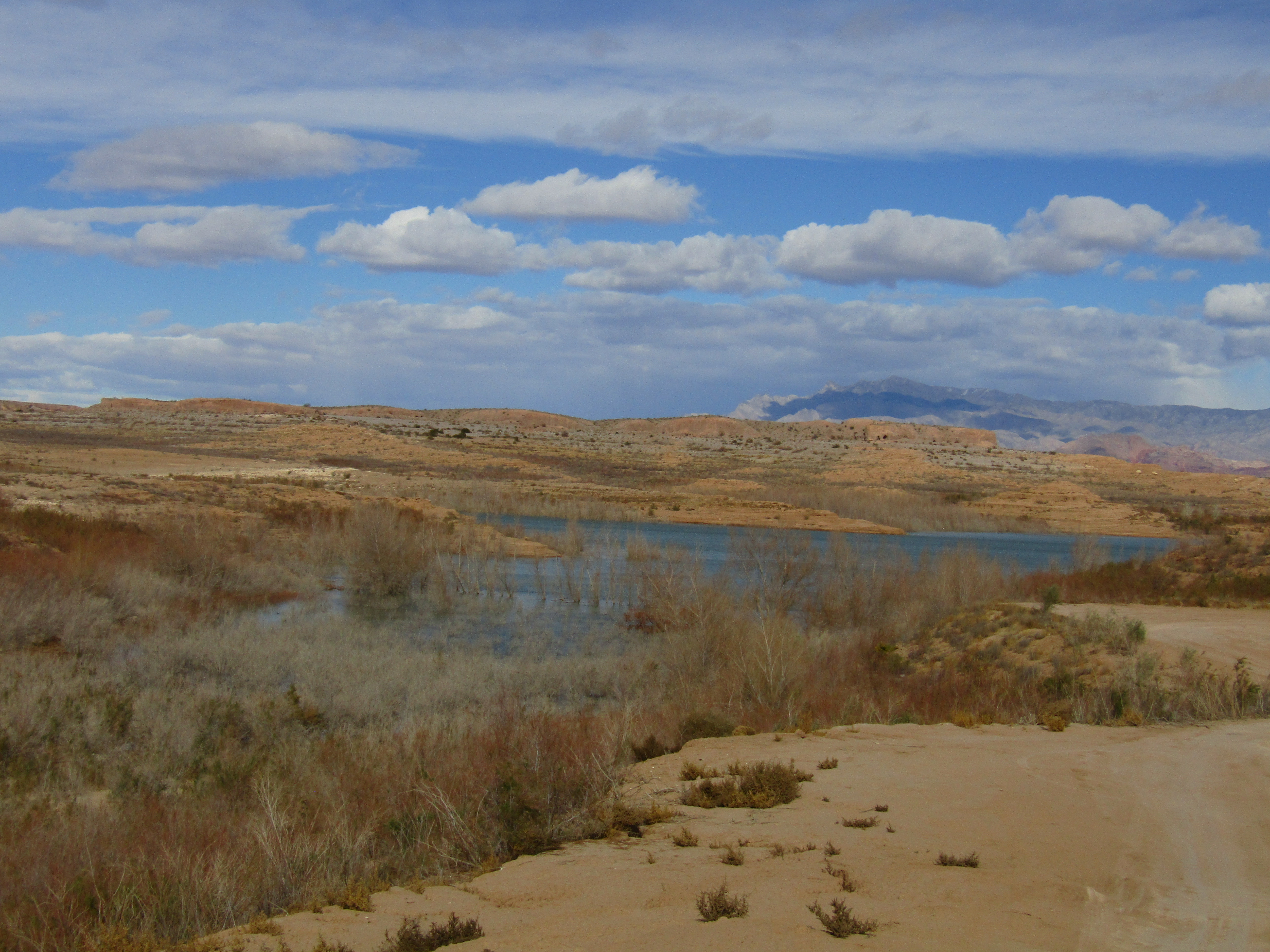
 |
| Lake Mead Recreation Area. |
Lake Mead Recreation Area is huge. I went through the entrance station from Boulder City, and it took an hour to drive all the way across to where I wanted to camp. And that's only one section of it. You have to pay $25.00 to drive through, even if you are not stopping, but that fee is good for a week, and you can dispersed camp for free in quite a few different places. I continued driving until I got to Stewarts Point. I picked that area specifically because it is very close to Valley of Fire.
The dispersed camping at Stewarts Point is unlimited, it would be pretty hard to not be able to find a spot. Most RVers get as close to the lake as they can, but most of the lake has fairly steep cliffs and it would be pretty difficult, although not impossible, to have access for hauling horse water. There is one bathroom when you first drive in, and plenty of cell service, but no other amenities.
 |
| RVers on the cliffs above the water. |
 |
| My spot at Lake Mead. |
I noticed some more burro manure in this area, but luckily there did not end up being any repeat performances of my previous experience. I got ready to ride as soon as I arrived, and ended up pretty much covering the entire area of the point, since there are deep ravines on either side, which prevent further exploration.
 |
| At Stewarts Point. |
 |
| The southern ravine at Stewarts Point. |
As I was riding along the far southern side of the point, I noticed some wild burros down in a ravine. They looked pretty surprised to see me, and started to run away, but couldn't help themselves from stopping periodically to gawk at me.
 |
| Wild Burro's at Lake Mead. |
 |
| Rina is perhaps wondering if one of those burros was her suitor from the night before. |
 |
| A fuzzy plant, don't know what it is. |
 |
| Stewarts Point. |
The next day I trailered over to Valley of Fire, which is just over 8 miles away. I assume it isn't always like this, but there was no one manning the entrance station, so I had to find a place to pull over and self pay the $10 fee, which is just good for one day.
As I was paying, I was accosted by a young guy from Michigan, who was drooling over my truck. He wants to buy it, so I now have his phone number in case I ever decide to part with it!
In the meantime since I had not received a map, I had to try and figure out where the equestrian parking area was. Since nothing was marked, I never found it, ( I did later on, but by then it was too late) so I just kept driving, and eventually found a spot alongside the road which ended up being the west end of one of the trails I was wanting to ride anyway. I did not get into any trouble for parking there, but who knows if I was actually allowed to. I started on the Arrowhead Trail, then went cross country through the Beehives area and over to the Petrified Logs. A film crew was setting up and asked, only half jokingly, if I would come back and ride through again while they were filming, I waved at them and declined.
 |
| The Beehives area. |
 |
| Did the little loop through the petrified logs. |
After the petrified logs section I crossed the main road and went up the Prospect Trail, ( this turned out to be one of the areas where you can park a trailer) and followed it until I got to what are called "rock scramble" sections of the trail. I actually went down one, but the next one was not doable on a horse. So I turned around and rode cross country for awhile through a wash, eventually finding another petrified log which was becoming unearthed from the soil. I'm not sure if any of the rangers know it is there, so I guess it will be my secret. Then I crossed back over the road and followed the east end of the Arrowhead Trail back to my trailer.
 |
| On the Prospect Trail. |
 |
| Riding cross country at Valley of Fire. |
 |
| Not sure what these are, but they smelled great. |
 |
| On the Arrowhead Trail. |
 |
| On the Arrowhead Trail. |
Another place to dispersed camp is Poverty Flats on Hwy 169, I passed it the next day on my drive over to Overton. There were a lot of people camped along the flats, it is a huge area, and would be very convenient as far as accessing Valley of Fire.
My destination was the Clark County Fairgrounds in Logandale, which is awesome! You get a whole lot of bang for your buck. For a $5.00 overnight fee, you can use the large pens (or $10 for stalls), park wherever you want, use hookups, and there is access to both of the arenas, including one that has lights. There are bathrooms, garbage cans, and of course potable water. Best of all, you do not have to call ahead, you just drive in and stay. You can even get WiFi, although it's a little iffy. I was the only one there at first, but a little later a couple of other separate rigs also pulled in.
 |
| The self pay station at Clark County Fairgrounds. |
I stayed there for three nights, I was specifically timing my return trip to Oregon, waiting out a small storm that was hitting the area I needed to drive through for the last leg of my trip. Another couple from Utah were doing the same thing, taking their time, because of some bad weather back at home.
Also I wanted to ride the Logandale Trails, although not technically part of Valley of Fire State Park, it's the same red rocks, there are 200 miles worth of trails, and no fee.
Although I could see this area from the fairgrounds, I still had to trailer over to it. There is one very large parking lot with no amenities, where I parked, but if you keep following the road another couple of miles, there is a smaller trailhead with a bathroom, and a picnic area. You could camp at either of these parking areas, but I wouldn't recommend it, since it would not be peaceful or quiet with the amount of OHVers that spend time there. In fact, when I returned after my ride, the lot was packed with toy haulers and trailers, so much so, that I almost didn't have room to get back out.
 |
| Riding up the road to the actual trailhead. |
 |
| Riding into the red rock. |
There are a lot of little side canyons to explore. I went into a few, but mostly just continued through the middle of the rocks, riding south. There were just a few OHVers out and about in the morning, and the farther out I rode, the less of them that I saw. They seemed to congregate closer to the trailhead for the most part. The riding starts out on a regular dirt road, but eventually becomes fairly deep salmon colored sand.
 |
| In one of the side canyons. |
 |
| Deep salmon colored sand. |
 |
| Logandale Trails. |
Since the fairgrounds are actually across the street from wide open BLM land, that is where I rode the next day. This is not especially exciting or scenic but you could certainly ride for a long time. I didn't..... because although I started out on a nice mild day, shedding my sweater, I had been on the trails for maybe 10 minutes when incredibly fierce winds suddenly kicked up. Sand was getting blown into my eyes and mouth, and it was a whole lot less warm. After awhile I gave up and went back to the fairgrounds, whereupon the winds eased up considerably.
 |
| BLM across from the Clark County Fairgrounds. |
That was officially my last ride of the trip. The following day I drove over and spent the night at Scotty's Junction where I had camped on the way to Arizona, then the next leg was over to the Winnemucca Fairgrounds, and finally the last 7 hour jaunt was back to my home sweet home in Central Oregon.
GPS COORDINATES TO STEWARTS POINT
GPS COORDINATES TO CLARK COUNTY FAIRGROUNDS
GPS COORDINATES TO LOGANDALE TRAILS


OK You started it. Do the wild burros really want to mate with your mare? I thought that animals only were attracted when the female was in heat. Serious question: I am not a horse perv haha
ReplyDeleteClearly he was interested in her, but I was less concerned about that, it was more about whether he/they were going to try to get into her corral, to get to the hay/water, and then the corral comes down and chaos ensues etc. Even if my horse is loose she won't leave, but I didn't want any altercations if the burro did have something like that in mind, or was aggressive at all. She wasn't in heat, and it seemed like he had a healthy respect for staying away from humans anyway. This was my first time dealing with them. In Utah I had some bulls try to get into her corral to get to the water. I had to chase them away, and hope they didn't come back.
DeletePoverty Flats is closer to the park but it is all hard pack with rocks. I spent one night there before moving to Stewart's Point. My horses were much happier in the sand at Stewart's. There's a pull-off at the Lake Mead NRA sign on Valley of Fire Highway where you can stage from. It's a 10-15 minute drive from Stewart's Point.
ReplyDelete