Friday, July 24, 2015

Whitefish Horse Camp, Oregon


Some friends of mine have started an annual group trip to Whitefish Horse Camp. Last year I couldn't make it, but this year I was able to fit it in. I had been there already about 5 years before, but there a lot of trails, and I certainly hadn't seen the whole area yet. If you like lakes, and lots of easy trail options then this is the place to go.

Diamond Peak from Diamond View Lake.

I got there pretty early in the morning before most everyone else in my group had arrived, and as I drove through camp I saw there was still someone in my reserved spot. Reservations are usually a good idea for this popular place, especially on weekends. Check out time wasn't until 2:00 pm so I proceeded to try to find somewhere else to park in the meantime. (There is no day use area.) The people in my spot who were from the Yakima area came over to talk to me, and mentioned they wanted to spend another night. So knowing that we had cancellations within our group, I moved into another site which was nicer than the one I would have had originally, so that worked out well. When the Hoodoo guy came through later in the day to collect everyone's money, he didn't care about the swap, but I am bringing this up because a lot of spots ended up being empty while we were there, although online it deceivingly appeared that the camp was booked solid.

Whitefish Horse Camp.

I got tacked up and got onto Whitefish Creek Trail which takes you to a really good view of Diamond Peak. I was going to do a loop, but I noticed that the trail continued on to Odell Lake from there, so I got distracted from my original plan and went that way instead. When I got about halfway I came upon Trapper Creek, and then eventually the trail ends at some railroad tracks, and I was suddenly back in civilization, at the Shelter Cove Resort and Marina and the Kokanee Lodge. This is an out and back ride, which is just over 20 miles.

Diamond Peak.

Odell Lake.

Lunch at the tracks by Odell Lake.

Trapper Creek Trail at Odell Lake.

Back in camp I said hello to my friends who had arrived in my absence, and a plan was made for riding the following day.

Whitefish is located close to the town of Crescent about 65 miles south of Bend OR. It has 17 sites, toilets, garbage, a manure bin with wheelbarrows, and potable water from spigots. The sites have either 2 or 4 horse steel corrals. They are $14.00 and $18.00 per night respectively. Crescent Lake is directly across the street within walking distance. The Pacific Crest Trail is accessible from here as well as the Metolious Windigo Trail which runs right through camp.

Crescent Lake.

The view from Crescent lake.

Six of us started out the next day to ride to Snell Lake, but we had to make a detour and ride along the road for awhile and then get back over to the Met Win since the bridge was out and we were not able to cross there. Update: The bridge is still out as of Sept. 2016. The remains of the bridge have been removed and people have been riding down the bank into the creek, but some friends of mine that camped there recently, reported that it may not be the best option for a green horse, since there is a large rock to step over before getting into the creek. Update #2: Apparently this descent into the creek has been leveled out by the forest service, and it is no longer a problem.

Bridge is out on the Met Win.

Riding up Rd. 6010 with Lori directly behind me on Bella.

We rode up dirt road 6010 until we got to the Snell Lake Trail and then continued on for awhile towards Effie Lake. Since I had planned a much longer ride than anyone else in the group wanted to do, I bid them all adieu and rode over to the trail to Meek Lake. This took me on a 18 ish mile loop past about a million other lakes, ( not kidding, there is a lake about every couple of minutes) until I reached Summit Lake. Summit is huge, but can be pretty quiet, since access is only by 4x4 or high clearance vehicles.

Meek Lake Trailhead.

Meek lake.

Although there was some trail clearing that had happened the weekend before we arrived, most of the trails I rode were not actually cleared. Most of it was not too bad, and I never had to turn around. Mosquito's were at a minimum, with it being such a dry year, there were just a few here and there, but don't count on that not being a normal occurrence.

Lots of forest in between the lakes.

Summit Lake.

Summit Lake.

The next day I went over to Oldenburg Lake, passing Bingham Lakes, Darlene Lake, Suzanne Lake, which was my favorite, and then Windy Lakes, making a loop of about 16 miles.

Darlene Lake.

Suzanne Lake, it's pretty deep and has some rocks for jumping off of.

Found this at Suzanne Lake.


There is another large loop that can be done to Fawn Lake, Pretty Lake and Stag Lake which I had done on my last visit, as well as some other trails to explore, making this a particularly good camp for any type of rider. Lots of options for long distance, but also a lot of easy out and backs, for people that want shorter rides.

Saturday, July 4, 2015

Currier Spring and Farm Well Horse Camps, Oregon

So this heat wave is something else. I had to find a way to escape for a little while. There are quite a few trail heads and camps that access the Fremont Winema Trail, and Currier Spring is the highest at almost 7000 feet. I figured that would do nicely.

The view of Summer Lake from Winter Rim.

Directions are correct in the OET book, but there is not much other info to be found online about this camp.

Just outside of Paisley OR you drive up to the top of Winter Rim and "voila" a nice little obviously underused camp and trail head. The drive is on a gravel road that is fairly steep, with a couple of narrow areas. On the way up I saw a bear, I was driving and he was running away, so no chance for a picture but it was great to see him since I rarely see bears in all my travels. As I pulled in I was greeted by a herd of cows and a very large bull congregating by the spring that the camp is named for. The bull was making some loud noises and pawing the ground a bit, so we eyed each other for awhile until he finally decided to saunter back over to all his womenfolk, allowing me to safely wander around and figure out where to park. There are three smaller campsites in a half circle and I found another site just around the corner from the trail head with a lot more room, enough for several rigs.

Currier Spring Horse Camp.

This is a primitive camp, with no bathroom, only one site has a set of steel corrals, two of the spots have picnic tables and fire rings. There is the spring nearby for stock water, but no potable water, and no fee.


Currier Spring Horse Camp.

The spring.

Local critter.

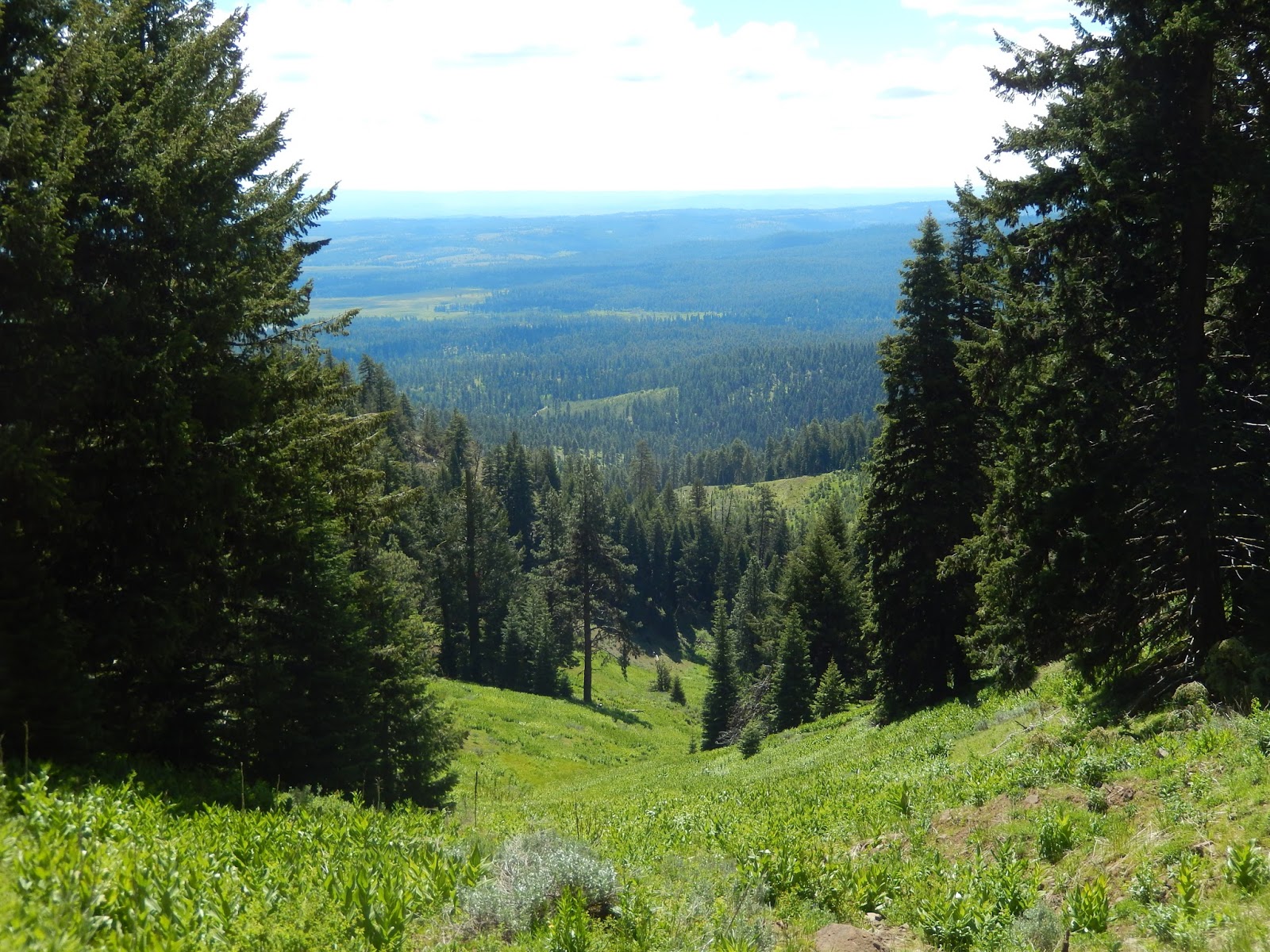
I headed out to ride the trail along the rim. Beautiful views, copious amounts of flowers, large birds soaring overhead, and a ton of bugs! Mosquito's were few and far between, but we were followed and harassed by a cloud of various other insects. I learned to keep my mouth firmly shut lest I ingest some unwanted protein. I was riding with my left hand and using my right hand to swat and kill deer flies that were attaching themselves to my poor pony.The trail heading north is very scenic but sometimes faint and I did lose it several times, but it is well marked. It became a game of "spot the national recreation trail signs" posted on trees, also there were a lot of large cairns, and sometimes orange trail tape. This section of trail has been maintained in the past, so as far as blow down, there was some, but it was easy to get around for quite awhile.... until suddenly it wasn't. I rode back down to the dirt road that runs parallel and then found the trail again later on.

Summer lake below Winter Rim.

So many different flowers.

Riding along the Fremont Winema Trail on Winter Rim.

Fairly well maintained for awhile.

Out in an old burn area.


Summer Lake.

Riding south however was another matter. On the second day I got about two miles along it and then the trail became a complete mess, which makes sense since it leaves the rim and no longer has a view so nobody has maintained it for a long time. I rode the rest of the day either on dirt roads or cross country.


Riding cross country through meadows and aspens.

Purple dirt road anyone?

I decided to leave that night and go to my next destination, Farm Well outside of Silver Lake. It is lower elevation, so it was hotter, but I wanted an early start for riding in the morning. Last year I did a day ride from Farm Well to the top of Hager Mountain, while I was camped at Silver Creek Marsh which I describe in another blog about that camp. Silver Creek Marsh Horse Camp
But this time I planned to ride the Fremont Winema trail to the south.

Farm Well is a really nice free camp, with lots of room between the 5 sites, there is a bathroom, a manure bin, and two large stock water ponds/swamps. The sites do not have corrals but there are four large communal corrals. I just parked in a spot close to them. I could see that this camp does get quite a bit of use but both times I have been there, there were no other horse people. I did have company though, some very quiet non horse campers. One fellow wandered over to say hi and to look at my horse.

The communal corrals at Farm Well.

Stock watering hole at Farm Well.

Stock watering hole at Farm Well.

I entertained myself that evening by photographing the local wildlife. There were a lot of vultures hanging about in the trees. I counted 16 that night. In the morning there were easily twice that many out by the watering hole.

Vulture.

Riding south the next day, the trail started out in the trees, headed into an old burn area for awhile, passing under some of those huge crackling power lines that make me worry my brain is being fried from exposure, through a few small canyons, across some grasslands, and then about 6 miles later, back into the woods. This whole section of trail was well maintained.

Riding south on Fremont Winema trail from Farm Well.

One of the small canyons.

Hager Mt.

Driving back to Silver Lake I learned that their gas station is only open three days a week, and Monday was not one of those days, so.... note to self, and anyone reading, make sure you have plenty of gas before heading out into this area. I barely made it back to La Pine!


GPS COORDINATES TO CURRIER SPRING

GPS COORDINATES TO FARM WELL

Sunday, June 7, 2015

Round Mountain Trail, Ochoco National Forest, Oregon


The Ochoco's are great for riding in the spring/early summer, since the snow melts there long before our higher country. It can be muddy if you get there too early, although it was not a problem this year with our especially dry winter.

Round Mountain Trail.

To get there: From Prineville, drive 15 miles east on Hwy 26. Take a right at the sign for Walton Lake and Big Summit Prairie. Follow this road for 14 miles, make sure to stay to the right where it becomes road 42 ignoring the left turn towards Walton Lake. Watch for the sign for Independent Mine. There is a washed out dirt road that heads uphill, drive up it very briefly and take a left into the large parking area.


Parking area sign.

The trailhead for Round Mountain South is at the end of the parking area. This is also where you park for the Independent Mine Loop and Lookout Mt.

Round Mountain trailhead.

This is an 18 mile out and back ride from the south trailhead to the north trailhead. But there are other options, like climbing to the top of the mountain to check out the view and then turning around, making it about an 8 mile ride, or you could continue on to Walton Lake adding an extra 2 miles to the total trip. When you are very close to the end of the trail there will be a signed junction, Walton Lake is one mile away to the right, or continue to the left to the north trailhead which was my destination this time.


The trail is marked the whole way with signs at junctions and white diamonds on trees.
This is wild horse country, there were numerous stallion piles along the trail but none were very fresh and I did not see any horses this time.

The Round Mountain Trail is welled marked with white diamonds and the occasional cairn..

There are some water sources along the trail, a swampy watering hole (it may not have water in it all summer) and some spring fed green troughs, plus another trough at the north parking area.


Swampy watering hole.

Round Mountain Trail.

Your horse needs to be in some semblance of shape since you climb Round Mountain twice.
The trail was completely clear with absolutely no downfall at all, as of June 5th. Once you reach the peak of Round Mountain you ride up a dirt road briefly and then the trail resumes and heads steeply down the other side.

Round Mountain Trail.

The top of Round Mountain looking down over Big Summit Prairie.

Corn Lilies.

Round Mountain summit.

The north trailhead is a gravel loop road with just some very small pullouts to park in.


The half way point, north trail head.

Convenient water trough at the north trailhead.

North trailhead.

Get out there and ride!!

GPS COORDINATES TO ROUND MT. TH

Thursday, May 28, 2015

Riding in the Malheur National Forest, Oregon


I have some friends that live outside of Burns OR, very near the Malheur National Forest.
We had planned to meet up and then drive to a dispersed camping spot they had picked out, but due to a lot of rain in the forecast, which would make driving on some of the dirt roads impossible (they had gotten their truck badly stuck the week before) we had to go with Plan B which was for me to camp out at their house and we would do day trips to ride. Our destinations were all off of Rattlesnake Rd. which heads north from Hwy 20 east of Burns, and we parked at different spots each day.
Update: In 2018 I finally checked out the only horse camp in this area,  Joaquin Miller

Barb riding Annie.

On our first day we did indeed get rained on for awhile. I had to dig out my duster that hadn't seen any use in many years. We just did a short three hours, and mostly stayed on dirt roads and some cross country. The ground was quite soft and mucky causing the horses to work twice as hard.


Following a cow trail in the Malheurs. 

Brian riding Hal and ponying Goldie.

 On day two the skies were looking very black in all directions and before we left a massive rain storm hit, coming down like crazy and turning dry dirt into lakes. We almost decided not to ride but once we got into the mountains the sun was out and the day remained nice.

Brian on Solomon, Barb on Sheeba.

There is one designated trail in the general area where we rode called the Craft Cabin Trail but we did not do it. We thought it probably would not have been cleared yet, but I learned upon returning home that it had been. My friends know the area well and like to make their own loops and ride cross country a lot so we just did that the whole time. There was a lot of mud on the second day as well, and a couple places we had to dismount to get through it safely.

Staying on their property had the benefit of me getting to hang out with their numerous animals. And Barb insisting on feeding me dinner most nights so I was pretty spoiled.

Baby!!

Katie Sue.

Day three started off windy and chilly, they took me on a ride where there was apparently a viewpoint, but we saw nothing due to heavy fog. It cleared up and was nice later on and we had a lot of fun, moving out a lot.  I rode Rina every day but Barb and Brian switched out horses on different days. That particular day was a combo of three high energy horses being especially competitive, so our ride was a little bouncier than normal!

One of our lunch spots.

Barb on Annie, with assorted dogs,

Brian on Hal aka High Energy Hal.

Day four was probably the prettiest ride and we did a nice 6 hour loop along a creek and then up into the hills.

Me and my pony and assorted dogs. We rode with between 5 and 7 dogs daily.

Rode through this area to get to the hills in the distance.

Heading up into the hills.

We could see the Strawberry Mountains from afar.

I was supposed to drive home that night but we got back too late so I stayed over another night and the next morning Barb took me on a scenic driving tour of some of the local sights. Starting at the Round Barn, which was originally owned by Peter French to train horses in the late 1800's. It has a holding area inside and an enclosed round pen around the outside.  We then went another five miles down the road to the Diamond Craters, then to the very small town of Diamond and the Diamond Hotel, and then we took the back road home through some of the land where the Kiger Mustangs roam. There is a Kiger lookout you can drive to from outside Diamond, but it is 11 miles on a 4x4 only road, so we decided to skip that.

The Round Barn.

Inside the Round Barn.

Diamond Craters.

I had a great time, other than catching Barb's cold on the last day. It's fun to ride with friends that are a little bit crazy like me!

GPS COORDINATES TO RATTLESNAKE RD.