Sunday, April 9, 2017

Cyrus Springs Horse Camp, Crooked River National Grasslands, Oregon

Cyrus is a great desert camp in Central Oregon, that can be accessed all year round, but it is the best in the spring and fall. Especially for people trying to escape the ongoing torrential downpour west of the cascades.

On the Warner Loop, Haystack Butte.

To get there: From Terrebonne follow Hwy 97 north for 7 miles, then take a right on Norris Lane.
Go 4 miles and take another right on a road that is not signed.
After almost another 2 miles the sign for Cyrus is on the right. Update: The horse camp sign is now missing, but the road number is 5750. It's one more mile to camp after the turnoff. After leaving the highway all the roads are gravel/dirt and are usually in good shape unless it has been extremely wet.

The road in to Cyrus Springs Horse Camp.

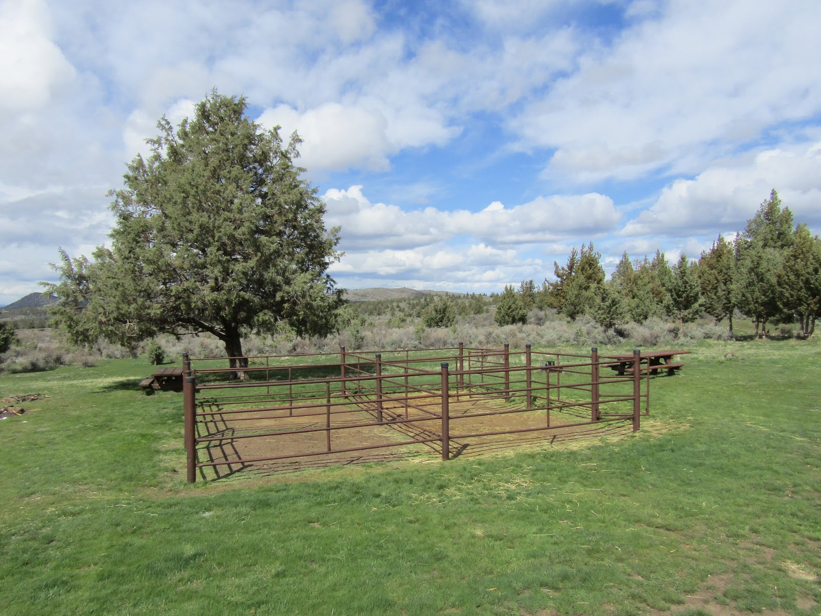
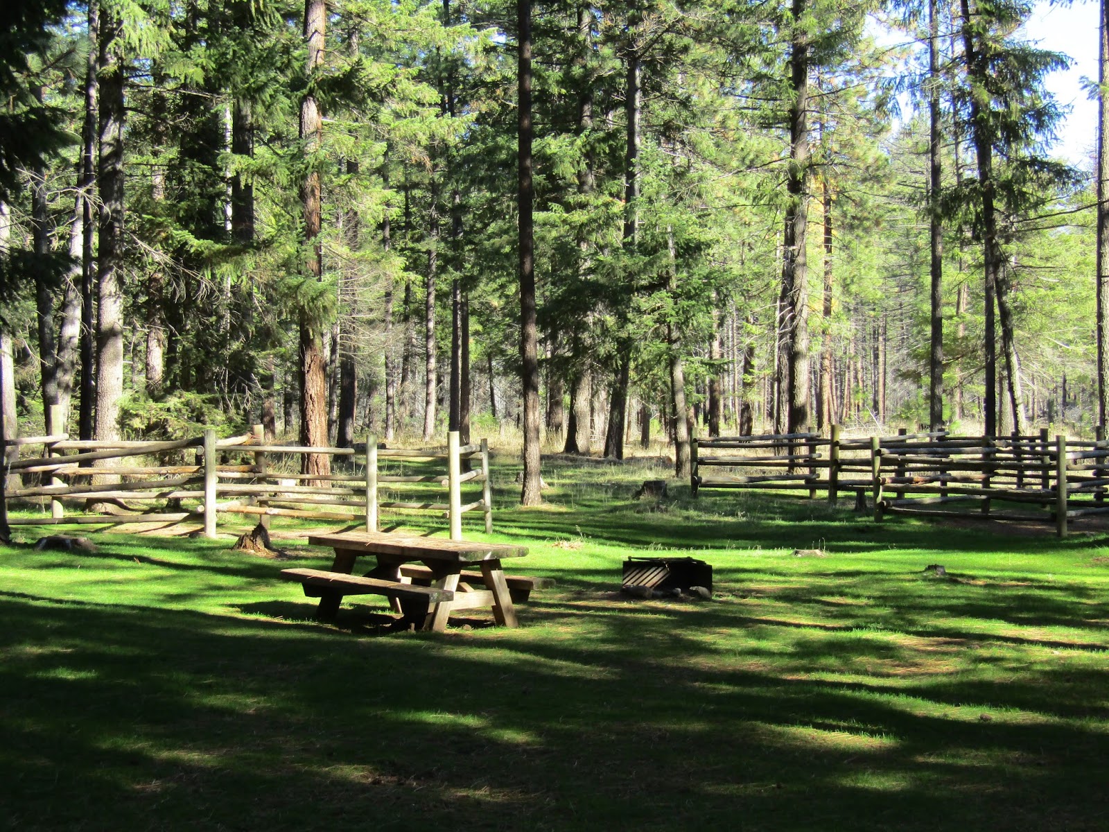
Cyrus is a free camp and it has nine sites with steel corrals, picnic tables and fire rings, and the spots are big enough for larger rigs. There is one bathroom, a manure bin, and a spring fed water trough for stock, but no potable water. Most of the year the water trough is there and in working order, however it does get removed during the winter, and they will set it back up again, usually in May, after there are no longer any freezing nights. Calling ahead to ask for info, usually does not work, so if it is especially early or late in the season, I would carry my own stock water.

The sign in camp.

Cyrus Springs Horse Camp.

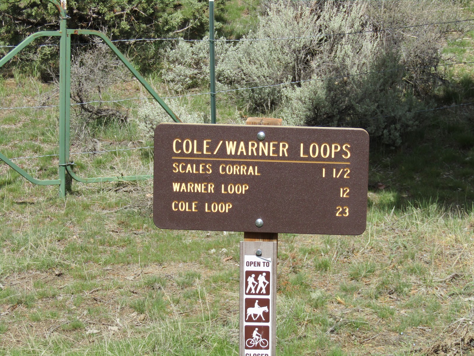
There are several different options as far as trails in the area go. The Warner Loop is 12 miles and leaves from camp. The Cole Loop Trail is 23 miles long, runs through camp and also crosses by several other trailheads on it's way around Gray Butte.

There are signs in camp with mileage for the trails.

On the Warner Loop.

On the Warner Loop.

Scales Corral is also on the north side of Gray Butte and it is about a mile further east past the turnoff to Cyrus. Since it is right off the main road, if I want to do a day ride, I just park there rather than driving into the camp.

Scales Corral.

Riding a dirt road near Scales Corral.

There is another trail that runs up the hill behind the camp, and you can follow it and just explore for awhile, or ride from there over to Trail Crossing Trailhead or Skull Hollow Trailhead.

Views from above Cyrus, Haystack Reservoir in the distance.

Trail Crossing Trailhead is on the west side of Gray Butte, with no amenities.There is some nice riding from there, especially if you want some elevation gain to give your horse more of a workout.

Henderson Flats OHV area is right nearby, but the trails are separate and it is only open from April 1st through November 30th, so in the winter, I ride the OHV trails a lot as well. Even when it is open, it is not an extremely heavily used area.

To get there: From Terrebonne, follow Hwy 97 north for 5 miles and take a right on Park Lane. After 2 miles it becomes a narrow dirt road, and after crossing a cattle guard, continue .05 of a mile until you get to the parking area on the right.


Trail Crossing Trailhead.

Heading up the hill from Trail Crossing Trailhead.

You can get in some hill work from Trail Crossing Trailhead.

From the OHV trails at Henderson Flats.

Even though this is dry desert, there are numerous springs throughout the area, on every trail you will run into some kind of water trough set up for cows.

Many springs available for water.

In the spring there are also a surprising number of wildflowers, especially after a wetter than normal winter.... okay, it's not like the super bloom California experiences, but it is still very pretty to see the pops of color here and there.

Wildflowers in the spring.

Wildflowers in the spring.

Skull Hollow Trailhead is on the east side of Gray Butte, although there are no amenities, there is a bathroom in the people campground nearby.

To get there:
From Terrebonne take Smith Rock Way east for 5 miles until it ends on Lone Pine Rd, then take a left and follow it for 4 miles. The trailhead is on the left, keep an eye out for the sign, it is sometimes hidden behind foliage, and you may blow right by it.
From Redmond take Hwy 97 north for 3 miles, take a right on O'Neil Hwy, drive for 5 miles then take a left on Lone Pine Rd. and follow it 5.5 miles to the trailhead on the left.


Plenty of parking at Skull Hollow Trailhead.

Jonni and Ron riding from Skull Hollow Trailhead.

Happy Trails!


GPS COORDINATES TO CYRUS


Saturday, November 12, 2016

Sheep Springs Horse Camp, Deschutes National Forest, Oregon

Sheep Springs is a very popular camp, with easy trails, a beautiful setting, and convenient early season accessibility.

Mt. Jefferson views from Sheep Springs Horse Camp.

To get there: From Sisters drive west on Hwy 20 for 12.5 miles, take a right at the sign for Camp Sherman, then follow the horse camp signs for the next 9 miles, the last few miles are on gravel.

Sheep Springs has 11 spots, with four horse log corrals, and there is an extra camp host spot. Update: site #9 now has brand new steel corrals. There are two manure bins, one at each end of camp, two bathrooms, a hand pump with potable water, and a separate small stock water trough. Both water sources are close to the entrance.
There is no day use area, but you can park in a dispersed camping area, on the left just before reaching camp. You can find season dates or make reservations ( probably a good idea ) on Recreation.gov and it is $16.00 per night. There is no gate, so riding or camping here can be done even when the camp is officially closed.

Sheep Springs Horse Camp.

Sheep Springs Horse Camp.

One of the water sources just outside the entrance to camp.

There are a couple of  beautiful rides within a short drive on bumpy gravel roads, if you are there at the right time of year to be able to get into the high country, and if trailering out is an option: Canyon Creek Meadows, starting from Jack Lake, and the ride to Cabot and Carl Lake.
Green Ridge is another fairly close option which can be done early in the season.

There are also several nice rides from camp:
The Metolius Windigo Trail is across the road, and you can ride it south as long as you want, if you make it all the way to the crossing over the Metolius River at Riverside Campground and then turn back, that is about a 21 mile ride.

Along the Metolius Windigo Trail.

Three Fingered Jack from the Metolius Windigo Trail.

On the Metolius Windigo Trail.

On the Metolius Windigo Trail.

One of the signs on the Met Win.

You can also follow the Met Win to the west towards Bear Valley. It climbs gradually, eventually reaching the junctions with the Rockpile Lake Trail and the trail to Minto Lake. Unfortunately neither of these trails are being maintained anymore, so from here it's best to just admire the valley and turn around making it a 10 mile out and back ride. Rockpile has been cleared in the past and may be again, but Minto has not been maintained in years.

On the trail to Bear Valley.

Riding back down from Bear Valley, Green Ridge in the distance.

Another option is to follow the trail behind sites 8 and 9, which heads over a small hill briefly and where you will then get a great view of Mt. Jefferson. You can continue on from there and do some loop rides since there are a lot of trails you won't find on a map, but that horse campers have made over the years.

Views of Mt. Jefferson.

Views from the small hill behind camp.

Fall colors in the burned area.

You can also loop past the Redmond Saddle Club over to the Metolius River and then follow Canyon Creek back.

The Metolius River.

Canyon Creek.

Owls live in this area and I have seen more than one on my various escapades. They blend in rather well in the trees, you never know when one is right above your head watching you!

The owls are around if you are lucky enough to spot them.

If you feel like a break from camping, Camp Sherman is so close you can drive in, have dinner at one of the restaurants, pick up supplies from the store, and explore some of the area, including the Head of the Metolius (where the beginning of the river literally appears out of the ground) or the Wizard Falls Fish Hatchery.

Happy Trails!


GPS COORDINATES TO SHEEP SPRINGS


Sunday, November 6, 2016

The Twin Pillars Trail, Ochoco National Forest, Oregon

Well I definitely have to get out and ride when we suddenly have a beautiful overly warm day in November. The Twin Pillars Trail is one that I have done a few times in the spring, and often have not been able to make it all the way to the base of the pillars because of blow down, but it is cleared now, so I went ahead and did the whole 12 mile out and back ride. The closest horse camp is Dry Creek but you would have to trailer out from there to do this ride.


On the Twin Pillars Trail.

To get there: From Prineville drive 8 miles east on Hwy 26, then take a left on Mill Creek Rd. Follow this for 11 miles, it will turn to gravel at about half way. At the sign for Wildcat Campground turn right and park in the lot for the Twin Pillars Trail.

Parking at the Twin Pillars trailhead.

The Twin Pillars trailhead.

The trail leaves beside the bathroom and follows the creek past the campground and into the forest. You will cross the creek eight times on the way out, as well as several other small streams that run across the trail here and there. Often there will be cows grazing, depending on what time of year it is.

A spring photo from a previous visit.

On the Twin Pillars Trail.

Not as green in the fall.

On the Twin Pillars Trail.

One of the many creek crossings.

After 3 miles you will get to the junction with the Belknap Trail, stay on the main trail here, but for future reference the Belknap Trail climbs fairly steeply uphill and intersects with the Wildcat Trail. Taking a left on the Wildcat Trail you can ride as long as you want, it will end at it's northern trailhead, if you can actually get through and the trail is clear. If you turn right, it will take you to White Rock Campground and the southern TH. You can drive to this camp, I have done it, but it was back in the day with a smaller rig than I have now, and the last two miles of the road is pretty rustic.

The junction with the Belknap Trail.

On the Wildcat Trail on a previous visit.

On the Twin Pillars Trail.

After awhile you will emerge from the forest into an old burn area from a lightning fire in 2000, and at this point the pillars will be in view.

The local wildlife.

On the Twin Pillars Trail.

The trail then switchbacks through large patches of manzanita to the base of the pillars.

The Twin Pillars.

I suspect most people would rather just visit the pillars, turn around and head back, but the trail does continue another 3 miles to the Bingham Springs Campground, this could be added to the ride making it 18 miles total.

The trail continues past the pillars.

The Bingham Springs Campground. I've hiked in from here, but it's not worth driving a trailer around this way.

Heading back down through the manzanita.

Views on the way down.

I actually met a few hardy hikers on this day, having to slosh through that many creek crossings could get old after awhile, but of course no problem via horseback!

Happy Trails!


GPS COORDINATES TO TWIN PILLARS TH