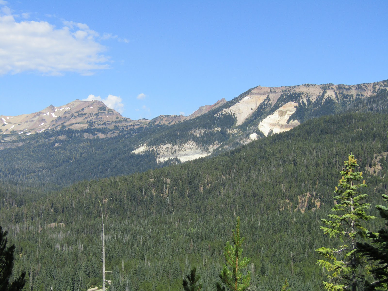
For anyone that has ridden into beautiful country, but had to work hard for the privilege, with either extreme elevation gain, very sketchy trails or a little bit of both, the Sawtooth's will seem like a piece of cake!
For the most part the trails are (my version) of easy to moderate and well marked, with some of the signage even having mileage. The trailheads all have huge maps so you can plan your route. Navigating the area and finding dispersed camping was also not problematic. Because there is a lack of actual horse camps, dispersed camping areas are plentiful, and some are even set up with fire rings and are usually always close to a creek or river.
 |
| On the trail to Sawtooth Lake. |
The night before I left to go to Idaho a friend alerted me to the fact that a fire had started and consequently the highway was closed on the way to Stanley, so my only real choice at that point was to go in from the other direction, a slightly longer route through Sun Valley.
My first destination was Tin Cup Horse Transfer Camp which may have once been an actual camp, but is now a trailhead with "no camping" signs. Strange... since it is separate from the hikers trailhead, and there are two very large nice steel corrals and a variety of hitching rails. There is a bathroom, a loading ramp, and a hand pump with potable water that was turned off for the season, so I have no idea whether it works or not. Road 365 continues on with dispersed camping areas on either side, and Rd. 363 which is directly across from the trailhead, also has a few spots, and that is where I camped. Some sites are better than others as far as access to the nearby creek. Update: As of 2023 the "no camping" signs at the trailhead are gone, and a grid of four steel corrals has been added across the road at the closest access to the creek, that are first come first serve. The hand pump at the trailhead still does not work.
 |
| Tin Cup Horse Transfer Camp. |
 |
| My dispersed spot across from Tin Cup TH. |
 |
| Pic from 2023, new corrals by the creek. |
As everyone knows wildfires were raging across the NW and the air quality back at my home was hazardous, so I was hoping that being over 500 miles away would be considerably better, but unfortunately the first evening was pretty smoky. The next day was also not very clear, so I started by just doing a very short loop over to Yellow Belly and McDonald Lakes, dillydallying slowly and dragging it out to a whopping three hours. I noticed a lot of downed trees along the way which I thought was odd, because I also saw some fresh cuts.
 |
| Riding along beside Yellow Belly Lake. |
 |
Yellow Belly Lake.
|
 |
A smoky version of McDonald Lake.
|
The following day started out smoky as well, but cleared right up as I was riding. The plan was to follow the Pettit Lake Trail to Alice Lake, but unfortunately I didn't make it. The downed trees theme I had encountered the day before continued on this trail, and this time there was no way around them. I talked to a hiker who mentioned that there had been an earthquake in the area in August, so perhaps that was the culprit, as it was obvious the trail had been cleared earlier in the year.
At that point I decided to to turn back and try the other trail that goes to Toxaway Lake. I figured I would have the same problem, but that I would ride as far as I could anyway. I got past a rock slide and then ran into the only other horse people I ended up seeing during my entire trip. They had tried to pack in to Toxaway, and were not able to make it through. So I turned back around, cutting my day short, saving my horses energy for future rides, packed up camp and drove over to my next destination, which was Decker Flat.
 |
| On the trail to Toxaway Lake. |
 |
| On the trail to Toxaway Lake. |
 |
| After crossing the rock slide, I turned back. |
Decker Flat is a large open area beside the Salmon River and Road 310 runs through it for miles all the way over to Redfish Lake Road. Where Rd. 310 starts, there are plenty of great dispersed spots along the river or you could also set up right near an irrigation canal. The river is nice and close, and has easy access for stock water. Being hunting season, a lot of these spots were taken, but I did not have a problem finding a place to camp. There are no amenities other than some hitching rails at the road junction, which is a good place to park for day use when riding the Hell Roaring Trail, as the actual trailhead does not have trailer parking.
 |
My camping spot at Decker Flat.
|
 |
The Salmon River, Decker Flat.
|
My horse was definitely not at all tuckered out yet, after our two very short rides thus far, so the following day, I decided to trailer over to Washington Lake Trailhead in the White Cloud Mountains. Road 209 is directly across the highway from Decker Flat, but I had heard from my friend Amber that this road could be a LONG drive, and indeed it was. 10 miles on gravel, gaining 1800 feet in elevation, but going 5mph nearly the whole way. When I was almost at the trailhead there were a couple of steeper sections which normally would not be an issue, but they were quite rutted, and even in 4 wheel drive, my truck tires spun a couple of times. I would not suggest taking too heavy of a rig into this area.
At the trailhead there are a couple of spots to park a trailer, and you can camp there. I wish I had known that beforehand, I would have spent a couple of nights there, since there is more than one ride that can be done from that trailhead. But I had no desire to drive that road a second time. There are hitching rails, feeders, a bathroom, a loading ramp and access to stock water from the creek, although it is a bit of a walk.
My goal for the day was to ride into Chamberlain Basin and back, which is about 18 miles.
I really enjoyed this ride, first passing Fourth of July Lake, then Washington Lake, then a little climbing through a recent burn area, up and over a ridge, to get to the basin.
 |
| Crossing the creek at Fourth of July Lake. |
 |
| This trailhead starts at 8800 feet, and I was up as high as 10,000 feet on occasion. |
 |
| Washington Lake. |
 |
| Looking at Castle Peak, above Chamberlain Basin. |
Once I got down into the basin I passed the first lake then got to the second one at the base of Castle Peak. There is a third upper lake I would have liked to see, but did not have the time to check it out. There are stock ties for people to pack into these lakes, a commonality that I would see on future rides during my trip. I saw a couple of mountain goats on the hillside, and also some horses tied to trees. I never actually saw their humans, even though I rode past them twice. Although this day was not very smoky in general, I know I was missing some of the experience, since the farther vistas were obscured in haze.
 |
| Riding down into Chamberlain Basin. |
 |
| Castle Peak, up close and personal. |
 |
| There is a stock tie area for packers. |
 |
| Mountain goats in Chamberlain Basin. |
 |
| On the way back on Washington Lake Creek Trail. |
I got back to camp fairly late that night, after the nearly an hour and a half drive back down to Decker Flat.
That evening it rained pretty consistently, and the following day was also cloudy and a little chilly. I bundled up and rode the trail to Hell Roaring Lake and then on to Imogene Lake, which starts from the Hell Roaring Trailhead, half a mile from where I was camped. This is a 19 mile ride, including the part on the road, but I did about 20 miles because once I got to Imogene, I continued on around to the other side of the lake.
 |
| The trailhead for Hell Roaring, there is no trailer parking there. |
 |
| On the Hell Roaring Trail. |
 |
| Hell Roaring Lake. |
 |
| Hell Roaring Lake. |
I ran into a backpacker at Imogene who asked me how my horse was doing on the trail, riding all that way. I said it was an easy trail and she was fine. He said he had horses and he would not ride them 9 miles including up a hill, because he thought they would expire. I figured I wouldn't bother telling him that I wasn't staying the night out there, and was going back the same day!
On the way back my horse and I had a little incident. We were riding across a boardwalk type of thing over some running water, which was only a couple of inches off the ground. My horse decided to spook at the water and I felt one of her back feet going off the boardwalk. Turns out there is a good reason for the boards to be there, her one back leg sunk in mud all the way to the top, and part way up her butt. She was basically lying across the boardwalk while trying to get back on to it, and as she was scrambling her front foot also went off. I had just a moment in time to slide off of her, and then she was able to get back up onto the boardwalk. A silly mistake, but these things can happen, even in a place that does not look particularly treacherous, and luckily no one was harmed.
 |
| Not the boardwalk we came off of, but a similar one, at Hell Roaring Lake. |
 |
| Lots of cute little islands in Imogene Lake. |
 |
| Imogene Lake. |
 |
| Looking down onto Hell Roaring Lake, on the way back. |
 |
| A rainbow greeted me on my return to camp. |
The next day was beautiful and sunny with no smoke, but it was time to give my horse a rest, so I hung out at camp, and eventually went for a short hike out onto Decker Flat. A person could spend a day just riding across the flat and into the nearby forest, there are mountain views the whole way and many miles to explore.
 |
| My short hike to Decker Flat. |
After our rest day, I drove just a few miles up the highway to the Redfish Trailhead. You can't camp there and there is no bathroom, but it is a very large parking area, with plenty of room.
There is more than one ride to do, but I picked Bench Lakes first, and it ended up being one of my favorite rides. Partly because the day was crystal clear, and when I arrived at the lakes, the light was amazing. This is a short but sweet 8 mile ride along a ridge, with views down onto Redfish Lake on one side and mountain views on the other.
 |
| Redfish Trailhead, lots of parking room. |
 |
| On the Redfish Lake Trail. |
 |
| Bench Lakes. |
 |
| Bench Lakes. |
The second lake is very close by, and there is a stock tie area in between the two lakes. Redfish Lake Corrals does trail rides, so this particular stock tie had very fancy high lines set up.
 |
| Between the lakes is a stock tie area. |
 |
| Bench Lakes. |
 |
| Redfish Lake. |
After that extremely delightful ride I drove through the handy RV dump station that Redfish has, and filled up with water. Then I drove into the tiny town of Stanley, picking up an extremely overpriced bag of salad at their one and only mart, (not a real grocery store) and then continued on Hwy 21 to the Iron Creek Trailhead. (Stanley also has potable water behind the gas station, and there is also another dump station at the Stanley Ranger Station.)
I drove around the loop at the trailhead, but it was packed, I found out you can't camp there anyway, but even finding a parking spot would be tight unless you arrive early in the morning.
There is 3 miles of decent gravel road to get to the trailhead, and along it on the left side near the creek are some designated dispersed spots with fire rings. You aren't allowed to camp anywhere except in these spots, but luckily there were plenty that were available. The two that are closest to the trailhead are not horse trailer friendly, but there are four that are big enough, a little farther away, which meant I had to ride about a mile on the road the next day.
 |
| One of the designated dispersed spots near Iron Creek Trailhead. |
This is the trailhead that takes you to Sawtooth Lake, and it is a beautiful 10 mile ride. It starts out easy but eventually there are some rocky switchbacks, gaining 1,700 feet in elevation. I stopped off at Alpine Lake first, and then continued to Sawtooth.
 |
| OMG it's pretty...on the trail to Sawtooth Lake. |
 |
| On the switchback section on the way to Sawtooth Lake. |
 |
| Just a small section of Sawtooth Lake. |
 |
| At Sawtooth Lake. |
 |
| Looking down at Alpine Lake, on the way back. |
I had had no cell service for the whole previous week up until I got to the Redfish area, where I was in an extended network, and I also still had it at Iron Creek, so I was able to connect with the rest of the world again....worried friend, mother, etc.
My next ride was back at Redfish TH, but this time I headed up to Marshall Lake. This is a 9.6 mile ride and starts out in a beautiful Aspen grove, then along a ridge looking down onto Fishhook Creek, and of course, more mountain views. One thing I noticed was that the wilderness permit boxes were mostly all at a nice height where I could just reach down, grab one and fill it out, without dismounting.
 |
| On the trail to Marshall Lake. |
 |
| More gorgeous views on the way to Marshall Lake. |
 |
| Entering the Sawtooth Wilderness. |
 |
| Marshall Lake. |
 |
| Marshall Lake. |
Although you can't camp at Redfish Trailhead, as I mentioned before, Rd. 310 runs all the way from Decker Flat and ends on Redfish Rd. I had previously scoped out the one and only dispersed spot that was close to the main road. I figured if it was available I would grab it, and it was! Again there are no amenities, and although Redfish Lake Creek is nearby it is not close enough for easy water hauling.
I gave my horse another day off, and wandered around over by Little Redfish Lake, and mostly twiddled my thumbs, until finally, the last riding day arrived, and I drove over to Cabin Creek Trailhead.
Cabin Creek doesn't have a huge parking area, but there is a side road that loops around that is perfect for trailers, and you can camp there. There is no bathroom and no stock water, at least close by. There is a creek bed that runs past an old dilapidated stock corral with a water trough, but the corral is not useable in it's current shape, and the creek was dry at this time of year.
 |
| Cabin Creek Trailhead. |
The Cabin Creek Trail is 7.6 miles and gains about 2000 feet of elevation on the way to several lakes. Most of the lower part is not as quite as scenic as all of the other trails I had done thus far. I ended up having to go up and around a few downed trees near the beginning, but it was clear after that. I passed a group of four ladies hiking and eventually they arrived at the first lake, after I did. We were chatting and they mentioned that there is an upper lake that they had never been to. I headed up to it first, and it was a short, but very steep climb. This was not a busy trail, the ladies were the only people I saw all day, and I had the upper lake to myself.
 |
| Presumably more earthquake related downed trees. |
 |
| Upper Cabin Lake. |
 |
| Looking down on one of the Cabin Lakes, from the trail to the upper lake. |
After this ride, I drove about 3 and a half hours closer to home, spending the night on public land near the highway, and then proceeded with the rest of the long drive the following day.
On this 12 day trip I just did a smidgeon of the trails, there are at least 8 to 10 more rides just in the one general area, including Grandjean which was too close to the fire zone for me to check out this time. There are also many opportunities for people that like to pack in, to do long loops, or ride across from one trailhead to another, if they have someone to fetch them on the other side.
Every day was kind of an eenie meenie miney mo type of thing, trying to decide which trail to do. I will definitely go back one day, to ride the ones I missed, including a sequel to the ones I wasn't able to finish, Alice and Toxaway.
My overall impression of the Sawtooth's.....beauty everywhere you go!