Yipeee!...first camping trip of the season, and it was a good one. Last fall I did a little trip over to California and did some hiking and exploring in and around the Redwoods.While I was there I figured out where some of the horse trails were, and consequently made a plan to return in the spring with my pony.
 |
| Yes, she is a small horse but this is a BIG tree...Redwood National Park. |
I watched the weather for a long enough stretch of good/dry days, and set off on my journey on the 6th of May heading to Orick CA. It's a pretty long drive, and so I was happy to get to Crescent City where I stopped to do a ride on the Mill Creek Horse Trail. This trailhead is just a few miles from town and has lots of room for parking.
 |
| The Mill Creek Horse Trail parking area. |
This is a 10 mile loop and can be made a tiny bit longer by crossing Mill Creek on another small loop, crossing back over the creek once again, and continuing on the rest of the main trail, however at this time of the year one of the creek crossings is closed due to salmon spawning, so I skipped that section.
 |
| The roots of a fallen Redwood on the Mill Creek Horse Trail. |
Back in the day they allowed logging in this area, so unfortunately there are some large stumps interspersed among the rest of the trees that are still standing.
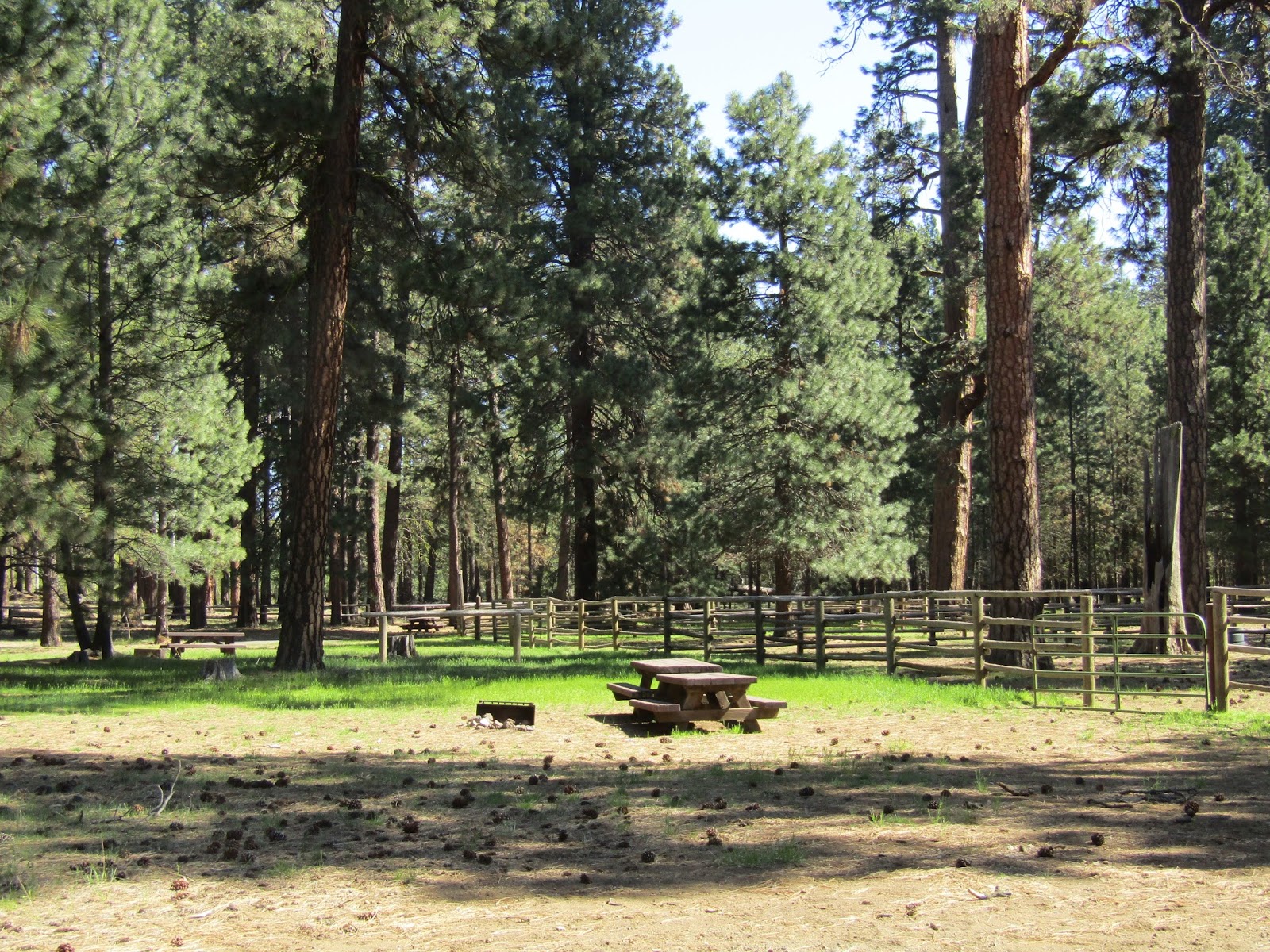
There are quite a few hitching rails along the way as well as a spot with picnic tables. The trails are well marked, cleared, and easy to navigate.
 |
| Riding on the Mill Creek Horse Trail. |
 |
| On the Mill Creek Horse Trail. |
 |
| Picnic area on the Mill Creek Horse Trail. |
After my ride I continued the rest of my drive over to the Orick Rodeo Grounds where they have a horse camp. I had called ahead to make a reservation, there is no reservation fee, they just want to know you are coming. Being so early in the season it was not busy, in fact I was only the second camper they had seen this year. This will change come summer, since millions of tourists flock to this area. In order to make the reservation you have to call the Orick Chamber of Commerce, and talk to a very nice lady who also has another business in town, and may answer the phone using that business name instead, causing you to think you have the wrong number. Orick is a VERY small town, literally just over 300 people and that includes all of the outlying areas. During the time I was there absolutely everyone who saw me knew right away I was not a local.
I pulled in, and quickly realized that the camp host was not around to ask about parking, so I just picked a pen for my horse and started to settle in. Eventually the host arrived, an affable fellow named Fred, he gave me a piece of paper with a list of rules, and I paid him for three nights.
 |
| Orick Rodeo Grounds. |
Orick horse camp has 8 pens, but there are opportunities to accommodate more horses by putting up your own corral or panels.
There aren't really any specific sites, you just park wherever you want. There are water spigots and in one area I noticed some plug ins, so it is possible to have hookups, with an extra charge. I asked Fred if I could drink the water, and he looked skeptical, so I decided not to chance it. It is well water, and no one knows whether it has been tested anytime lately.
It is $10.00 per night per horse to camp, or a $5.00 fee for the day use area. There is a ramshackle shed that turned out to be the bathroom, it does have a flush toilet and sink and Fred has thoughtfully placed some reading materials inside. There is a wheelbarrow and an area to dump manure.
 |
| The biggest pen at Orick Rodeo Grounds. |
 |
| Orick Horse Camp. |
Although there were no other campers while I was there, there was some activity happening during the weekend. The rodeo grounds is the only access to the horse trails in the area, and there are two outfits that run horse rides for the tourists. They trailer the horses in when they have business, and take them back home afterwards. There were also some guys doing construction on a building that will eventually become a better bathroom, with showers etc. It might take a little while to complete, since it is being done by volunteers. Once it's done they will likely raise their camping rates.
 |
| One of the groups that do horse rides for tourists. |
The following day I rode along the levee beside Redwood Creek to get to the trailhead. There is a map there showing various loops you can do, but instead of mileage they have described them in how many hours it will take you. Since everyone goes at a different pace, I wasn't sure what this meant so I picked a loop that was called the Overnight Loop and headed out. Later researching online I saw that this is also called the Elam Creek Loop and it is 20 miles. It took me 5 hours and 20 minutes and yet it is supposed to be much longer than the one they call the 6 hour loop, so perhaps it's best to take the descriptions as more of a guide for hikers, rather than on horseback. The longest ride you can do is a 32 mile loop and the shortest is 7 miles.
 |
| The map of the Orick Horse Trails. |
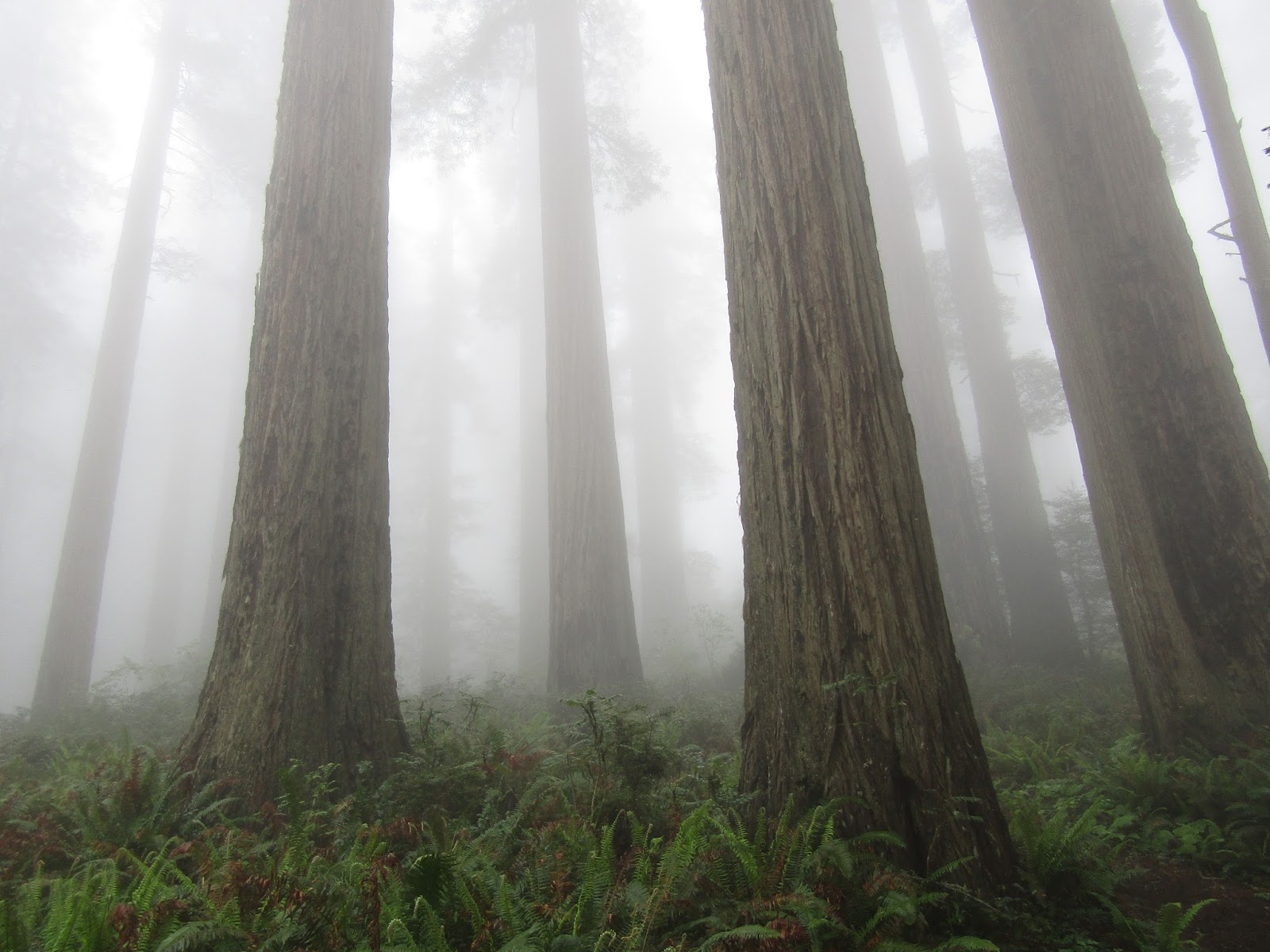
As I rode up to a higher elevation I was in the fog for awhile, which made it a somewhat mystical experience.
 |
| Fog in the Redwoods. |
The first part of this trail has the best variety of Redwoods, there is even one you can put your highly tolerant pony into!
 |
| A pony in a tree. |
 |
| Riding in the Redwoods. |
After awhile the trail switchbacks downhill, and I ran into a couple of backpackers who exclaimed that they had seen no other humans in two days, and eventually I found myself at Elam Camp which is a backcountry overnight spot for packing in. There is an outhouse, water trough, and picnic tables.
The trails are clearly marked at all the junctions with the number of the trail and the corresponding color.
 |
| The outhouse at Elam Camp. |
 |
| The trails are well marked. |
 |
| Rhododendron on the Overnight Loop. |
 |
| Riding through the Redwoods on the Overnight Loop. |
Since I had done this long of a ride to start with, I realized there was no reason to do anymore of the shorter loops because I would be retracing most of my steps, except for a short section in the middle, so the following day I rode to the beach instead. I got back on the levee and followed it towards the ocean. It took about an hour to get there, you ride under Hwy 101 and past the town of Orick. I saw a fox, a bald eagle, and I also heard a number of coyotes start yipping after I had passed by a wooded area. The trick to riding on the beach is to know when the tide is out, otherwise you can't ride to the north. Redwood Creek runs into the ocean there, and it is too deep to cross, so I just rode on the small section of beach available to me ( since the tide was in) and then headed back.
 |
| The beach in Orick. |
 |
| The levee beside Redwood Creek. |
I wanted to keep riding so I headed back towards the Redwoods trailhead but veered off over by the creek and rode around just exploring for awhile. I came across a couple of strange contraptions in the water (I asked Fred later, and he said they are fish counters) they have a barrel in the middle that spins and my horse wasn't quite able to wrap her mind around it. After my soon to be 15 year old seasoned trail horse exhibited a lot of bug eyed, snorty behavior, we continued past it and then crossed the creek.
 |
| The oh so scary fish counter. |
I found myself on a paved road that was going towards the Redwood Creek trailhead but it is a hiker only trail, so I turned around at that point.
After riding, I hung around camp for awhile chatting with Fred ( he is an interesting character) and then went for a walk on the levee.
I had a really enjoyable time and didn't really want to leave, but the next morning it was time to head back to Oregon. I planned to camp a couple of nights at Lake Selmac to extend my trip. This is a good place to stop, since it's right on the way, and it breaks up the amount of driving time. I found the horse camp at the end of a people campground called the Mallard Loop.
Lake Selmac is a county park in Selma OR with a resort beside the lake, and quite a number of campgrounds. Josephine County manages the camps and you need to get a hold of them, not the resort, for info or reservations.
The horse camp has 6 sites, 3 have 2 horse corrals, 2 have 3, and there is 1 with 4 corrals.
Site number 6 is actually the first site when you drive in and it is the only one with electric hookups.
This is not a loop, you drive straight in, and there is not a lot of room to turn around once you reach the end. If there had been people parked there I would probably have had to back out, but I had the place to myself. To make matters a little more interesting the ground was pretty wet and I had to be careful not to get stuck in the mud.
There are water spigots,with potable water, attached to the corrals at every site. There are also several garbage cans. There is no bathroom but the other campground is close by and they have a bathroom with showers. There is no manure bin and no pay station at the horse camp, which brings me to an interesting predicament I found myself in.
 |
| Lake Selmac Horse Camp. |
 |
| Lake Selmac Horse Camp from afar. |
Usually if there is no pay station it means someone will likely drive around at some point to collect money. But no one came by that night. At 6:45 the next morning, a parks guy drove in and then back out again. Later in the morning he came back, and asked if I had had a chance to pay yet. I asked him where I was supposed to do that, and he said I could put it into any of the other campground's drop boxes, I had seen those, but they had no information about horse camp prices on them. Then as I am standing there holding my checkbook he says "and we don't take checks". I have been horse camping for a lot of years, and have never once come across a place that doesn't accept checks.
I then asked him how much it was per night and he said $30.00. I must have looked a little shocked, since that is pretty high, and certainly higher than the other campgrounds in the park were charging.
He then told me I could go over to the store at the resort, and get cash from the ATM machine. So since I was just about to leave on my ride, I said I would do it later, he agreed, and as we parted company he even said he wouldn't charge me for my first night. I thanked him, and left to go riding.
I went over to the day use area where the trailhead is, and started to explore. I ended up riding along what is called the Long Cut Trail which climbs up the side of a hill and then turns into logging roads eventually, so I just followed those for awhile.
 |
| Riding on some old logging roads from the Long Cut Trail. |
Coming back down, I then followed the Lake Trail which follows along one side of the lake and then spits you out into a boat launch area. I kept riding down the road and ended up on some more trails that led to logging roads on the other side of the lake. Nobody seems to care where you ride horses in the whole park, there were no horse free zones that I saw. In fact as I was heading across the parking lot at one point, a park host lady hollered at me to stop, and I thought maybe I wasn't supposed to be there, but it turns out she just wanted a picture. I got about 5 hours of riding in and then went back to camp.
 |
| Mountain views from the Long Cut Trail. |
 |
| Lots of butterflies. |
 |
| Lake Selmac. |
 |
| More logging roads on the other side of Lake Selmac. |
Later as I was getting my stuff together to walk to the store to get cash, the park ranger drove back in, but this time it was not the same guy, it was his wife, and she looked cranky. She started in on me about not paying, and I explained that I was on my way to do just that, but she just kept saying how I was supposed to have paid as soon as I got there etc.etc. Her husband had apparently failed to mention to her about the free night he had originally offered, AND about me paying after getting back from riding. She told me I owed $40.00 for the two nights, which is $20.00 a night, a different price than I was told earlier. I proceeded to walk to the store, and was informed by the sweet lady behind the counter that they did NOT have an ATM. I then had to walk back, unhook my truck and take a drive to town. So my thoughts are: if anyone reading this decides to camp there, either bring a giant wad of cash, (I still have no idea which price it actually is, but on reserve america it does say $20.00 ), or call ahead and reserve a spot, perhaps you can pay online or at least get some info beforehand. Sigh.
The next morning I just did a short ride on the remaining trails I had missed the day before. Some of them have some very steep sections.They are on a small mountain across a creek and the trails meander back and forth across this mountain, none of them really going anywhere, and a lot of them end completely, or turn into a trail with a different name. After about an hour of this I had ridden every trail, and decided to just head on home. Check out time was at noon, and clearly there was no way they were going to let me stay longer. That may have been the shortest ride I have ever done on my horse in the entire time I have owned her!
 |
| Lots of short trails to do, all clearly marked. |
 |
| On the Mountain Top Trail. |
Driving home I managed to get a half decent shot of Mt. Thielsen through my bug spattered windshield.
 |
Mt Thielsen.
|