 |
| On the Chinle Trail in Zion National Park. |
My next destination was Washington Legacy Park just outside of Hurricane. This park is quite large and is a combination fairgrounds/rodeo grounds/racetrack.
There are two ways to stay there, rent a stall for $15.00 per night, and get a spot with hookups over by the barn (I don't know what they charge for hookups) or get an outside pen with water, and park near the pens behind the Grafton Building. The option I chose was the outside pen and it was very affordable at only $5.00 per night. There is a drop box in the stall barn where you pay, so if you call ahead, and they do not have an event going on, you can just drive over and make yourself at home.
They do not have much info on their website so call 435 652 4000 to get set up.
Every morning and evening the racehorses get exercised on the track, but other than the race horse people which are not especially close by, it was not a busy place, and no one else was using the pens.
They have several bathrooms, but they were locked when I was there.
They have cameras set up here and there, so don't do anything you aren't supposed to!
At this point my horse was ready for another day off, so I took advantage of having a safe place to leave her, and went on a hike nearby at the Red Cliffs Desert Preserve. You can ride there as well, and there are several different trailheads into the preserve. I checked out White Reef TH which has plenty of horse trailer parking spots, and a $5.00 day use fee.
But I ended up hiking from Cottonwood TH which is free, and a lot more rustic, but there is still room for a few horse trailers. You have to drive through narrow highway underpasses to get to both of these trailheads.
 |
| Parking at the Cottonwood TH in the Red Cliffs Preserve. |
I hiked along an actual trail for awhile but then decided to go cross country and hop around on the red rocks for awhile, isn't that the whole point of being in Utah?! Hopefully without falling into a crevasse and having to cut off my own arm... yes, I saw the movie 172 Hours.
 |
| Rock hopping in the Red Cliffs Preserve. |
After my hike I went to Hurricane to get a few groceries, and when I got back to the park the race track people had put a horse in a pen near mine, so my mare had company for the rest of the evening.
The next ride on the agenda was the Hurricane Rim Trail over on Sheep Bridge Rd. near the town of Rockville. Sheep Bridge Rd. is a very busy place because of it's proximity to Zion, and a lot of people primitive camp on side roads in this large expanse of BLM. The Hurricane Cliffs Trail System is mostly for mountain bikers, but there are a couple of horse trails as well.
I didn't go to a real trailhead, I parked at a pullout that is on private property, but can be used for the day. From there I rode a short ways to the Rim Trail which starts out along the Virgin River. It veers away from the river for awhile, and then back eventually to a much deeper part of the canyon. Then as per usual, I made it into a loop, by riding up Chinatown Wash and then back along the road. There are some pretty nice views of Zion from afar.
 |
| On the Hurricane Rim Trail. |
 |
| The Virgin River, from the Hurricane Rim Trail. |
 |
| The deeper part of the canyon from the Hurricane Rim Trail. |
 |
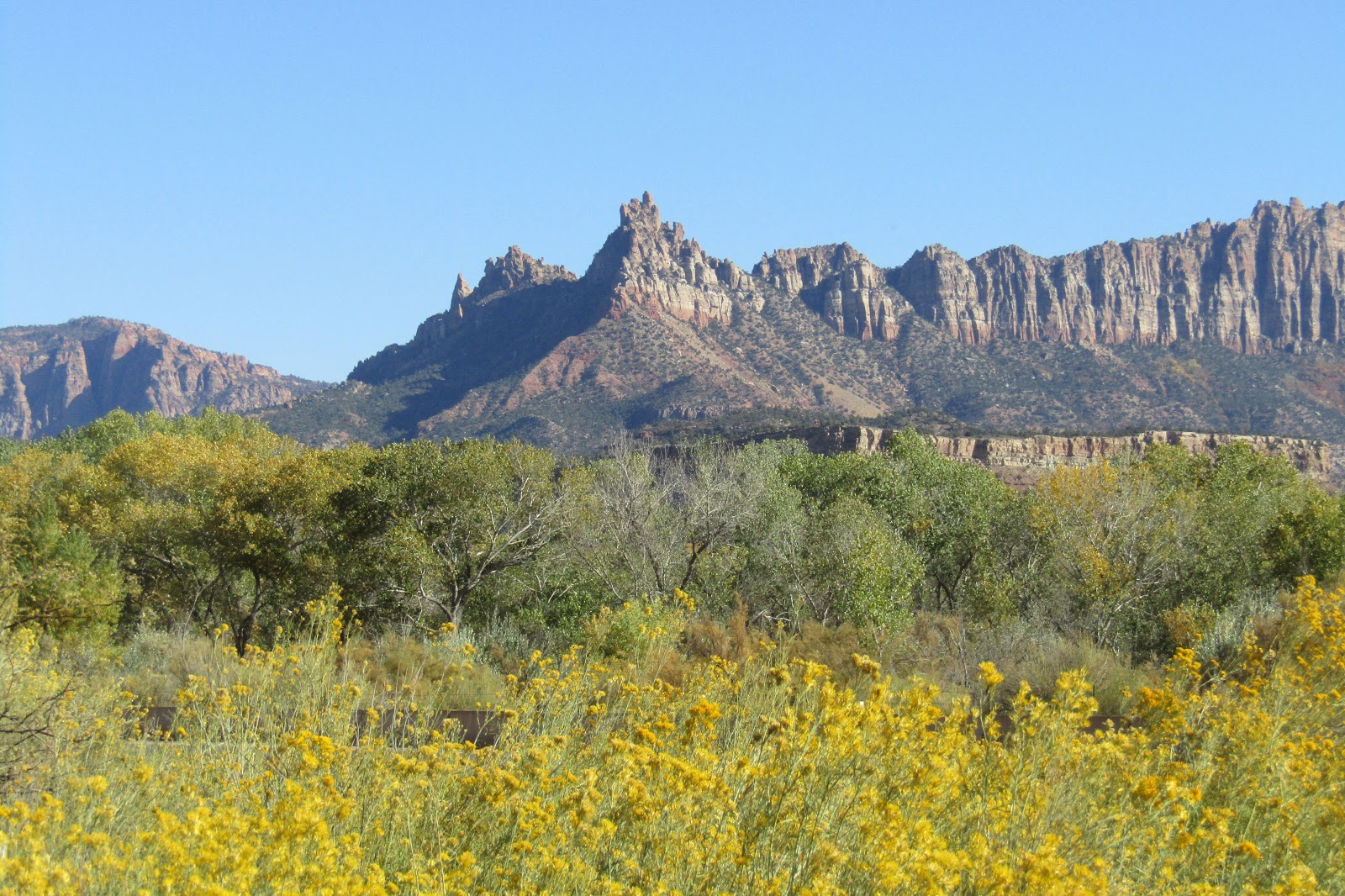
| Views of Zion from the Hurricane Cliffs Trail System. |
 |
| Views of Zion from the Hurricane Cliffs Trail System. |
The next day, sadly, was my last ride in Southern Utah. I had contacted Jon Tanner a local Utah rider to see about finding a place to stop and ride on my way home, which he was very helpful with, but he also recommended that I do Coalpits Wash in Zion, and so that is what I did. You access this trail by parking at a pullout alongside Hwy 9 near Rockville, by mile marker 25. There were a couple of park rangers about to hike in for the day who greeted me when I arrived, but just like the Hop Valley TH I had done previously, this is not an area that you have to pay a fee to access the national park.
 |
| The view from the parking area, before I even started the ride! |
From the parking area you can ride in the actual wash, but there is also a perfectly good trail to follow above it, and eventually it leads to the Scoggins Stock Trail. This trail takes you up and out of the canyon, to the junction with the Chinle Trail, which then meanders through the scenic and beautiful cliffs of Zion.
The Chinle Trail keeps going for awhile, and I followed it keeping an eye out for pieces of petrified wood, it is illegal to take any home with you, but fun to try to spot them. It eventually heads back down to it's trailhead in Rockville so unless you have another rig parked there, you have to turn around and go back the same way.
 |
| Heading up the trail beside Coalpits Wash. |
 |
| Trying to see how "blendy" my horse is with the red rock. |
 |
| This trail goes up a short hill out of the canyon to the Chinle Trail. |
 |
| On the Scoggins Stock Trail. |
 |
| On the Chinle Trail. |
 |
| On the Chinle Trail. |
 |
| Heading back down the Scoggins Stock Trail. |
It's a long drive to get back to Oregon, and although I did the trip to Utah in two days, I wanted to break it up a little bit on the way back, so I drove from Hurricane to Weber County North Fork Park outside of Ogden, which was one of Jon's recommendations. It wasn't too far out of my way and I could spend the night, do a ride the following day, and then spend a second night before continuing on my way home.
Weber County Park has several different campgrounds, but there is also an area with communal horse corrals. Presumably you are supposed to pick a spot right near them to camp, but there was a nice open area that was more level, and with access to sun, so that is where I set up instead, and the camp host did not care. There was only one week left of the park being open, so the bathrooms were locked and the water was turned off. It is $5.00 per horse, per night, and possibly $10.00 extra to camp. The reason I am not sure, is it said $20.00 on a sign, but there was no self pay station, and when the camp host came around to collect the money, he was kind of making it up as he went along, and gave me a deal for the two nights.
The corrals are in a large grid with two roomy ones in the middle, and then 12 very small ones along the outside. There is also a day use area with a loading ramp.
This is in a higher elevation than Ogden, you have to drive up and over part of the Wasatch Range to get to the park which is near the town of Eden. So not for the first time on this trip, I endured temperatures way below freezing overnight.
 |
| The corrals at Weber County North Fork Park. |
The next day I started riding up the trail and I had not gone very far before I saw a moose. I was pretty excited to see the moose, because although a few may exist somewhere in Oregon, I had never actually seen one, but I was also a little confused about the situation, since she was lying down and did not get up when I rode by. I couldn't tell if anything was wrong, but it seemed weird....more about that later. I rode onward and followed some of the lower elevation trails that had no real rhyme or reason to them. I had seen an online map of the trail system, but it didn't really accurately depict what is actually there. At one point I ran into a group of school kids on a field trip, and they were much more excited to see a horse than continuing to listen to whatever the teacher was trying to explain to them. Eventually I ran out of trails down below, so I headed uphill. Jon had told me there was a nice loop to do on the Ben Lomond Trail, but I also knew there was snow up in the higher elevations already, so I wasn't sure if I would be able to ride the whole thing. It turns out I wasn't able to, but I climbed pretty high, and got some good views back down onto the park and over to Pineview Reservoir.
 |
| Starting off on the trail from the park. |
 |
| Just a short way along the trail, I found this moose. |
 |
| An apropos sign, on one of the lower elevation trails. |
 |
| Most of the fall colors were already gone, except for this little patch. |
 |
| On the lower elevation trails. |
 |
| Climbing up the Ben Lomond Trail. |
 |
| Looking back down onto the park from the Ben Lomond Trail. |
 |
| Views from the Ben Lomond Trail. |
Since I couldn't do the loop, I ended up going back the same way, and four hours later the moose was still there, which was clearly a bad sign. There was a family camping in the park that were there to do some hunting, and the wife was standing on the trail near the moose when I came back down. She said she didn't know what was wrong either, but the camp host had been notified. After that it was a matter of waiting around until a guy from the DWR came to the park, hiked up and shot the moose. He informed us that she had a broken back leg. A sad end to the day.
Early the next frigid morning, I left and drove most of the way home, stopping for one more night of primitive camping in the BLM in Eastern Oregon. I enjoyed a lovely sunset that night, and got back home at a decent hour the following day.
 |
| An Oregon sunset, on my way home. |
This concluded my three week adventure into Utah, a trip I had planned for a long time. Although I had seen many people's pictures and videos, and had even been to Utah before on a hiking trip, the riding I did during this visit exceeded my expectations, and was really something to remember.
These directions are to the pullout I parked at:
GPS COORDINATES TO HURRICANE RIM
GPS COORDINATES TO COALPITS WASH
GPS COORDINATES TO NORTH FORK PARK
No comments:
Post a Comment