Tuesday, October 8, 2013

South Steens Horse Camp, Oregon

As winter comes much earlier than normal to my part of the country this year, forcing me to curb my riding and hiking in the high country much too soon, I am reflecting back on what I was doing at this time last year.
In the first week of Oct. 2012 a friend and I went to South Steens Horse Camp.
We left from Bend and though it didn't seem like too long of a drive in theory, with a stop at the BLM wild horse facility on the way, once we passed Frenchglen and hit the South Steens Mountain Loop Rd. it slowed us WAY down. 18 miles on washboard is a bit of a nightmare! Hence, we got there quite late, but wanted to get in a short ride anyway. There is a 5 mile trail to the old Riddle Ranch so we did that as soon as we arrived.

There is another cabin on site that the caretakers live in, and then the original Riddle Brothers Ranch house which is open to the public so you can go inside and check it out, which we did.
A trail continues past the ranch along the Little Blitzen River and we followed it for awhile but then realized we had better hightail it back to camp as it was getting dark rapidly.

The Riddle Brothers Ranch

The Riddle Brothers Ranch.

South Steens is a BLM campground, with 15 sites, but only some spots have corrals. There are two bathrooms, potable water, and it is $6.00 a night. This campground is separated, one side for horses and then the people is campground right next door.When we arrived I realized that there was just one fairly large corral in our site so luckily my friend was able to find a rope that was just the right length to divide it in half. Otherwise it would not have worked out well for us to stay together with her 17hh horse who eats a bale a day,(ok slight exaggeration, but close) and my little 14hh horse who eats a flake a day. The camp was very dusty and COLD at night, way below freezing. But choosing that time of the year was a way to avoid the apparently non stop mosquitos that normally reside there.
It was hunting season, so it was us, the only horse campers, and a whole bunch of hunters.

After donning as much orange as was possible, (not my color), we rode Big Indian Gorge the following day. This is a beautiful ride, with quite a few streams to cross, aspens, cottonwoods and so many other different types of foliage in these gorges.


Big Indian Gorge

This is about a 16 mile ride, the trail fades away as you get to the end of the gorge but you can keep climbing up a bit higher.


At the end of the gorge, resting time.

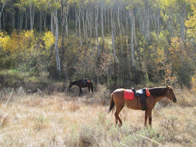
The trail heads through the aspen grove.

Wendy and Ritz.

Riding back through Big Indian Gorge.


Little Blitzen Gorge was the adventure for our third day.

Little Blitzen Gorge

This ride has similar scenery to Big Indian, 17 miles round trip if you go to the very end. We decided to not do the whole thing this time, since my friend thought it was a little deja vu. It's a little rough in some sections, very rocky, with big boulders. We also ran into some hunters along this stretch but considering how many were in camp, those were the only guys we saw while riding.


Where we stopped for lunch

Little Blitzen Gorge.

These are the only three trails from camp, we would have liked to have continued driving across the mountains on the loop road and maybe finding another spot to ride on the way back, but we were low on gas.....certainly a good idea to fill up in Burns, even if you are not empty yet. So we drove back the same way. Frenchglen does have a small store with a pump selling some extra expensive gas/diesel, so we were in luck.

We had our binoculars and on the drive both ways we spotted some of the wild horses, although they were quite far away. On a sad note, we saw a lone horse pretty close to the road, I looked through the binoculars and saw he was skin and bones, no longer part of a herd ...just waiting to die.

We tried to find a stretch of the Oregon Desert Trail that was supposed to be near Frenchglen, but we did not find the trail, and in fact we were told it wasn't actually there anymore, so we rode on some BLM land our last day just for a few hours before the long drive back home.
A good end to the camping year.


GPS COORDINATES TO SOUTH STEENS


Sunday, September 22, 2013

Box Canyon Horse Camp, Oregon

                                                                                                                   
Last camping trip of the year...sad but true.                                                    
Almost every trip I have done this year has been changed at the last minute due to weather.
This one being no exception.
I headed to Box Canyon on Aufderheide Rd. in the Willamette National Forest, since it is fairly close, and wasn't supposed to have as bad weather as my original plan.
This is a nice little camp. And it is free! It is well maintained, the corrals are in good shape, with wooden gates instead of chains. The road is paved all the way there, as is the loop in camp. It is a little tricky to back into some of the spots due to the narrowness of the loop road. Someone with a big rig would have to park in site #1 which is the easiest. The spots have two corrals each except for the two double sites. The ones with four corrals are separated, two and two, which is handy if you have horses that don't get along. There is no manure bin or garbage, or potable water but there is an actual tap for stock water, which is so much easier than the hand pumps!
It's a very shady camp with tall trees and rhododendrons.

Box Canyon horse corrals

There is a guard station across the street from camp that can be rented, and it has it's own large corral.

Box Canyon Guard Station

Next to camp spot #1 is one of the trailheads, this will take you to either the Grasshopper trail which I did not do, or the Chucksney Mt. Trail, a loop of about 10 miles, which is a bit of a climb.
This loop has good views, due to fire having burned the trees at the top.

Photo op, Chucksney Mt.

The Cascades


Chucksney Mt.

Enjoying the view atop Chucksney Mt.

I only had three days so instead of trying the Grasshopper Trail, (the first 4 miles is part of the loop I just did the day before), I decided to try the McBee trail which also starts from camp.
This trail goes on forever into the forest and is supposed to eventually reach the Mink Lake Basin and Horse lake area. It starts with a small slightly rocky climb, levels out for awhile and then gently meanders upwards to a ridge, there are brief glimpses of the Sisters through the trees. I eventually turned around and went back to a trail I had passed earlier called Crossing Way and decided to take it back to make a loop.
It popped me out at the Crossing Way trailhead which also happens to be a primitive horse camp, just pull throughs and hitching posts, nothing else. I then rode down the gravel road three miles to the main road, and then half a mile back to camp.
A nice easy trail, but no real views or any lakes, at least as far as I went on that day.

The McBee trail starts from the water trough in camp.

As I settled in to cook dinner that night the rain started. Luckily it was done by morning and things looked promising so I decided to do the Erma Bell Lakes trail.
There are two options with this one, either trailer in to it about 3.6 miles, (it says 4 on the sign, 3.6 in my hiking book), and do the 8.4 mile loop, or ride from camp, which adds the seven or eight miles to the trip, making it approx. 16 miles.
If choosing to drive, it is a one lane gravel road across from camp... and there is plenty of parking once you get to the trailhead which is also Skookum Campground.
I decided to ride in and do the long version.
Once there the trail starts across a sketchy looking bridge, that hopefully will be repaired soon, and goes through the forest for a pretty much flat mile, until you get to Lower Erma Bell Lake.


Lower Erma Bell Lake

As I rode the weather got gloomier and started to drizzle. After the first lake you pass a waterfall, and then there is Middle Erma Bell Lake, the waterfall connecting the two.

The waterfall that connects Lower and Middle Erma Bell Lakes

The rest of this loop is through various types of forest, passing many other lakes and ponds along the way. There are a few more bridge crossings, one that looked so bad I chose to go through the stream, instead, although I saw signs that horses had been across it.

All in all a good camp to go to in the heat of summer since it is so shady and the trails are so forested.
Weather wasn't as great for my trip, but a day on my horse is a good day in my book.
Until next year....:)


GPS COORDINATES TO BOX CANYON

Friday, August 30, 2013

Cayuse Horse Camp, Tucquala Meadows, and Pete Lake, Washington


My original plan was to head to the Wallowa's for a week, but a weather check revealed there was a lot of thunderstorm activity happening in that area, so a quick change to Plan B sent me over to Cayuse Horse Camp in the Wenatchee National Forest in Cle Elum Washington.

Cayuse Horse Camp.

When I got there I did not have much time left in the day, so I started to do a quick ride up a pretty steep and rocky trail out of camp, called Jolly Mountain. After much sweating and huffing and puffing on my horses part, (it was a hot day) I realized getting to the top was going to take too long, so I turned around about half way. I was going to go back and do it again on another day, but I never did, since so many other trails were beckoning me. I heard from people in camp it was 12 miles with 4000 feet elevation gain and the views are splendid at the top.

This camp has an interesting arrangement where the 14 campsites are in a separate area from the corrals, which are all together in one big grid. Except for the double sites, each camp that you pay for is a single site and comes with one corral. So if you went with friends they would all have to pay for their own sites, OR you can get one of the bigger corrals (you pick your own when you arrive) but then your horses would all have to be together in one corral. A good money maker for the camp, I am guessing. You are supposed to check in with the camp host when you get there, he is a very nice friendly fellow with maps to hand out, and a lot of advice on the trail systems. There are wheelbarrows, a dumpster, and recycling cans. Also some slight upgrades, such as a light that comes on in the bathrooms after dark, and hand sanitizer! It was $20 per night at the time, although it appears to have gone up to $21.00 since then. The camp is about 17 miles from Cle Elum on a paved road.

The communal corrals.

A plaque near camp.

On my second day I decided to do the long ride to Waptus Lake. There is a tie trail that leaves from camp but I learned that it is quicker to just ride down the road to the trailhead approx 3/4 of a mile away. You have to ride on the road eventually anyway, and cross a bridge over the Cle Elum river which is directly across the street from camp.

The Cle Elum River.

From the Salmon la Sac Trailhead, Waptus Lake is a 22 mile ride not including the short jaunt from camp... so 23.5 miles all together.
You ride beside the Waptus river for most of it, and it is a flat and easy trail.

The Waptus River.

The Waptus River.

Arriving at the lake there are beautiful peaks to behold including Bears Breast Mountain.

Waptus Lake.

On day 3 I decided to take on one of the steeper trails in the area, so I picked the Pollalie Ridge Trail, mostly because everyone in camp said....."No, don't do it" or "Good luck with that"!
Granted, it isn't for out of shape horses, but it could have been worse. We were not on any cliff sides that were dangerous, it was simply a steep long climb, over 3000 feet elevation gain.Various areas were rocky, and on parts of the trail, on the way down especially, I felt like it was better to dismount a few times to make it easier on my horse.This is only 10 miles all together, but it takes a long time.
The goal was to get to Diamond Lake which we achieved.
I stayed at the lake for about an hour and a half for my horse to rest and eat and then we headed down. I met only one person on the trail all day, a solo female hiker.


Rina at Diamond Lake.

Diamond Lake.

The following day I decided to rest my horse ...I was thinking bringing two horses into that kind of country might have been a good idea, but I just had my one sweet pony with me, so she had the day off, and I went to Cle Elum to get a screw out of my horse trailer tire. Thank goodness there was a Shell station with a garage open on a Sunday.

Day 5, was an adventure, I had asked the host and many other horse campers whether anyone had driven up the dirt road past camp. I knew there were some trail options I had read about in a hiking book and I wanted to go to the Tucquala Meadows Trailhead. No one had ventured there, and had no info to share, so I decided to try it anyway. 11 miles on this very bumpy, slow going, potholed road took an hour and a half  BUT I was glad I did the drive.
I rode the Cathedral Rock trail, which ended up being the best views I saw the whole trip. I ended up in the middle of the mountains I had seen in the background of Waptus Lake. This trail has a little over 2000 feet elevation gain to Cathedral Rock itself.

Cathedral Rock.

Then hang a left on the PCT from there for just a few minutes and.... TA DA!
This ride is only 10 miles but with the bumpy drive both ways, it turned into a long day.

From the PCT at the end of Cathedral Rock Trail.

Cathedral Rock Trail.

On my last day I packed up, and then drove to the trailhead for Pete Lake. This is the ride that everyone raves about in the area, I think because it is an easy trail with a nice view at the end. You can do a long version from camp which is about 17.5 miles, or the short version from the trailhead which is 8 miles. I still had to drive home that day, so I did the short version. The trailhead is about a 7 mile drive from camp.
It was a wet and drizzly day and the view from Pete Lake was partially obscured by clouds when I got there, so I missed out on seeing what all the fuss was about. Also I chose to not spend a lot of time at the lake, since there was a strange backpacker guy lying in a sleeping bag without a tent, and he looked very cranky.

Pete Lake.

There is another ride that I did not do called the Cooper River Trail, which is 8 miles and good for novice riders or green horses. I felt like in a week I had barely scratched the surface of the riding in this area. Although there are a few easier rides, most have a lot of steep elevation gain, and so a fit horse is a must.
I met some very nice campers, and even plan to meet up again with a couple of people who drive all over Canada and the States to camp and ride...my kind of folks!


GPS COORDINATES TO CAYUSE

GPS COORDINATES TO TUCQUALA MEADOWS TH

GPS COORDINATES TO PETE LAKE TH

Monday, July 29, 2013

Howlock Mt. and Kelsay Valley Horse Camp, Oregon

Late in July of 2013 a friend and I headed to Kelsay Valley Horse camp in Southern Oregon.
I had done some research ahead of time and wanted to ride a trail on the way there that brought us to the base of Mt. Thielsen.
The Howlock Mt. Trailhead is right off of Hwy 138 at the Diamond Lake Recreation area sign. There is a guy there that runs a dude string and he has some overnight camping spots, but we just parked in the day use area and did a 15.7 mile loop, which gets onto the PCT for awhile.

Mt. Thielsen

Howlock Meadows, me on my pony.
  

Diamond Lake from the PCT.

After our ride we drove to camp, after a slight detour, going the wrong way. The older OET book I have does NOT have the right directions. The best and quickest way is to follow Hwy 138 (if coming from Bend like we were) past Diamond Lake about 5 miles, then take a right on Windigo Pass Rd. It turns to gravel but it is a nice road without much washboard. At a 4 way crossing take the little red dirt road to the right which gets to camp in one mile. There are no actual horse camp signs until you are at the camp.

Site A5  a two horse site

This camp has different types of corrals in every site. There are only a couple of four horse ones, the rest are either three, two, or one horse corrals, and there are also some sites with no corrals. Non horse campers can camp in the ones without corrals. The spots are all pretty shaded and close to the creek for stock water. We had a lot of privacy since we did not have neighbors. Mosquito's were a problem near the creek and on a lot of the trails near water. Obviously it is better to go there later in the summer to avoid them.There are wheelbarrows and garbage cans, but no potable water.

On our second day we headed east on the N. Umpqua Trail, and did 18 miles round trip to Maidu Lake. The trail signs have mileage on them which is convenient for planning rides.

Maidu Lake....yes that is me!


We tied up the horses and gave them a long break while we frolicked in the water. Although refreshing, this lake was a little sludgy!


Horses getting a well deserved break.

Heading back from Maidu Lake. Courtney and Gracie.


On our third day we headed to Lemolo Falls, also on the N. Umpqua Trail ,but heading west this time. This was a total of 15 miles through the forest. The last mile and a half is a popular trail along the river with a lot of hikers and mountain bikers. There were some places the trail was steep and a little narrow. We used caution passing people on the cliffy parts. It is a very scenic trail, the falls are beautiful and are 165 feet high.


Rina checking out the falls.

Hard to tell, but I took this from the top of the falls, a long drop off.

Gracie and Courtney having lunch.

On the way back from the falls we stopped at Lemolo Lake for another swim. This is a huge lake, with nice clear water.


Lemolo Lake with Thielsen in the background.

The N. Umpqua Trail.

On our last day we wanted a shorter ride so we took the trail to Calamut Lake for a nice 10 mile trip.

Calamut Lake

Tired pony, resting at Calamut Lake.

All in all a nice camp with good riding. I usually get to ride all the trails at a camp in one trip, but there were trails we did not have time for, a couple more from camp and one a short trailer ride away....so I guess I will have to return another time!
Update: I went back to this camp in 2016 and did the other rides, click on this link for trip #2  Kelsay Valley Part 2


GPS COORDINATES TO HOWLOCK MT. TH

GPS COORDINATES TO KELSAY VALLEY


Wednesday, March 20, 2013

Close Encounters with Ochoco Mustangs, Oregon


In late September of 2012, I found myself with some free time, my plans had changed, and I decided to take off with my pony and spend one night at a horse camp. I went to Allen Creek  in the Ochoco National Forest. When I arrived there were no other horse people there, not surprisingly, it is a free camp, but with no designated trails and at that time the log corrals were all falling over. There were several guys near the creek, who were shooting guns and acting rowdy, I wasn’t very thrilled about that, but I thought I would go on a ride and if they were still there when I got back, I might regroup, and maybe find another place to stay.
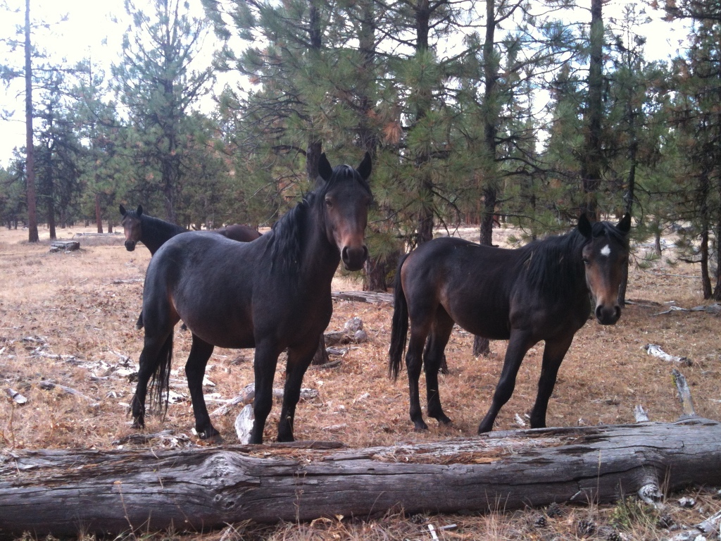
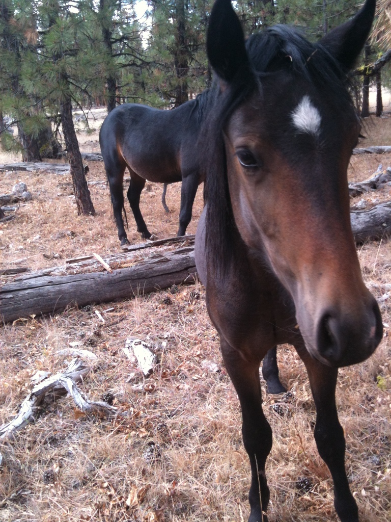
I rode in all different directions for awhile, trying to actually get into the Big Summit Prairie area. But I realized quickly that it is all private property and fenced, so no luck there. The ground was very rocky so after awhile I just decided to follow the fence line and at least get a glimpse of the prairie which was host to about a million cows. I also saw a couple of antelope fairly close up, before they high tailed it out of there. Eventually I decided to head back towards camp and set off cross country. I tend to be quite observant when I ride usually spotting deer or other critters before my horse Rina does. Good thing, because I looked back way behind me at one point, and saw a stallion watching me from behind a tree. I stopped Rina and turned her toward him, and I saw that he had four mares with him. They were quite far away and as I stood there, I was cursing myself for forgetting my camera in my truck. I figured they were going to remain off in the distance, and I would get a bad shot with my Iphone of several blobs that I could show later to friends as proof that I did indeed see wild horses. Surprisingly the stallion started to approach me with the mares following. I got off Rina so he could see I was a separate entity. I started taking random pictures with my phone, and as I was doing that the four mares that I now realized were actually young fillies, all suddenly came directly up to me.

The four curious fillies approached me.
The stallion, a gorgeous bay with a star and small strip hung back and watched over all of us.

 The smallest filly wanted to touch noses with Rina so I let her. Then I reached out and touched her on the nose which surprised her, but she didn't run away.
They must have figured this two legged person was okay since I had a horse with me that showed no desire to leave me. The stallion was very mellow, he just stayed in the background, and I watched him to make sure he was okay with everything.

Having Rina with me was great, she did not get stressed that they were there, I didn’t even hold on to her, I just stood between them, so they couldn’t surround us. Plus I knew she had zero interest in running off with a handsome stranger. At one point they tried to get too close and I shooed them off a little, the stallion reacted to that by doing a small half circle run. I thought he was going to herd them away from me, but he still chose not to. So then we all stood and stared at one another for awhile.

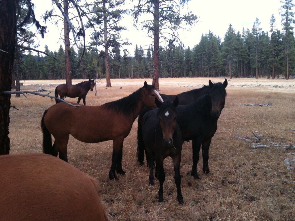
The fillies still nearby, the stallion in the background.
I took more pictures, although I didn’t get that many good ones with just having the phone, especially of the stallion. After some time had passed I decided I couldn’t stay there all day, so I started to walk Rina away, they promptly all followed, so I got on her and tried to ride away, they all followed again, and now the stallion was following as well. I made some hand motions and voiced my desire for him to stay put. He got the message, and stopped following me, the fillies stayed with him, and as I rode away, I told him he was a beautiful boy and thanked him for letting me hang out with them. What an amazing experience! I’m the only human to touch that little one’s nose, and if she remains free maybe she will never be touched again.
I got back to camp, realized the gun toting guys had left, and so I decided to stay there after all. An uneventful night passed. The next day I trailered to Douthit Springs to do a ride on my way home. I headed up one of the many dirt roads, and after a couple of hours, lo and behold I ran into yet another band of horses. Have I mentioned that at the time although I had only lived in Central Oregon for a year and a half, I had ridden in the Ochoco’s many times before and had never seen a single wild horse. This time a mare crossed the road in front of me with her foal.
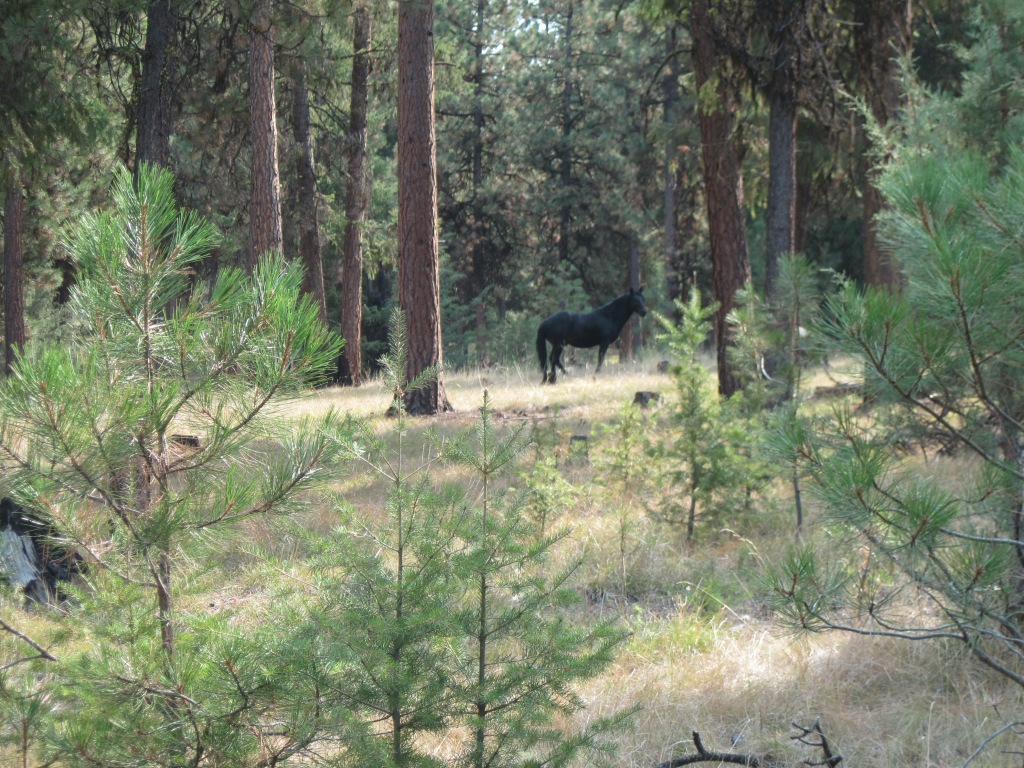
 She didn’t seem to compute that I was human at first so she stared at me for awhile, then suddenly figured it out, put her tail in the air and ran off. I heard some nickering from the hill above me and there was the stallion, he came trotting toward me to see what was going on. I got off Rina again so he could see I was human, and not to come too close.  Rina ate some grass, I had a sandwich, the stallion alternated between watching me and grazing. This was more like the behavior I would think a wild stallion would have, he stayed much farther away, kept his mare behind him and kept an eye on me, but otherwise was not concerned.

I walked around a little bit trying to get some pictures, since this time I had my actual camera, although a not very great camera with no zoom. The stallion was pure black, with no white markings, and he only had the one mare and foal with him. I eventually rode away and let them be.
What a great couple of days! What healthy, beautiful horses they are.
An update: This was written in 2012, and at the time I just wanted to put the experience I had into writing, but it inspired me to start blogging about my camping and trail experiences, and the rest is history. Since then I have seen a lot more wild horses in the Ochoco's, and I have a much better camera!

Allen Creek Horse Camp has also been revamped with brand new shiny corrals. There are eight spots but only four of them have corrals. Several of the sites are plenty big enough for larger rigs. There are two bathrooms, but no garbage, manure bin, or potable water. Allen Creek is available nearby for stock water. It does take some effort to haul the water from the creek, as another option there is a dispersed camping site you could drive to across the road that has easier access to fill water containers. This camp is still free, and still has no developed trails.

Allen Creek Horse Camp.

New corrals at Allen Creek.

I have done subsequent visits into the Ochoco's specifically to see the Mustangs. I know their watering holes and where they tend to hang out. There are several herds that are more standoffish and some that have no issue with my presence. None have approached in quite the way that first herd did in 2012 but those were unique circumstances. Being that I was alone and with a horse that they wanted to see up close, and the fact that they were young and curious.

The following are several pictures of Ochoco Mustangs I have visited in recent years.


GPS COORDINATES TO ALLEN CREEK