In 2013 I visited this camp with a friend and we rode for four days, but I knew at some point I would have to return to do more of the trails in the area. To read the first blog click here:
Kelsay Valley
 |
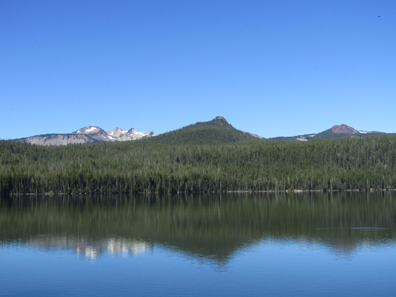
| Miller Lake. |
I had not actually planned to go back at this exact time, but Plan A had to be postponed since I could not be away for a very long time, due to a business transaction I was right in the middle of. Plan B also had to be scrapped at the last minute, as I was informed that I had to be somewhere where I would have cell coverage, so I wracked my brain and remembered that Kelsay Valley had plenty of coverage ( if you have Verizon) and so that became Plan C. Last time I was there was also at the end of July and I remembered that mosquito's were a problem, so I went prepared for battle with every kind of spray imaginable.
I started the trip by doing a ride at the Miller Lake Trailhead which is outside of Chemult OR. Horses are only allowed on one side of the lake, but my plan was to follow the lakeshore, then head up to the PCT and ride over to Tipsoo Meadow from there. This is basically directly east, as the crow flies, from Kelsay Valley, so this is just a shorter way to get into areas that would be a LONG ride from camp.
 |
| Some fishermen on Miller Lake. |
 |
| A viewpoint on the PCT. |
The trail around Miller Lake was clear, the trail up to the PCT was not, however I was able to get around the few areas of downfall. Eventually I was at the highest point of the PCT that there is, in both OR and WA, at 7560 feet, ( CA must obviously have a higher section) and then I arrived at my destination in between Howlock Mt. and Tipsoo Peak.This was an 18.5 mile out and back ride.
 |
| Tipsoo Peak. |
 |
| On the PCT at Tipsoo Meadow. |
 |
| OR and WA's highest point on the PCT. |
 |
| Heading back along the lake shore. |
I then drove the rest of the way to the camp, pulled in and found to my surprise that no one else was there, not even a camp host, although he did eventually show up on the third night.
I picked the shadiest and farthest spot I could find from the creek, to avoid the mosquito's, not that it helped much.
Kelsay Valley Horse Camp is located near Diamond Lake OR and has two loops A and B with 16 spots, although one of those is for the camp host. You can make reservations on recreation.gov. There is a day use area, four manure bins with wheelbarrows, steel corrals in most of the sites, (a few spots do not have corrals), a bathroom, garbage cans and the creek for stock water. A number of the spots have plenty of room for larger rigs. There is no potable water and it is $10.00 per night.
 |
| Kelsay Valley Horse Camp. |
 |
| The North Umpqua River, the stock water source. |
It cooled off nicely that night and I was glad to be camping, and not back at home where the heat was rapidly rising. I usually like to go for some walks in the evening, take some pictures and whatnot, but although I made some attempts to leave the safety of my shaded spot, the mosquito's were pretty thick, I did what started out as a walk, but ended up abruptly turned into a brisk jog.
The following day I did a nice long loop, following the Windigo Pass Trail up to the PCT, then heading south for several miles, and taking a side trail down to a four way junction. From there I took a detour up to the top of Tenas Peak, which afforded some great views, and then I went back down the Tolo Creek Trail, and back to camp, making this around an 18 mile ride.
 |
| On the Windigo Pass Trail. |
 |
| A small burn area on the PCT. |
 |
| On the top of Tenas Peak. |
That evening I finally got some company, a few different rigs pulled in which turned out to be some ladies that are with OET, and they camped at the end of the B loop.
The next day I went over to the trail that heads up to Calamut Lake, I had done this ride the last time I was there, but we had just gone to the lake and back. This time I wanted to turn it into a 16 mile loop. We also had bypassed a side trail, that went to Linda Lake and Lake Charline, so I did that detour as well, and then continued on to Calamut. (Although Linda Lake is the name on the signs and maps of the area, the FS website says it is actually called Lake Patricia.) I hung out for awhile at Calamut just because it is such a beautiful, clear, sandy bottomed swimmable looking lake, and I had the place to myself.
 |
| On the trail to Calamut Lake. |
 |
| At Linda/Patricia Lake there is a very fancy bathroom. |
 |
| Lake Charline. |
 |
| Calamut Lake. |
I continued up the Windigo Pass Trail, this next section was not cleared, but it is such open country that it was easy to navigate around any downed logs. I saw some signs that someone on horseback had ridden the trail fairly recently, and had attached some new flagging tape along the way and so I figured it was worth a try. I would like to thank the person who flagged it, as there were a few spots where the trail came out into some small meadows and then disappeared, and so I was able to just look ahead and find the bright pink tape. This was the only trail I rode during the trip that had steep sections, most of the rest of the trails are wide, and easy, with good footing and have gradual inclines. Eventually this trail brought me back to the junction with the PCT where I had ridden the day before, so I returned to camp that way.
 |
| One of the small meadows on the Windigo Pass Trail. |
 |
| The sign at the junction near the PCT. |
On my last day I trailered up Windigo Pass Rd. to the PCT trailhead, and got ready to ride north up to Cowhorn Mt.
This is a very scenic stretch of trail with something new to see around every corner, starting with West Windigo Lake, Timpanogas and Indigo Lakes, and Sawtooth Mt. Once I reached Cowhorn Mt. I continued on for about another mile until I could see Crescent Lake and also over to Diamond Peak and Summit Lake. At this point I turned around and headed back making this ride about 11 miles.
 |
| Looking down onto West Windigo Lake from the PCT. |
 |
| Mt. Thielsen from the PCT. |
 |
| Cowhorn Mt. |
 |
| Sawtooth Mt. |
 |
| Crescent Lake from the PCT. |
 |
| Diamond Peak and Summit Lake from the PCT. |
 |
| Cowhorn Mt. on the PCT. |
Well Plan C turned out pretty well. Now a brief break before the next trip!
GPS COORDINATES TO MILLER LAKE TH
GPS COORDINATES TO KELSAY VALLEY
GPS COORDINATES TO COWHORN MT. TH


So....when are you going to put all of your adventures, directions, etc. in print? :)
ReplyDelete