Sunday, April 29, 2018

Spring Basin, Sutton Mountain and Priest Hole, Oregon

There are a lot of wilderness and wilderness study areas in the east central section of Oregon that are far enough off the beaten path that they don't get very many visitors. I've hiked at Spring Basin once and Sutton Mt. twice so I already knew how to get there and where to park. But they are quiet areas that you wouldn't necessarily know about, even if you were nearby to visit some of the John Day Fossil Bed sites.

Spring Basin Wilderness.

We went from wintry temperatures to 80 degrees rather suddenly and I almost changed my mind about going, since riding in the desert heat with no shade is usually not that enjoyable, but on the flip side I wouldn't have to deal with cold nights, so I decided to go for it.

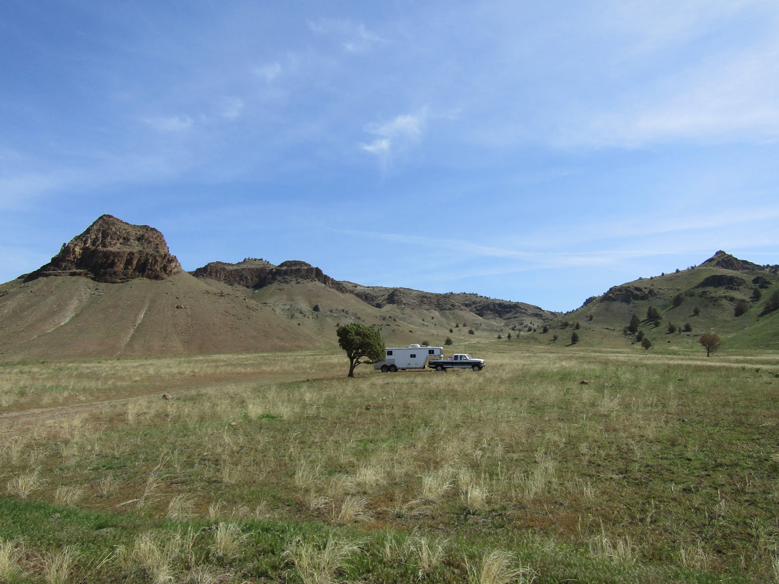
Spring Basin is on the way to Fossil OR, on Clarno Rd. which eventually dead ends. About 3 miles along it there is a small parking area next to a lone juniper and the trail runs straight uphill from there. This is where I camped, but about another 1/4 of a mile along Clarno Rd. they have put in a Spring Basin Wilderness Area sign board and there is some parking there as well. This is primitive camping with no amenities whatsoever.

Spring Basin Wilderness.

This wasn't an especially long drive from my home in Central OR so I got there with plenty of time to explore all day. There is an old jeep track that runs through the wilderness with a few offshoots here and there. I decided to ride to the end of Clarno Rd. where it starts, and then follow it all the way until it finally ends at the boundary to land that the Confederated Tribes of Warm Springs owns. There is a map online that shows the "trails" but they aren't really trails and they don't get much use, so in some areas the old road becomes very faint, although there are a few cairns set up here and there.

Heading up the old jeep track.

I passed by the spring that the area is named after, but there was not a whole lot of water coming out of it.
This is the time of year that the hedgehog cactus are blooming and I got to see lots of bright pink flowers as I rode. I went to a ridge over looking Hay Bottom Canyon, then continued on passing the trail that goes back downhill to where I parked, and kept going to Horse Mt and beyond. Once I reached the boundary signs I turned around, although there isn't a fence or any no trespassing signs, according to the map this is private property that you are supposed to stay off of.

Spring Basin Wilderness.

Spring Basin Wilderness.

The hedgehogs were blooming.

Looking down onto the John Day River.

The view from a cliff near where I turned around.

The next morning I drove over to Sutton Mt. passing by the Clarno Unit of the John Day Fossil Beds.

The Palisades at the Clarno Unit of the John Day Fossil Beds.

You would never see the Sutton Mt. trailhead if you didn't know where it was, but since it is right by mile marker 15 on Hwy 207 that makes it easier to describe. There is a large area along the highway where you can park, or you can drive in through a wire gate and park or camp there. Again there are no amenities, other than a creek for stock water that you would be sharing with cows.

The wire gate into the Sutton Mt. area.

Just through the wire gate there are camp spots. My rig is parked along the highway.

This is a straightforward follow the dirt road up to the top of the mountain ride, but when I had hiked it before I had always wondered where the road continued on to. So after admiring the views down onto the Painted Desert and looking for more hedgehog cactus, (they were there, but these ones were not blooming), I followed the road some more. It drops way downhill, passing a spring, a pile of lumber and an old stove that was once someone's home, then crosses a gully and heads back uphill rejoining itself eventually, so I was able to do a loop which I always like to do if possible.

Halfway up Sutton Mt.

Views from the trail up Sutton Mt.

Riding up Sutton Mt.

On Sutton Mt.

Looking way down from on top of Sutton Mt.

Originally I was thinking of spending the night there, but instead I decided to drive over to my next destination which was Pat's Cabin Wilderness Study Area. It's located on the opposite side of Sutton Mt. from where I was, and the BLM map showed the quickest route as leaving from a junction that was very close by. The route starts well and ends well but unbeknownst to me, the middle section becomes narrow, windy, and one lane gravel for quite some time. But once I was committed, there was no point in turning around. The legend on the BLM map shows this road as being a "main road" not even gravel. So that was completely inaccurate. There is another perfectly good way to get there along Burnt Ranch Road past the Painted Desert. At the sign for the recreation sites there is an old rickety cow corral, and that is where I parked. There are lots of other camping spots nearby but I thought I would take advantage of the handy corral for my horse's overnight stay. Once again no other amenities at this spot, although Bridge Creek is nearby, across the road.

The signs right near the corral where I camped on Burnt Ranch Rd.

The old corral on Burnt Ranch Rd. 

According to my not so accurate map, the trail into Pat's Cabin was supposed to be directly across the road. In the morning I headed over to the creek and saw that it was not going to be an easy crossing. I went up a small hill and tried to see if there was even a hint of a trail, or old road on the other side, and I saw nothing, so I decided to scrap that plan and ride to Priest Hole instead.
It's 3.5 miles of road riding to get there from where I was parked. I am really glad I decided to do this, because it turned out to be a lovely spot along the John Day River. Across the river there is another, not quite as big or spectacular, but beautiful none the less, version of hills similar to the Painted Desert. I'm sure this is a busy place in the summer, but other than one guy camping alone, I had the place to myself. I rode along the river for awhile and then rather than go back the same way I continued around on the loop road, and then back to my camp spot along Burnt Ranch Rd. A car passed me twice and finally the guy asked me if he was going in the right direction to get to Mitchell. I said "no Mitchell is the other way". His GPS was sending him on quite the wild goose chase.

Bridge Creek.

Road riding to Priest Hole.

Along the John Day River at Priest Hole.

At Priest Hole.

The John Day River at Priest Hole.

The John Day River at Priest Hole.

Priest Hole.

Some painted hills across the John Day River.

It was getting pretty hot so I was glad to be done my ride a little early, and so I drove home passing the Painted Desert on the way. I've seen this area before on previous hiking trips, so I did not stop this time, but it is certainly worth a visit.

The Painted Desert, my photo from a previous visit.

The Painted Desert, my photo from a previous visit.


GPS COORDINATES TO SPRING BASIN

GPS COORDINATES TO SUTTON MT. TH

GPS COORDINATES TO THE CORRAL ON BURNT RANCH RD.

Monday, April 16, 2018

Quincy Wildlife Area (Ancient Lakes), Washington

The Quincy Wildlife Area in Washington is known by a few names such as Ancient Lakes and Burke Lake and over the last few years I had seen other people's pictures and heard enough about it, that I figured it was time to check it out in person.

Ancient Lakes.

April turned out to be a great time to be there, good weather, not hot enough for the rattle snakes to be out yet, and as it turned out a lot of other people had the same idea. I arrived on a Tuesday and was surprised to see as many people camped there as I did, mostly fishermen. The main road runs through the area for about 4 miles, on each side of the road there are either trailheads or parking areas next to lakes. If you drive through the parking areas, there are smaller roads that lead to plenty of camping spots. When I first arrived I parked in a pullout off the main road and figured I could definitely camp there, but I would go for a ride first and if I saw a better spot, I would move my rig. As it turned out I chose to stay where I was. Most of the better spots where I could have put up a corral were taken. I also had a bit of a wind break beneath a small hill, and I soon learned it can get mighty windy on occasion! During the next couple of days I saw many horse trailers arriving, and I noticed that most of them camped up along the south side of Burke Lake right before getting to the reservoir.

My camping spot.

To get there: This area is between George and Quincy WA. Take exit 149 from 1-90, in five miles take a left on NW 5 Rd. also called White Trail Rd. In just over 3 miles look for the sign on a corner that says "public fishing" and take a left onto the gravel road.

The gate into this area is closed October 1st through March 1st. You can still ride or hike there but motor vehicles aren't allowed in during that time.This area is dispersed/primitive camping, there are no corrals or amenities. However there are numerous lakes and ponds everywhere you look, so it is possible to get stock water that way. Also there are quite a few bathrooms throughout the area. It is free to camp there but you need a Discover Pass. Trees are few and far between, so it would be hard to highline, but some people get creative and attach a rope from their trailer to a rock on a hill. If you don't like primitive camping or you want an easier way to get into some of the lower trails, there is a horse camp on property nearby. I did not ride over to see it, but this is the link with info about it. Bishop Recreation Area

Quincy Lake.

The camping areas are at the highest level of the area, then the land drops off to several other levels of benches, with lakes and waterfalls all the way down to the Columbia River.
I started riding over to Stan Coffin Lake first since I had seen some large white birds while driving in, which turned out to be pelicans, and I wanted to see them up close.
I then rode over to the trailhead for Ancient Lakes. I didn't get very far before finding the trail to be impassable to horses. I figured there must be another way to get down to the beautiful lakes I could see below me and I did indeed figure that out eventually, but for the remainder of the first day I went back and rode alongside Quincy Lake and then over to Burke Lake. I learned that you have to be a bit of a detective to find the horse trails, nothing is marked or signed but the regulars that ride there have made trails that go everywhere, you just have to find them. Sometimes a small pullout along the road with a parking spot, but no obvious signs of a trail, will actually have a trail at the far end of it. I just decided to follow every trail I saw, and look for telltale hoofprints.

So many lakes in every direction.

Pelicans on Stan Coffin Lake.

Looking down onto Ancient Lakes from the trail that becomes impassable to horses.

The first waterfall going down into Ancient Lakes.

Quincy Lake.

Quincy Lake.

As I was just about to get back to my camp spot, a lady saw me riding by and came over to chat. Although she did not have her horse with her, she wanted to come back and ride at some point, so she was asking me about some of the trails. I told her I would let her know what I found out the following day.

In the morning I decided to ride to the south gate of the main road. The south gate used to be unlocked and you could drive in from that direction as well, but unfortunately due to vandalism it is closed indefinitely. On the way over there I started down the trailhead to Dusty Lake and again realized this was not really a horse trail, so I came back up and continued on. The main road narrows and then follows along the shores of Evergreen Reservoir for awhile. After passing the gate, I found a trail that was heading in the direction I wanted to go, so I followed it until I got to the power lines that run up above the Columbia River. I stood on the edge and looked out at the two ravines or coulees as they are also called, that go into Ancient and Dusty Lakes.

Looking down onto Dusty Lake from the main trailhead.

Views from the trail that's by the south gate.

Someone's former home.

Looking down onto the Columbia River.

The view back over towards the two ravines/coulees.

A trail continued off to the south, so I kept going, thinking maybe it would just go to another view of the river, but instead I found a trail that dropped me down off of the plateau I was on. At this point I was directly below the Gorge Amphitheater which is an outdoor concert venue that has been considered one of the most scenic concert locations in the world. I can see why.

From there I could have ridden over to the two ravines, but it was getting late, the wind had really picked up through the gorge, and I got caught in a little rainstorm.

Deer on the way down towards the Columbia River.

The Gorge Amphitheater.

Evergreen Reservoir.

On my way back I ran into Elaine, the lady I had met the day before, and her husband Phil.
We chatted for a bit and I told them where I had gone that day, they said they were going for a walk and would go over to where the other horse people were camped and ask them which trail I should take that would be a more direct route down to Ancient Lakes. Later they came by and told me where it was, which turned out to be very close to my camp spot! So the next day that is where I went. The trail has an amazing view of the lakes from above. I was riding around down below when five ladies on horseback came down the trail as well, we waved at each other, but weren't close enough to say hi. Coincidentally although we went in different directions we saw each other again later in the day since we were all heading back at the same time.

From the ledge overlooking Ancient Lakes. Hard to tell scale in pictures but the little dots above my horses right ear are tents.

Ancient Lakes.

Some ladies ride along the trail below me.

After admiring the lakes for awhile, I started riding towards the Columbia River, I had to drop down onto another bench, riding over a lava field for awhile. There are so many trails and roads down below you could really explore all day. I went north briefly but eventually I turned around because I wanted to go and see Dusty Lake.
After hanging out at the lake for awhile I was riding back and got hit by a brief hail storm. As I was cantering along a piece of hail got me right in the eye, although it wasn't especially painful, I had to keep my eye shut for awhile until it melted!

After my ride I  walked over and visited with Phil and Elaine for awhile.

On the lava field heading down onto another bench.

Just above the Columbia River.

Taking a rest on the way to Dusty Lake.

Dusty Lake.

Dusty Lake.

On the way back into Ancient Lakes after the hail storm.

I did two 6 hour rides and a short 2.5 hour ride in three days and I still could have explored more of the area.
But the next day the plan was to drive halfway home stopping at Brooks Memorial State Park, and ride the 9 miles of equestrian trails that they have. But once I got there it was cold and raining and I became uninspired pretty quickly, so I hung out for awhile and took a break while my horse mowed their grass.

Brooks Memorial is on Hwy 97, but the signs and arrows pointing towards the state park are NOT where you turn to get to the horse camp, it is actually on the opposite side of the highway. After passing by the ranger station, take the right turn at the fork towards the group camp. There are only two camping spots with nice larger pipe corrals, a porta potty, plus another bathroom a short walk away in the group camp, water spigots, and a creek. The downside is the highway is right beside the camp. Update: I stopped there again in 2023 and the only horse camping left is the group camp that you have to reserve, which has corrals. What was once the small horse camp is no longer, the corrals are gone, and there is just a porta potty and a good sized day use area for parking to ride the trail.

Brooks Memorial State Park Horse Camp.


What a great first trip of the season!
Happy Trails!


GPS COORDINATES TO ANCIENT LAKES

GPS COORDINATES TO BROOKS MEMORIAL
Sunday, October 22, 2017

Wild Mare Horse Camp, and the North Spit Trails, Oregon

Well you never know what the weather will bring, and this year in particular I realized pretty quickly that my last camping trip of the season would not be in the high country as per usual, so I decided to go to one of the only beach camps I haven't been to yet.

Wild Mare Horse Camp.

On my way there I stopped at Baker Beach outside of Florence OR, I was going to ride that day, and then possibly spend one night there, but when I pulled in, all the camp spots were full. I've stayed at Baker before, and at that time it wasn't that busy, but now there is a camp host and a lot of non horse people camped there. On my previous visit I didn't ride on the beach that much or on the little inland loops because I spent more time on the Cape Mountain Trails. To read about my trip in 2014: Baker Beach

I tacked up and rode on the little loop past Lily Lake, as well as the Berry Creek Trail and then I randomly followed a trail inland that eventually became very soggy, so I turned around, got onto the beach and headed south.
I rode until I reached the first of the houses along the shore and then headed back. At one point I saw movement out of the corner of my eye and when I looked to my right, a bald eagle was flying level with me, then he dropped down to the beach, grabbed a dead critter and took off again with a couple of crows harassing him.
Arriving back at the camp the spots were still all occupied, so I drove an hour south over to Wild Mare Horse Camp.

Lily Lake.

A few riders from C&M Stables on Baker Beach.

Baker Beach.

Riding on Baker Beach.

Wild Mare is part of the Oregon Dunes National Recreation Area and is one of the nicest beach horse camps I have ever seen, with 12 paved spots that have either log or steel corrals. There are two bathrooms, two manure bins, a day use area, potable water from spigots (although you cannot attach a hose to them) and garbage cans. They are all back-in spots and # 6 has the most room for an especially large rig. It is $22.00 per night and is a reservation camp, but at this time of the year it is first come first serve, and although there were a few people there the first night, they all left the following day.

In mid October the last thing I was expecting to see were mosquito's but there were a number of lethargic ones flying around half heartedly. There are bat boxes set up throughout the camp for this purpose.

There is a plaque in the camp dedicated to the wild mare who used to roam free amongst the dunes. The plaque has conflicting dates/timelines to the history I read online about her. Apparently she was not actually turned loose on purpose, she escaped as a two year old, and although many people tried, no one could ever catch her again, so there she remained for 32 years, and became a local legend, hence the name of the camp.

Wild Mare Horse Camp.

The plaque dedicated to the wild mare.

The next day I took the Wild Mare Trail from camp that leads to the ocean and rode north along the beach, and rode and rode and rode! You can definitely ride for many miles this way, but the scenery is not particularly varied. Eventually I went inland for a little while and rode on a few of the OHV trails as well.

On the Wild Mare Trail.

A natural tunnel on the Wild Mare Trail.

Just over the hill to the ocean.

Horsfall Beach.

Rode on a few inland OHV trails briefly.

The following day I bundled up and rode south, it was supposed to be cloudy and very windy. As it turned out it was neither, and I was forced to shed my layers as it very quickly turned into the nicest, warmest day so far. Instead of just beach riding I wanted to ride most of the North Spit Trail system. You can also trailer over there to save a few miles in the saddle, but I just rode to the end of the spit on the beach first, then cut inland through an area that is closed from March 15th through September 15th for Snowy Plover's to nest, and then over to the North Jetty.

A beautiful day on the beach.

Sandpipers are always entertaining.

At the signage for the North Jetty.

On the North Jetty.

The Cape Arago Lighthouse was visible in the distance.

From the jetty I rode back along Bayside Rd. (which is underwater at high tide) until I got to the Gray Trail then followed the South Loop to the Bunker Trails. The trails are well marked and the junctions have maps so you can tell exactly where you are. The southern side of the North Spit Trails are forested and there is a World War II bunker to check out. Just after examining the bunker I rode into some deeper woods and as I looked ahead on the trail, I saw a bear. I saw him a millisecond before he saw me, at which point he left in a hurry. If anyone had asked me recently how often I see bear while riding or hiking I would have said rarely, but this is the third bear I have seen in the space of a month, all in completely different locations!

The North Spit Trails are well marked.

The World War II bunker.

On the North Spit Trails.

On the North Spit Trails, just before the bear sighting.

I then rode along the Dune Trails, on the north side of the spit, and at times you need to keep an eye out for the markers in the distance, since the trails become harder to see.

On the Dune Trails.

The following day was misty and cloudy, I thought about doing a short ride from the day use area, since there are other inland trails that leave from camp, but they are pretty deep sand, and my horse had spent enough time slogging through the stuff already. So I drove on home, very pleased that I had had three nice weather days in a row, which can be a rarity. Apparently a big storm came through right after I left.


GPS COORDINATES TO BAKER

GPS COORDINATES TO WILD MARE