In October of 2019 I took a horse camping trip into the Bryce Canyon Area, at the time I dispersed camped at Losee first, and also stayed at Coyote Hollow Equestrian Campground. I did the three most popular trails, Losee/Casto, Thunder Mt., and Willis Creek, but then I dropped down into Kanab to escape the chilly upcoming temperatures. To read about my first trip to this area click here: October 2019 Trip Now that I live significantly closer, I decided to go back and ride some more of the trails in the area.
 |
| On the Ledge Point Trail. |
This time instead of chilly it was a little hotter than they had originally forecasted, but I camped along Tom's Best Spring Rd. at a nice high elevation, and it was quite pleasant. On the drive over, which was very scenic, like driving through a postcard, I made a quick stop at Butch Cassidy's boyhood home.
 |
| Stopped to see Butch Cassidy's boyhood home. |
 |
| My spot on Tom's Best Spring Rd. |
Tom's Best Spring is a good driveable road directly across Hwy 12 from the road that goes to Coyote Hollow Equestrian Campground. There are numerous dispersed spots to choose from, although some, especially on the right side of the road have a small but deep trench you have to drive through. I watched countless RV's bottom out pieces of their trailers while crossing over it. I camped on the left side that has easier access, right near a meadow with grazing cows....more about them later! There is no water and no amenities, but lots of cell service. If you wanted, you could ride to the Thunder Mt. Trailhead from this area, passing right by the horse camp.
 |
| A scruffy Antelope near camp. |
 |
| Some nice views from camp. |
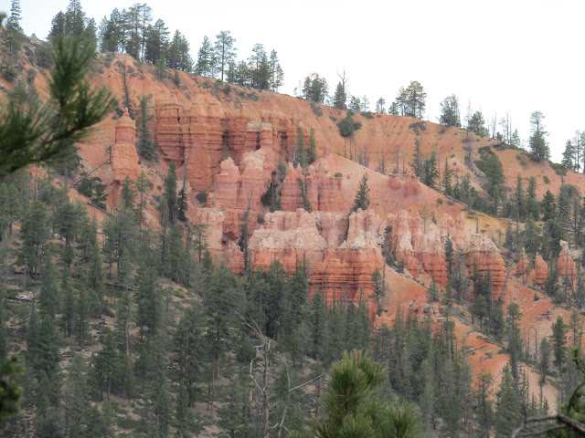
My plan was to trailer out daily, and so on Monday I drove the whopping 4 miles over to the Red Canyon Trailhead to do the Cassidy Trail. This ties in eventually to the Losee/Casto Loop, but there are some side loops you can do on the way, the Rich Trail to Ledge Point and Brayton Point. Endless gorgeousness! It was a good time to go, I saw no one all day on the trail.
 |
| At the Red Canyon Trailhead. |
 |
| On the Ledge Point Trail. |
 |
| On the Ledge Point Trail. |
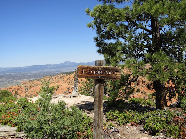 |
| At Brayton Point. |
 |
| Hoodoos at Brayton Point. |
 |
| Great views at Brayton Point. |
 |
| My red dun pony in the red rocks! |
 |
| On the Rich Trail. |
I stopped at the Losee junction where there are some hitching rails and a small outhouse. This is only about a ten mile ride, but it was getting hot so I turned around, taking the other side of the small loops, so I had different scenery on the way back.
 |
| Hitching rails at the Losee Canyon junction. |
 |
| At the Losee Canyon Junction. |
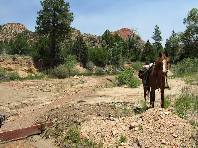
The following day I drove over to East Fork Rd. which takes you to Tropic Reservoir, and beyond. You can also disperse camp out there, in designated spots only, and it is a lovely area at this time of year, quite a few streams, and lots of green grass. Right past the reservoir there is a pullout at Tropic Spring, which I was absolutely delighted to see. I parked there because after the ride my plan was to dump out all my crappy city water and fill all my jugs with fresh wonderful spring water. In Oregon I had a well, which was great, but Colorado is not big on wells, ( must be a reason), and so city water it is, even living outside of town.
I started by riding around the whole reservoir and then I crossed over the dam. I was on the Paunsaugunt Trail briefly, and there is also the Great Western Trail and the Fremont Trail in the area, which are actually roads, and used by ATV's.
 |
| Tropic Spring. |
 |
| Started out by riding around the reservoir. |
 |
| Looking back at where I had parked. |
 |
| Tropic Reservoir. |
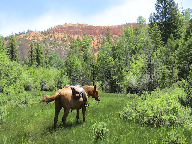
After crossing the dam, I decided to follow another road onto Whiteman Bench, this eventually brought me to a nice overlook. There was a group of ATV riders having their lunch at the top, but I wandered over and took a quick look. Then I tried to loop back, I saw another way down from up top, but when I started heading that way it wasn't long before I came across a random locked gate. Seemed an odd place to be blocked off, and that forced me to return the same way, but only after hiding out under a tree for awhile during some thunder and rain.
 |
| Storm clouds started to gather. |
 |
| Looking down on the reservoir from Whiteman Bench. |
 |
| Riding back down the same way. |
 |
| Lots of greenery, but also some red rock. |
The weather cleared up again, as it tends to do, and I filled my jugs and drove back to camp.
 |
| Hanging out at Tropic Spring. |
 |
| Tropic Spring. |
The cows: I had an issue with some young bulls when I was at Coyote Hollow in 2019, they were trying to get into my electric corral, but at that time, being fall, there was hardly any grass, and so it made sense for them to be interested in my hay.
On this trip, the adult cows all left me alone, they had more than enough green grass, but there was a gang of little young white cows, not the black ones, not the brown ones, just the white ones, that were super mischievous and wanted to mess with my horse's fence. Putting it in their mouths and jiggling it, (it's not electrified) and they were small enough that they could just go under it. This mostly happened either really early in the morning or just near dark. So I would go out and chase then off. One evening quite late, a few white cows strolled by and had a stare off with my mare. Then suddenly a whole herd came galloping, bucking and kicking over the ridge running straight at my horse. They veered past, at the last minute, and my horse being as old and wise as she is, reacted by putting her tail in the air, snorting at them several times, and then resumed munching her hay. One morning I awoke to see my fence was down, cow related obviously, but my good pony was still inside, she won't step over it, even if it is completely on the ground.
 |
| They look so innocent while napping, but they are very mischievous. |
The third ride was at Kodachrome Basin State Park. This was the farthest I had to drive and I dropped down in elevation quite a bit, so it was much hotter. What's done is done, but had I known there was only a 4 mile loop for equestrians I would not have gone. I had seen a post on FB from someone who rode there in 2022 and there were around 11 miles of trails at the time. Clearly that has changed. I pulled in, paid my $10, they told me where to park and then after I was tacked up I saw the map by the trailhead that mentioned the mileage. The parking area is now just a large dirt loop area, and if it were at all wet and muddy, you would never get in there.
So I dragged out that four miles as slowly as possibly, taking lots of photos and enjoying the scenery. I suppose I could have done the loop a second time, my horse handles the heat well, but I was a sweaty mess by the end of the first go around.
 |
| On the loop at Kodachrome State Park. |
 |
| Kodachrome State Park. |
 |
| Kodachrome State Park. |
 |
| Kodachrome State Park. |
 |
| Some views across the valley, from Kodachrome State Park. |
 |
| Kodachrome State Park. |
There are a couple of detours to scenic vistas, one is a little cliffy, and another one is steep, but both are worth doing.
The last part of the loop has some disc golf course baskets, so I suppose it's possible you could get a frisbee winged at your head, for some extra excitement.
 |
| On the cliffy scenic overlook at Kodachrome State Park. |
 |
| Kodachrome State Park. |
 |
| The second scenic vista at Kodachrome State Park. |
 |
| Kodachrome State Park. |
 |
Parking for equestrians at Kodachrome State Park.
|
Since I was there I took advantage of the campground's dump station, and filled up with water, no extra charge for that.
 |
| A view on the way back from the dump station. |
Thursday was a rest day for the pony. In the morning, a lady came riding by on her Mustang and said hi, I had noticed her drive in the night before, and she was the first horse person I had seen camped there.
I'm not really good at sitting around for long, so later I decided to walk over to Coyote Hollow and see if anything had changed at the horse camp.
It looked the same, the fee has gone up from $10 to $18, and the water was still on. This is a nice, well designed horse camp, but nobody was there.
That evening, while I was waiting on a friend to call, a couple more horse trailers pulled in and a guy with an RV got stuck in the ditch/trench. As I walked out into the meadow to get my horse, she was grazing loose, I looked over and there were huge billowing smoke clouds across the highway. 911 informed me that crews were on it, and that I should be safe where I was camped.
 |
| A fire started on Thursday night. |
The smoke disappeared before bed, and at 6 AM all was fine, but by 7:30 a lot of smoke rolled into camp. My plan for that day had been to go back out past Tropic Reservoir and ride the Grandview Trail, so I hurriedly got ready and headed out. A few miles down East Fork Rd. there was a notice about those trailheads being closed. It was a bit strange because I thought the original fire was very close, but this one was pretty far away. In any case, I went back to camp and took down my corral, I did not want to be dealing with unbreathable air in case it hung around all day and evening. I also needed to figure out where I could ride that day instead, so I decided to check and see if there was clear air at the Thunder Mt. Trailhead, and there was! That parking area is tight, there was another horse trailer in the one real spot they have, so I squished myself partially off the loop road. You could park in a pullout alongside the highway instead, but the only other larger parking area they have has a "no trailers" sign.
 |
| Squished my rig partially off the loop road at the Thunder Mt. Trailhead. |
The Grandview Trail is over 70 miles long and since I couldn't do the section of it that I had planned, I rode this section instead. You follow the same trail that goes to Thunder Mt. but after awhile you get to a junction and the Grandview Trail goes straight from there. I was technically riding directly towards the fire at this point, but it was far enough away.
 |
| On the Grandview Trail. You can see the smoke cloud in the distance. |
 |
| On the Grandview Trail. |
The trail eventually passes through an area that looks like it should be in a Dr. Seuss book, then I came across Hillsdale Canyon, where there was a trickle of water, and a nearby ranch, with a lot of guest cabins and their own private lake.
 |
| On the Grandview Trail. |
 |
| On the left, you can see part of the lake on the private ranch. |
I continued past the ranch, there is a junction with the Johnson Can Trail, and a side trail with a steep climb to a viewpoint. I decided my ending spot for the day was when I dropped down into a gully and found a gorgeous meadow with Aspens, and red rock cliffs above.
 |
| Hillsdale Canyon. |
 |
| A little bit of horse drinking water in Hillsdale Canyon. |
 |
| The gorgeous meadow on the Grandview Trail. |
 |
| On the Grandview Trail. |
This section of trail does not get a lot of use, I saw no one all day until the very last mile or so. On the way back it was getting quite hot, especially at the trailhead. There was no point hanging around there any longer so I drove about 2.5 hours closer to home, stopping at the Great Western Trailhead to overnight.
 |
| Almost back to the trailhead. |
 |
| Raspberry colored cactus blooms. |
The Great Western Trailhead/ Campground outside of Salina, Utah was a nice free camp with 5 spots, a bathroom, and stock water from the river. The spots on the right have the most tree cover and shade, but the spots on the left have the easiest access to the water. The first site on the right has two hitching rails, it is a camp that anyone can stay at, including horse people. The camp is fully fenced, has picnic tables and there is plenty of room for big rigs. You can ride from there, but there was no way I was going to attempt that area in that kind of heat. Another time.... I have a feeling I will be stopping there again. There is no cell service, and it is alongside Hwy 1-70, but even though I am a light sleeper, the overnight traffic noise was not that big of a deal and didn't bother me.


