Cyrus is a great desert camp in Central Oregon, that can be accessed all year round, but it is the best in the spring and fall. Especially for people trying to escape the ongoing torrential downpour west of the cascades.
 |
| On the Warner Loop, Haystack Butte. |
To get there: From Terrebonne follow Hwy 97 north for 7 miles, then take a right on Norris Lane.
Go 4 miles and take another right on a road that is not signed.
After almost another 2 miles the sign for Cyrus is on the right. Update: The horse camp sign is now missing, but the road number is 5750. It's one more mile to camp after the turnoff. After leaving the highway all the roads are gravel/dirt and are usually in good shape unless it has been extremely wet.
 |
| The road in to Cyrus Springs Horse Camp. |
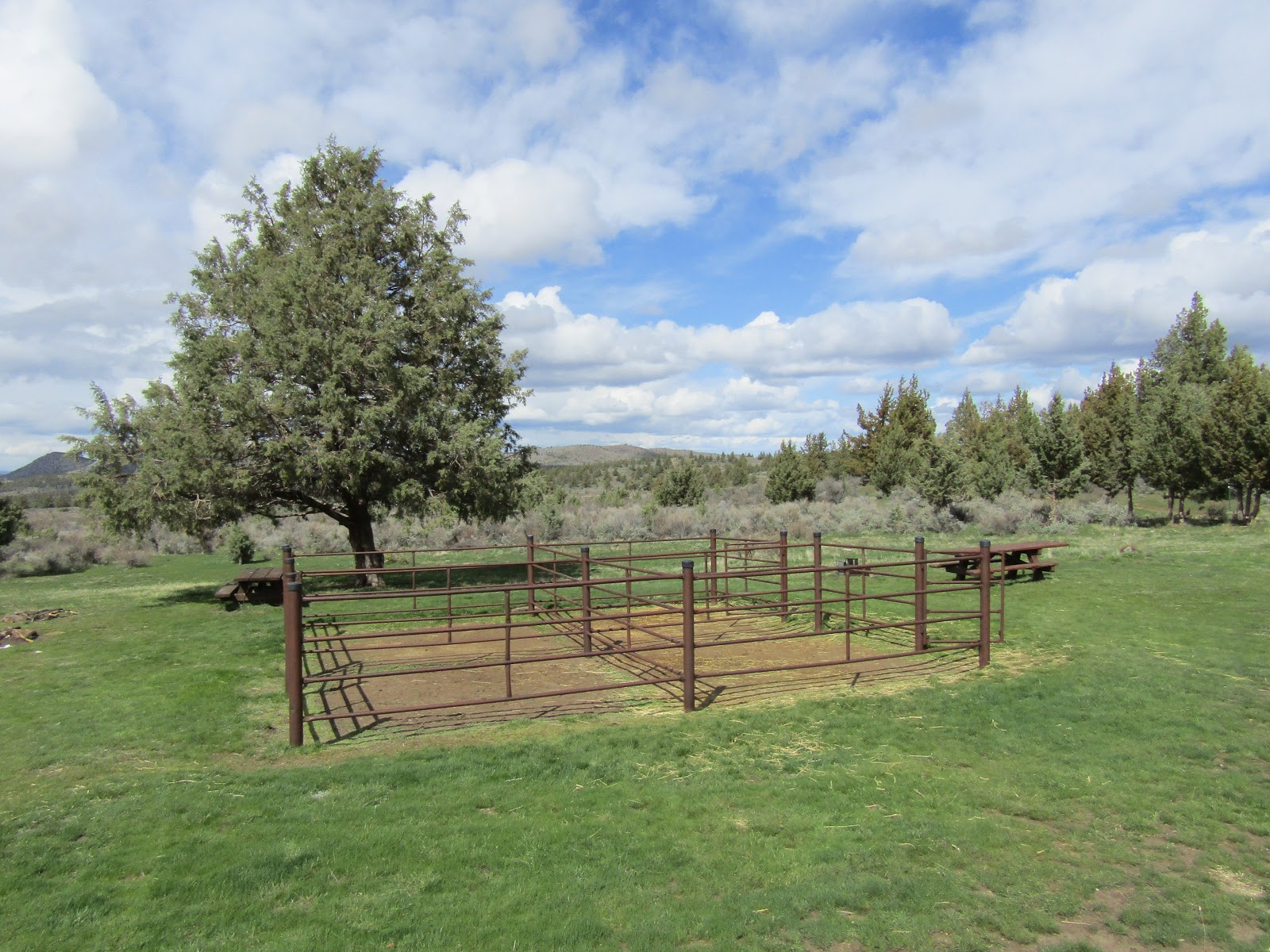
Cyrus is a free camp and it has nine sites with steel corrals, picnic tables and fire rings, and the spots are big enough for larger rigs. There is one bathroom, a manure bin, and a spring fed water trough for stock, but no potable water. Most of the year the water trough is there and in working order, however it does get removed during the winter, and they will set it back up again, usually in May, after there are no longer any freezing nights. Calling ahead to ask for info, usually does not work, so if it is especially early or late in the season, I would carry my own stock water.
 |
| The sign in camp. |
 |
| Cyrus Springs Horse Camp. |
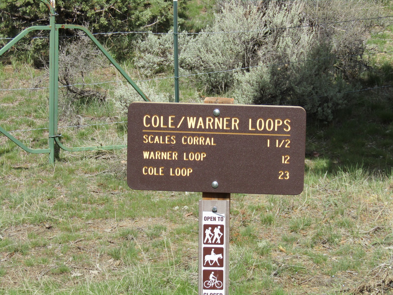
There are several different options as far as trails in the area go. The Warner Loop is 12 miles and leaves from camp. The Cole Loop Trail is 23 miles long, runs through camp and also crosses by several other trailheads on it's way around Gray Butte.
 |
| There are signs in camp with mileage for the trails. |
 |
| On the Warner Loop. |
 |
| On the Warner Loop. |
Scales Corral is also on the north side of Gray Butte and it is about a mile further east past the turnoff to Cyrus. Since it is right off the main road, if I want to do a day ride, I just park there rather than driving into the camp.
 |
| Scales Corral. |
 |
| Riding a dirt road near Scales Corral. |
There is another trail that runs up the hill behind the camp, and you can follow it and just explore for awhile, or ride from there over to Trail Crossing Trailhead or Skull Hollow Trailhead.
 |
| Views from above Cyrus, Haystack Reservoir in the distance. |
Trail Crossing Trailhead is on the west side of Gray Butte, with no amenities.There is some nice riding from there, especially if you want some elevation gain to give your horse more of a workout.
Henderson Flats OHV area is right nearby, but the trails are separate and it is only open from April 1st through November 30th, so in the winter, I ride the OHV trails a lot as well. Even when it is open, it is not an extremely heavily used area.
To get there: From Terrebonne, follow Hwy 97 north for 5 miles and take a right on Park Lane. After 2 miles it becomes a narrow dirt road, and after crossing a cattle guard, continue .05 of a mile until you get to the parking area on the right.
 |
| Trail Crossing Trailhead. |
 |
| Heading up the hill from Trail Crossing Trailhead. |
 |
| You can get in some hill work from Trail Crossing Trailhead. |
 |
| From the OHV trails at Henderson Flats. |
Even though this is dry desert, there are numerous springs throughout the area, on every trail you will run into some kind of water trough set up for cows.
 |
| Many springs available for water. |
In the spring there are also a surprising number of wildflowers, especially after a wetter than normal winter.... okay, it's not like the super bloom California experiences, but it is still very pretty to see the pops of color here and there.
 |
| Wildflowers in the spring. |
 |
| Wildflowers in the spring. |
Skull Hollow Trailhead is on the east side of Gray Butte, although there are no amenities, there is a bathroom in the people campground nearby.
To get there:
From Terrebonne take Smith Rock Way east for 5 miles until it ends on Lone Pine Rd, then take a left and follow it for 4 miles. The trailhead is on the left, keep an eye out for the sign, it is sometimes hidden behind foliage, and you may blow right by it.
From Redmond take Hwy 97 north for 3 miles, take a right on O'Neil Hwy, drive for 5 miles then take a left on Lone Pine Rd. and follow it 5.5 miles to the trailhead on the left.
 |
| Plenty of parking at Skull Hollow Trailhead. |
 |
| Jonni and Ron riding from Skull Hollow Trailhead. |
Happy Trails!
GPS COORDINATES TO CYRUS