This was my second trip with my new LQ, having had most of the problems with it fixed in the interim. So enjoyable not to be in a tent anymore!
Mud Springs is located in the Ochoco National Forest about 28 miles outside of Paulina, Oregon. As per usual it took twice as long to get there as Bing maps led me to believe. The roads were all in good shape, just one small stretch of washboard in one area.
Directions are accurate in the OET book, although a little off on mileage. Directions on the FS website are not quite as accurate. Like most out of the way places, there is only signage once you get closer to camp.
 |
| The entrance to camp. |
Set amongst huge Ponderosa, this camp is absolutely beautiful. The entrance has a very narrow cattle guard, which I barely squeaked my trailer tires over. It is one long road rather than a loop, with big sites on each side with the best one at the end, next to a meadow. According to the camp map there are six sites but technically there are only five. Only three of the sites have corrals, which are steel, and you are not allowed to put up high lines or portable corrals in any of the others. This is a free camp and does not have a manure bin or garbage. There are two bathrooms and a stock watering hole (mud spring) but it's not highly convenient. It is behind the camp and requires a longish walk to get to it.
 |
| The nicest site at the end of the road. |
 |
| Steel corrals and lots of grass for a happy pony. |
 |
| Mud Spring. |
This is kind of a "wing it" place to ride. Take off on old abandoned roads, ride cross country, or as I did the first day, do a large loop along FS dirt roads. I surprised a herd of elk along the way, although they did not stick around to pose for pictures.
 |
| Rager Creek is not raging. |
 |
| Riding on the FS roads. |
On day two I rode the South Prong Trail, this leads into the Black Canyon Wilderness.
The trails in the Ochoco's are notorious for not being cleared on a regular basis so I was not surprised to come upon some obstacles along the way. Some were harder to navigate than others, I was hopeful I would make it all the way, however I only got about two hours in, and had to call it quits. This ride is 5.5 miles, one way, into the canyon, dropping 1600 feet in the last two miles where it eventually meets the Black Canyon Trail. There are lots of sweeping views as this is an old burn area. Since I got back earlier than expected I also rode some old abandoned roads that meandered down hill from the watering hole.
 |
| The trail head leaves from site #1. |
 |
| South Prong Trail. |
 |
| A couple of coyotes watched me pass by. |
 |
| South Prong Trail. |
 |
| South Prong Trail. |
 |
| Black Canyon from South Prong Trail. |
 |
| Downfall started to get too hard to get around. |
The following day I decided to check out Salter's Cabin, which although not directly on the way home, is only about six miles out of the way. This is also a free camp that has obviously been used mostly by hunters. There is the cabin...which I would not recommend staying in, and I don't think the forest service wants you to...a corral, a fenced pasture area, a tack room, a bathroom, and a water trough. As of this visit the water hadn't been turned on yet, although the trough was full. There were several downed trees that had crashed into the corrals.
 |
| Salter's Cabin. |
 |
| Salter's Cabin |
 |
| Salter's Cabin is a little rustic. |
 |
| The tack room at Salter's Cabin. |
I went on a brief ride following both of the roads nearby, but there are no trails and not really any logging roads so it's another "wing it" kind of place but not as interesting as Mud Springs.
Driving home I passed directly through the center of Oregon....the little town of Post.
 |
| Post. |
In June of 2022 I returned to Mud Springs with my friend Cindy. I had seen a Facebook posting from Backcountry Horsemen, that said that the trail into Black Canyon had just been cleared. Since I wasn't able to get all the way down to the bottom on my last trip, I wanted to try again. Long story short, my wonderful mare has recently had over two months off due to lameness issues, and I am just getting her back going again. I wasn't sure how well she would do, but Cindy, who has two horses, brought them both, with the idea that on the second day when we descended into the depths of the canyon, I would leave my horse back at camp and ride Cindy's cute little Icelandic gelding instead.
On the way to the camp, before the town of Post, I stopped and did an easy ride at the Prineville Reservoir Wildlife Area.
I entered at the east gate and rode along the river until about the halfway point. After that at a camping area called Cattle Guard, there is an actual cattle guard, but without a gate to go along with it unfortunately, so from there I could go no further. I rode out onto the flats, close to the water, and then returned the same way back to my truck.
 |
| The entrance sign at the east gate. |
This area is closed from mid November until mid April, but during the rest of the year the road is accessible. There is a pullout along Hwy 380 to park, but no gate next to the entrance cattle guard there either, ( they are not big on gates) so you would need to drive in a little ways and park elsewhere, OR you can drag your horse up and over a small hill to the left of the cattle guard where the fence has been cut. The main road passes by at least 34 numbered primitive campsites, with no amenities, although there are a couple of bigger named camping areas with bathrooms. I ran into a parks guy, doing some clean up work, but otherwise there was no one out there.
 |
| Riding along the road beside the river. |
 |
| On a hill looking back towards the east gate. |
 |
| Down by the water. |
 |
| The Prineville Reservoir Wildlife Area. |
I then continued on my way to Mud Springs. Most of the roads getting out there are actually in really good shape, but the last 8 miles are a little rougher. As I mentioned, the OET book has good directions, but I would not attempt to use a GPS. It will take you on a shorter, but pretty much impassable with a trailer, type of road.
Cindy was already at the camp and so I got set up, and then I jumped on her gelding bareback, and we went on a little jaunt over to the spring/pond to water her horses. This was my first time on an Icelandic, super fun ride!
I have already described the camp in the beginning of the blog, and not much has changed. Because of a rainy spring, the corrals were pretty muddy so Cindy made the good decision to camp in the first, less soggy spot, rather than the nicer one at the end of the road. If you have Verizon you will have cell service, (I even had it at the bottom of the canyon) but Cindy had no service with AT&T.
 |
| The first spot at Mud Springs Horse Camp. |
 |
| Lots of rain, brings lots of flowers. |
The next day was the day to ride into the canyon on the South Prong Trail, and I decided to take my own horse after all, it was clear that she was ready and willing. Even though it is about a 2600 foot elevation drop all together, and then we had to climb back out, she had zero issues. Horses take awhile to lose fitness when they are laid off, and that was abundantly clear. She scampered back up the canyon leaving Cindy's horse, who is half her age, in the dust. We had good weather on the way down and then got rained on, on the way back.
 |
| Cindy on Grace, ponying Buddy. |
 |
| Views along the South Prong Trail. |
 |
| On the South Prong Trail. |
 |
| Cindy's photo of me on the South Prong Trail. |
 |
| On the way down into Black Canyon. |
 |
| Cindy about to cross Black Canyon Creek at the bottom of the South Prong Trail. |
That evening as we went for a little stroll uphill from camp, we saw some ominous clouds heading our way, and just as we got back, the storm hit. Thunder, lightning, rain, hail.... the works.
On our last day we hit the saddles pretty early, and just followed random two tracks and forest service roads for four hours until the next storm rolled through in the middle of the day. We got a little soggy on our way back, and at this point I had no dry pants left, so Cindy leant me a pair to drive home in. The weather forecast was not exactly accurate.... surprise, surprise.
 |
| Came across quite a few ponds. |
 |
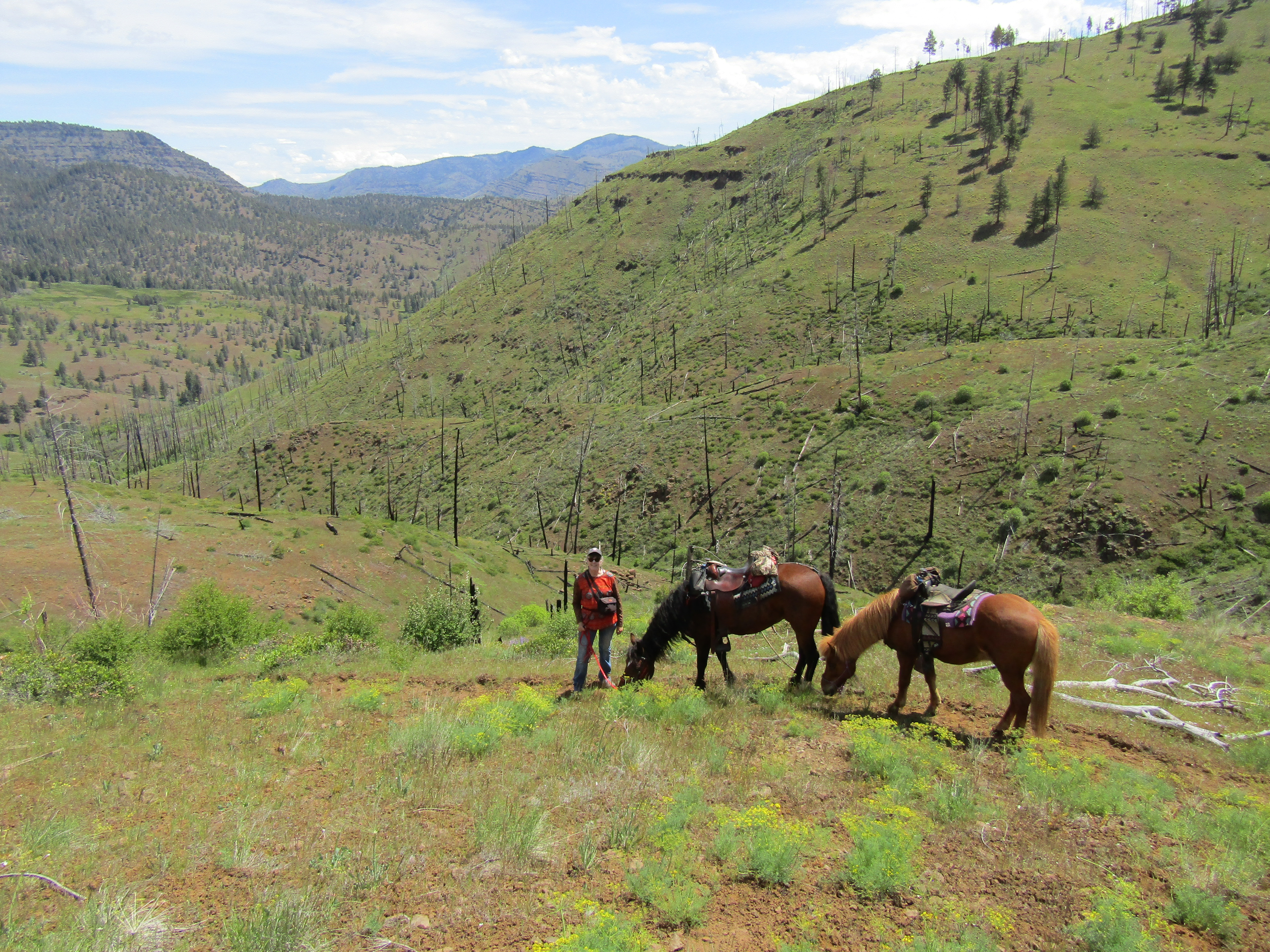
| Following old roads near Mud Springs Horse Camp. |
Much thanks to BCH for doing the trail clearing, so we could both check this off the to do list!


Gorgeous photos, and awesome write-up!
ReplyDeleteVery enjoyable! Thank you for sharing.
ReplyDelete