Saturday, July 17, 2021

North Crater Trailhead, Oregon

It's hard to find somewhere to camp in early July that is not mosquito infested, has cleared trails, and with no snow in the higher elevations. Usually ( although not this time ) the PCT is a good bet for being clear, and I know I can get at least two rides accomplished, riding both north and south. I decided to check out North Crater Trailhead, near Diamond Lake in Southern Oregon.

Mt. Thielsen from the PCT. (Pacific Crest Trail)

North Crater Trailhead has a narrow loop drive with a couple of camp sites tucked back in the trees. There are no actual parking spots for the camping, you just park in the lot. There is a bathroom, which was not stocked, some hitching rails and a loading ramp, but no water or other amenities. You can highline or put up a corral, and it is free. 

North Crater Trailhead.

North Crater Trailhead.

My camp spot at North Crater Trailhead.

This is not too far of a drive from my home, so I left early and did my first ride when I arrived. Besides the PCT there is also the North Crater Trail, which is supposed to head over to Diamond Lake. Not anymore. It is not cleared, hasn't been for awhile, and doesn't look like it ever will be, judging from the state of the junction where you are supposed to be able to do a loop. They are not allowing snowmobiles in the area anymore, and all of the old roads are a mess. I would not normally spend too much time on a trail in that bad of shape, but I persevered for quite awhile, due to the fact that I had nowhere else to ride that day. Eventually I turned back and went a different direction, ending up on Summit Rock Trail which is actually a road. I followed it until I reached Summit Rock, which has a nice viewpoint.

Just an example of North Crater Trail.

The junction where the loop used to be.

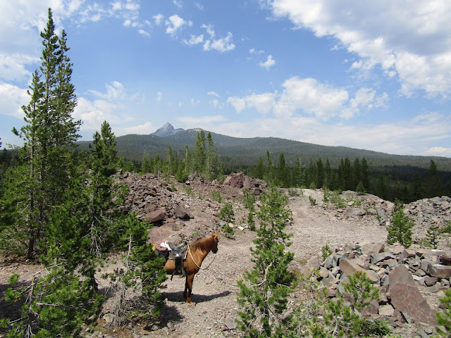
On top of Summit Rock, with a view of Mt. Thielsen.

More views to the south from Summit Rock.

On top of Summit Rock.

There was a fire burning to the north, and another fire that I could see while on top of the rock, burning to the south, but it wasn't smoky right in the middle, where I was, until later that evening when it drifted into camp for awhile.

The next day I rode the PCT to the north which I knew would take me into the Mt. Thielsen Wilderness and although I have been there before, riding from the Howlock Mt. Trailhead, this was a much more scenic way to view Mt. Thielsen. I rode all the way to Thielsen Creek ( about 16 miles round trip ) and along the way I got views of the mountain from three different sides. Unfortunately the PCT had not been cleared either, but it was at least doable that direction, and it was a nice shady gradual uphill climb with lots of opportunities to pick up the pace.

On the PCT heading north.

On the PCT looking at Mt. Thielsen.

Mt. Bailey and Diamond Lake views.

On the PCT on the west side of Mt. Thielsen.

On the PCT.

At Thielsen Creek.

Mt. Thielsen view from Thielsen Creek.

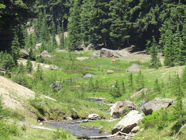
A deer grazing at Thielsen Creek.

On the last day I rode the PCT to the south, at least I attempted to. Immediately after the trail crosses Highway 138, it enters Crater Lake National Park. I knew I would not actually be riding anywhere near the lake, but I was hoping for some kind of view at some point. Mostly it was just trees, trees and more trees, and after awhile I gave up and went back, since there were just too many downed logs across the trail. There were also a few mosquito's which were irritating my horse. I ended up going back over to Summit Rock Trail/Road again and started riding towards Diamond Lake, but this was not interesting either and it was getting hot and smokier the closer I got to the lake, so I called it a day. 

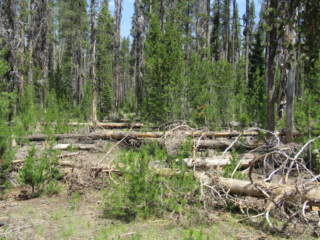
On the PCT going south, too many downed trees.

On Summit Rock Trail, which is a road.

Went I got back to camp there was a family who had decided to have a picnic lunch on my picnic table directly in my camp spot. That was a first. They were nice enough people.... but who does that??? It was only slightly awkward as I untacked my horse right next to them, and put her away while they finished up. Not to mention there was another empty picnic table in the other spot, I'm guessing they must not have even seen it. After they left, I got packed up and drove on home, I wished there had been somewhere else I could have ridden in that area, but I was out of options, especially with the fires burning.


GPS COORDINATES TO N. CRATER TH


Wednesday, June 9, 2021

Moss Meadow Horse Camp, Oregon

The Fremont Winema Trail in SE Oregon is over 150 miles long and has quite a few horse camps along the way. I have camped and /or ridden at a few of them, but I had not checked out Moss Meadow, over by Paisley, until now. It is a lovely camp, that gets very little use, and I ended up having thousands of acres of national forest all to myself. In the four days I was there I actually thought it was a possibility that I would  not see any other humans at all, but the spell was eventually broken, when I saw a lone vehicle drive by on the road.

On the Fremont Winema Trail.

Moss Meadow has four spots, three of which are for medium sized rigs, and one that can fit a much larger rig. The spots are all back- in, nicely graveled and have steel corrals. There is a bathroom, (might need to bring your own TP) a loading ramp, and there is stock water just up the trail in a trough, however it is pretty stagnant, a spring is supposed to keep it flowing, but is no longer doing so. Moss Creek is nearby and although it did have a small trickle upstream, it was dried up closer to camp. There is no garbage or manure bin, and no fee, this camp is free! There is a cell tower on a nearby hill, and I had great service the entire time.

Spots are not numbered at Moss Meadow.

Moss Meadow Horse Camp.

My first ride was on the Fremont Winema Trail, heading north. There is a mile or so to ride on an old marked logging road, which leaves camp and leads to the main trail, or you can ride up Rd. 5310 to Moss Pass. I knew some trail clearing and camp maintenance had been done last summer, and sure enough the few trees that needed to be cleared were taken care of. After that I was riding along a ridge with great views. This is a pretty unpopulated part of Oregon, and it is vast. The trail starts on the west side of the ridge but eventually goes over Round Pass, so you get views over to the east side as well.

At the junction with the Fremont Winema Trail.

Allium, I think?

On the Fremont Winema Trail, riding north.

Endless views on the Fremont Winema Trail.

On the Fremont Winema Trail.

Zoomed in, from the ridge, way down onto the Chewaucan River.

This trail is geared towards horseback riders, besides the fact that there are signs at all junctions, there are stock water sources along the way, all of which actually had water, and "scenic vista" signs pointing towards even more great views. Occasional posts are missing signs, but I learned quickly just to look around for whatever it used to indicate, and I would find a side trail going to a pond, or water trough.

Found this water source just after going over Round Pass.

Eventually after riding for several hours I got to the burned part of the forest, a fire had gone through there last summer. Sometimes it is hard to for me not to keep on riding and riding, to see what is around the next bend, but once I hit the burn, this gave me an excuse to turn back.

On the east side of Round Pass.

Funky cloud and shadow.

Looking out towards Lakeview.

Turned around once I got to the recent burn.

A seasonal stock water pond.

I rode for seven hours that day, then the following day I did another seven hours, heading to the south this time. The trail actually drops downhill gradually, so by the time I turned back, I was on the valley floor. This is grazing land and I saw cows here and there, usually near creeks or meadows.
At one point there is a brief section of trail that goes through a privately owned piece of land that the owners have allowed access to, as part of the packstock route.

We dropped down off this ridge.

On the Fremont Winema Trail, heading south.

A meadow with cows grazing.

The trail enters private land briefly.

Originally I was going to head over to another nearby camp on this same trip, but I was loving my time at Moss Meadow, and so I decided to save the other camp for another time and continue exploring.

My last ride was along forest service road 5310, which the camp is on, over Moss Pass, and then downhill all the way to the Chewaucan River. The forest service website is extremely outdated (it says there are no corrals at the camp) and also that riding to the river was "about 5 miles". Just looking at it from the ridge, I could see it was more than five miles! It turned out to be just over 7.5 miles one way, although on the way back I took a shortcut along 113, a very faint old dirt road, which was a nice way to make a loop.

On Rd. 5310, almost to the river.

When I got to the river I noticed some horses grazing nearby, a QH stallion with four mares and three foals. It took them awhile to notice me, but once they did, they were very surprised. Part of the property along the river is privately owned, although there are no visible buildings, so these horses belong to someone, but they acted wild. The stud couldn't seem to believe his eyes, they must not get a lot of visitors, and he spent a lot of time snorting at us. I took my horse down to the water for a drink, and I could still hear him snorting away, even though he couldn't see us anymore. 

On the bridge over the Chewaucan River.

The mares and foals.

The stud, giving us the eye.

Hanging out at the Chewaucan River.

Views back to the ridge I had already ridden on.

On the way back I followed another dirt road alongside Ben Young Creek, and it took me to an old homestead. At first I just saw a dilapidated barn, but then tucked back in the trees was a newer cabin structure. It may be newer, but very rustic, and I realized nobody was living in it. After that I cut cross country to road 113 and looped back to camp. This is fairly open land, so it is easy to bush whack and make your own way around.

The old dilapidated barn.

A very rustic cabin.

I thought about staying one more night, but I was close enough to home to do the drive back that evening, after my ride. For anyone else who likes solitude and lots of mileage, this might be a camp to check out, I really enjoyed my time there!


Saturday, May 22, 2021

Rock Creek Horse Camp, Yacolt Burn State Forest, Washington

I always like it when I have low expectations, then I go somewhere and I end up enjoying it better than I thought I would. This was the case with Rock Creek, which is near Battle Ground. I had done a day ride there years ago, and didn't remember that much about it, but it ended up being more scenic than I anticipated. 

Mt. St. Helens views.

Rock Creek Horse Camp is on DNR land, which means the camp is free if you have a Discover Pass. I have never been much of a reservations type of person, so with the pass, I showed up, picked any spot, and then decided while I was there, how many nights I actually wanted to stay. If your coming from the south there's a good chance your GPS will take you on the short cut, which is definitely shorter mileage wise, but not worth dragging your rig up and over a steep mountain and back down the other side onto gravel, when the longer route is pretty flat and paved.

The camp has 23 spots all together, but 8 of them are for non horse people. The camp map and online info is not correct, several unnumbered spots have been added to the camp. There are two loops "A" and "B". "A" has a few really nice big spots especially A1, A9 and A10, but the rest are for pretty small rigs. Loop B has decent sized spots, especially the two that aren't numbered. Update: In 2022 these spots are now numbered, but they are different from the numbers on the camp map. Not every spot has corrals, although most do, the way it is set up is that sometimes a couple of spots will share corrals. Each loop has a stock water trough with a spigot and hose, and there is another spigot in front of the B loop bathroom, but the water is not potable. There are multiple manure bins throughout the camp, a wheelbarrow, as well has two day use areas, and three bathrooms. Four sites have new pipe corrals, but the rest are log. There is also a large picnic shelter, a mounting ramp, maps of the trails, and a camp host. Update: In Oct. of 2022 there is currently no camp host, but they are looking for someone. It was pretty quiet when I was there, but if it gets busy with non horse campers, the horse spots are held for horse people until 8pm, after that they are fair game. I did not have cell service in camp, but I did while riding. Update: in 2022 I was able to send texts and sometimes get email, but calls would not go through.

One of the unnumbered spots in the B loop.

Site B4, which is pull through.

There turned out to be a lot of riding, the trails are marked, and I considered them to be easy, unless your horse is a total couch potato, in which case most of the trails have some elevation gain.  There are lots of bridges to cross, quite a few old and new clear cut areas that provide views, and although the trails are shared with mountain bikers, I did not run in to any cyclists on any of the trails while I was there. (I was not there on a weekend)

The Tarbell Trail is a 23 mile loop which you can do in one fell swoop or break it up into sections and make smaller loops, or get creative and make huge loops partially using gravel roads. I decided to go to Hidden Falls first, starting on the Tarbell Trail, then taking a steeper short cut along the Silver Shadow Trail, which eventually rejoins the Tarbell Trail. I also passed a junction to a trail leading up onto Silver Star Mountain, and I really wanted to ride up there, but knew I didn't have time to do both in one day....so this means I may have to return another time!

On the Tarbell Trail.

All the junctions are marked.

On the Tarbell Trail.

Once at the falls, there is an area that people can highline horses, if need be. I did about 16 miles, turning back after the falls, but taking the slightly longer route home, skipping the Silver Shadow Trail. This was one of those perfect situations, the weather was amazing, no pesky insects, or any other annoyances, just a perfect riding day.

Hidden Falls.

Hidden Falls.

Silver Star Mountain.

Paragliders launch off of Silver Star. Mt.

So lush on the Tarbell Trail.

The next day I followed the Tarbell Trail the other direction towards the Yacolt Burn Trailhead, but only briefly, since I was on my way to the Bells Mountain Trail. I got onto a "mountain biker only section" by mistake, but then shortly found the trailhead I was looking for. The Bells Mountain Trail runs beside Cold Creek for a pretty long time, and then climbs up along Bells Mountain. I did about 18 miles round trip, since I turned back at the top, but it continues another couple of miles over towards Moulton Falls County Park. 

On the Bells Mountain Trail.

On the Bells Mountain Trail.

Views from Bells Mountain.

On the Bells Mountain Trail.

That evening while I was taking a stroll through camp, a couple of small boys starting running towards me yelling "mommy, mommy"! Since I'm pretty sure I haven't actually had any children, I was a bit taken aback, but they figured out their mistake fairly quickly, and we all thought it was pretty funny.

My last ride was a shorter 11 mile loop along the Tarbell Trail, climbing up to near the top of Larch Mt. and then going back down the Sixth Sense Trail. This particular loop seems to have the most obvious signs of potential cyclist traffic. There is a gravel road that is in the middle of the loop, and I noticed cyclists going uphill along the road, so that they could then ride one of the trails back down. 

On the Tarbell Trail.

Just one of the many bridges in this area.

On the Tarbell Trail, almost to the top of Larch Mt.

Some of the signs for the Tarbell Trail have mileage, so if you were doing the whole loop, you would be able to keep track of how far you had gone. 
Every time I got to a higher elevation, once I was out in a clear cut area, I got some nice Mt. St. Helens views, and on this particular ride I could see Mt. Adams as well.

Near the top of Larch Mt.

Magnificent Mt. St. Helens.

Starting down the Sixth Sense Trail.

Happy Mother's Day, a scary balloon on the trail.

I drove home after my ride, but instead of the four hours it should have taken, I got to the Government Camp area immediately after a really bad wreck, consequently the highway was closed for over two hours. There was a place for me to pull off the road, while Life Flight was called in, people had to be cut out of cars, and an investigation was conducted. I talked to some other horse people briefly who were on their way to Sisters, but they thought the wait was going to be too long, and they turned around and went home. I did not really want to drive a lot of extra miles out of my way, so my patient pony and I waited it out. I arrived back home at a decent hour... a small inconvenience in the grand scheme of things.

In October of 2022 I returned to Rock Creek on the way back from a 10 day trip to a couple of other Washington camps. Just like the last time I was there, the place was deserted when I arrived, except for one non horse camper, so I was able to nab A-1, the best spot, in my opinion.

Site A-1 at Rock Creek Horse Camp.
 
My goal was to ride to the top of Silver Star Mt. so the next morning I got an early start and headed out on the Appaloosa Trail. The Appaloosa Trail reaches the Tarbell Trail, where I turned left, until I reached the junction with the Silver Star Trail. From there I climbed up to the top, with lots of views back down into the valley. I was quite surprised to see what awaited me on the other side, a steep drop off with a beautiful view over to another mountain, as well as some rather severe wind.

Crossing a bridge on the Appaloosa Trail.


Views from the Appaloosa Trail.
 
On the Silver Star Trail.

On the Silver Star Trail.

On the Silver Star Trail.

The amazing view from atop Silver Star Mt.

On top of Silver Star Mt.

Instead of going back the same way, I decided to make a loop along the Grouse Vista Trail over to Grouse Vista Trailhead. This area is not as well marked, and it was pretty rocky most of the way down. When I got to the trailhead there was a warden parked there, he told me he was surprised to see a horse in that particular area. From there I continued on the L 1200 Road for about 5 miles, which comes out very close to camp. This was about a 16 mile ride, but if you are not a fan of road riding, you could do a 19 mile lollipop loop by getting back on to the Tarbell Trail, which goes past Hidden Falls, and then retrace your steps on the Appaloosa Trail.

Heading back down the Grouse Vista Trail.

At the bottom of Road L-1200, looking back at Silver Star Mt.

Later that day I was hanging out at camp and my horse was out grazing, when she suddenly looked very alert. I was sitting nearby and I glanced over and saw a bobcat emerge from the foliage. The bobcat was also a bit startled to see her, and he decided to retreat back into the bushes. A few minutes later, he got brave and sauntered back out, at which point I was able to get a video ( which is on my FB page.) He couldn't have cared less about my presence. This time my horse and the cat mostly ignored each other, and he went about his business, which I assume was to get down to the creek for water. 

That night a few more people arrived at camp, including one couple with horses whom I chatted with for awhile, but for a Friday it was still not very busy. The next day I headed home, concluding my camping season for the year... can't wait for next summer! 


GPS COORDINATES TO ROCK CREEK