There are a few ways to get to Swamp Wells Horse Camp, but a good long loop ride can be done by parking near Boyd Cave and riding in from there. It is one of the shorter versions, although still 17.5 miles round trip.
 |
| Swamp Wells Horse Camp. |
To get to the Boyd Cave parking area: From Bend follow Hwy 97 south to exit 143 at Knott Rd. Take a left on Knott and follow it 1.5 miles until you reach China Hat Road. Take a right and go 8.3 miles, just as the road is about to turn to gravel,there is a pullout on the left. Not too long ago you could just drive right in, but now a fence has been plopped down right through the middle of it, so you have to back in to either the south or north side of the fenced area and cattle guard. If you park on the north side you will be closer to the trailhead but it is easier to back into the south side because of the angle of the road. If you park south, just ride the fence line east briefly, and there will be a gate to get you to the other side.
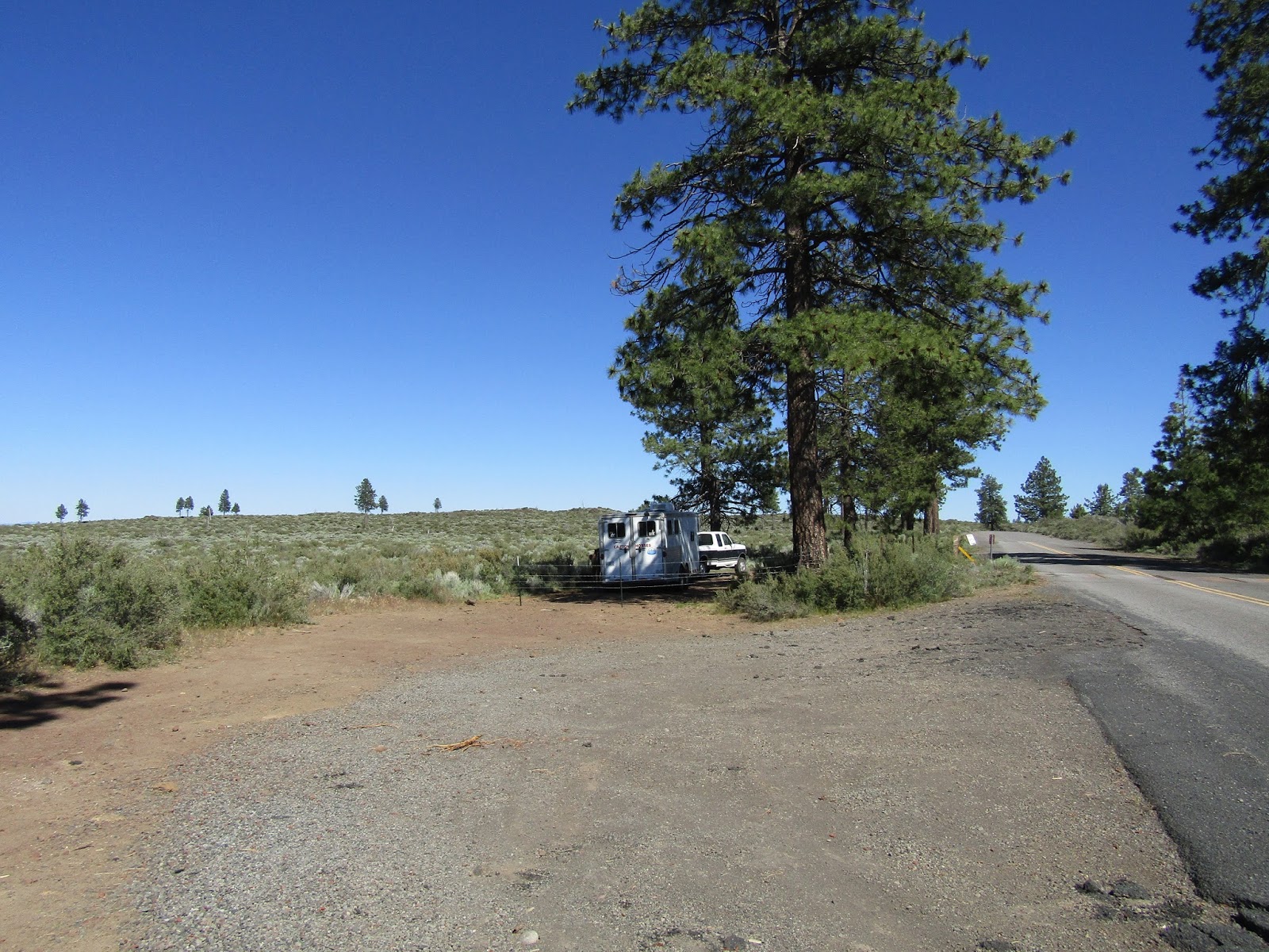 |
| The parking area next to the dirt road that leads to Boyd Cave. I am parked on the south side of the fence. |
The Coyote Loop Trail starts directly across China Hat Rd.
There are sometimes cows in the area so make sure to close all the gates.
 |
| The Coyote Loop Trail. |
 |
| Cows are grazing at this time of year. |
The Coyote Loop Trail is marked with grey/silver diamonds and the trail number is 62. You start off in the open and gradually ride higher and into the forest. The junctions are marked with signs and have mileage on them. This trail system is popular with cyclists as well, so it's a good idea to keep an eye out for them.
 |
| Trail markers for the Coyote Loop Trail. |
 |
| You ride into the trees fairly soon. |
 |
| Trails are clearly marked at junctions. |
Don't veer off on any other roads or trails, this one trail will take you directly to the camp.
When you are nearly at the camp there is a junction, with more than one way to get there. There is a slightly longer way which is marked as 2 miles, or stay on the same trail and it is 1.5 miles.
I went the shorter way on this day in order to take a little detour up Fuzztail Butte. This is an option at the very next junction, off to the left, but it adds another mile to the total trip.
There are some nice views from up top. As I was taking pictures my horse was nibbling grass and stuck her nose into a nest of ticks, if there is such a thing. All I know is they were all over her nose and legs instantly and before I realized it she had rubbed half of them off onto me. So I spent the next several minutes plucking them off of both of us. I then went back down and rode the rest of the way into camp, which luckily was tick free. It's an especially bad year for these little blood suckers. I've encountered more this year than in any other year of my entire life!
 |
| On top of Fuzztail Butte right before the tick attack! |
 |
| Mountain views from atop Fuzztail Butte. |
To drive directly to the camp: From Bend follow Hwy 97 south to exit 143 at Knott Rd. Take a left on Knott and follow it 1.5 miles until you reach China Hat Road. Take a right and go 6 miles until you reach FS Rd.1810, (there is a sign for the horse camp), take a right and follow it for another 6 miles until you see a horse/rider sign, and take a left. This is FS Rd 1816 and in another 3 miles you will reach the camp. This section of road is dirt, narrow and one lane and although I find it to be in decent shape, it is probably why the camp doesn't get much use. There are no cliffs, but there is not a lot of room to get out of the way if you run into someone else. Update: As of July 2021 the road to camp has become deeply rutted, and bumpy, with soft powdered dirt, and may not be maintained in the near future, so don't drive in unless you have good clearance. Update #2 As of June 2023 the road is the same, no worse, no better.
 |
| The narrow FS Rd. 1816 leading to camp. |
Swamp Wells is a free camp, and has five spots with picnic tables and fire rings and four horse steel corrals. They are missing gates, but otherwise are in good shape. There are four manure bins conveniently placed in between the sites. There are two large day use areas, complete with boards with maps of the trails, and a bathroom.
 |
| Steel corrals at Swamp Wells Horse Camp. |
 |
| A couple of map boards in the day use areas. |
There is stock water available just south of one of the day use areas, from a guzzler in the ground, although I wouldn't rely on this always having water all year. This camp has big enough spots for larger rigs, especially the spot next to the horse mounting ramp.
There are also two ponds west of camp but they are fenced, in fact the fence has recently been fixed/replaced, and the ponds are not accessible for watering horses.
 |
| The fenced in pond area. |
 |
| The guzzler for stock water. |
 |
| Riding along Kelsey Butte on the Swamp Wells Trail. |
And then there is the Arnold Ice Cave Trail, number 63, which is the one I use to loop back to my truck.
 |
| Arnold Ice Cave Trail sign. |
On the way back you will cross over several OHV tracks, and then eventually come to yet another junction. You can continue to follow 63 and it will eventually cross over China Hat Rd. From there I tend to just ride back to my truck on the road, it is gravel with very little traffic. But you could continue on 63 and although it adds a little more mileage, you will end up back at Boyd Cave just east of where you parked.
Or you can detour over to see some of the caves in the area. You will first come upon Hidden Forest Cave and Charcoal Cave and then lastly Arnold Ice Cave.
 |
| Charcoal Cave. |
 |
| Arnold Ice Cave. |
After checking out all the caves, follow the red dirt road from Arnold Ice Cave's parking lot, back down to China Hat and take a left to ride back to your truck.
 |
| The view riding back along China Hat Rd. |
As you are driving out, don't go back the exact same way, once you get to Knott Rd. just cross over it and China Hat will pop you out onto Hwy 97 from there.
Happy Trails!!
GPS COORDINATES TO BOYD CAVE
GPS COORDINATES TO SWAMP WELLS
