First trip of 2017! I decided to head over to Idaho for a week, and all three of the different areas I went were better than expected. Of course I could have been anywhere and been happy, after the long winter we were exposed to this year.
 |
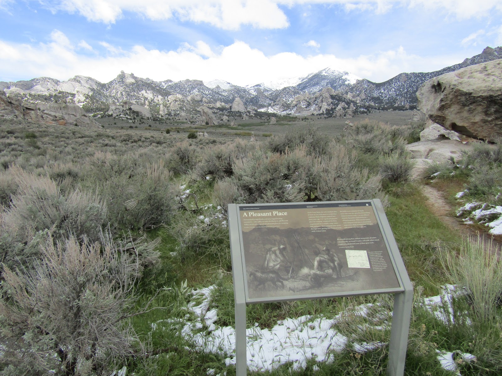
| City of Rocks National Reserve. |
First was Bruneau Dunes State Park which was a nice stop over on my way to City of Rocks. It is a long drive and I lost an hour due to the time difference, so I did not arrive until 5:00 pm, had a quick snack, and hopped on my horse to explore. The camp was deserted when I got there and I never did see anyone the rest of the evening. The equestrian camp is the first turn off as you enter, and very separate from the rest of the park which is quite large and spread out.
 |
| The horse camp at Bruneau Dunes State Park. |
There are 19 spots, none of which are extremely large, really just room for one rig and they do not have corrals in the spots. There are a set of four wooden communal corrals and then a separate fifth one next to them. There is a bathroom, picnic tables and fire rings, several water spigots and garbage cans, a shelter also with picnic tables, and a very small manure bin. Apparently there are showers and flush toilets somewhere in the park, but you would have to drive to find them. If you live in Idaho you get a cheaper rate, for out of state people like myself it was $23.02, to be exact, per night.
 |
| The communal corrals at Bruneau Dunes State Park. |
There is a map of the trails on their website and also one on the outside wall of the bathroom. There are a lot of hiking trails and two horse trail loops, a shorter 7 mile version or a 9 mile version. I was going to do both, but ran out of time, and I was also nearly frozen to death near the end of the ride.
The shorter loop runs up onto the ridge away from camp, then back down next to two enormous sand dunes, ( I learned that one of them is the tallest single structured dune in North America ) through a thicket of Russian Olive trees and back to camp. The longer loop goes past a couple of small lakes, but I did not see them except from afar.
 |
| The trails are marked with white plastic posts along the way. |
 |
| On top of a dune at Bruneau Dunes State Park. |
 |
| Hard to tell in the picture, but these dunes are enormous. |
The next morning I had a relatively short drive of three more hours to get to City of Rocks National Reserve. I drove over a couple of passes on the way there which had just had snow the previous night, and that made me a little concerned about what conditions I would encounter upon arrival. As expected it had snowed in the park as well, but was melting rapidly.
Smoky Mountain Campground is a large people camp with an additional loop section of six horse sites each with a small steel corral, technically you are allowed two horses in each corral, but they are so small I wouldn't recommend it. There is a much larger communal corral, that you can use if you happen to get to it first. The camp is paved and has garbage cans, picnic tables, fire rings, water spigots and hookups. (This was my first time ever having hookups in all my years of horse camping.) There are a couple of steel receptacles to deposit manure into, but you have to scoop it in to them. There is a large day use area which is where the equestrian trailhead is and it has a vault toilet. But there are also two bathroom buildings in the main campground with flush toilets and one also has showers. They charge $32.00 a night for out of state people, but with the reservation fee and taxes added in, it came to $37.00 per night.
 |
| The corral in spot 36 at Smoky Mountain Campground. |
I had reserved a spot, you don't have to, but it seemed like a good idea since I would be staying through part of the weekend. Also they allow non horse people to use them, and it was the only spot left when I checked Reserve America. I pulled in to site 36 and was getting ready to ride, when the camp hosts came by. After a long conversation it was determined that I was in the wrong spot. This camp is very badly designed, of the 6 horse sites, three of them are crammed in side by side at the top of what seems to be a loop road. Instead, the loop road was actually my camp spot, this became increasingly confusing during the rest of my stay as other people with reservations drove straight up the road and encountered my rig directly blocking their way, causing countless people to have to back up around a corner, some with trailers, and then drive in from the other direction. This was especially bad for the poor folks who needed to get into #37, since the only logical way for them to back in to their spot was to drive through mine, which they could not do. Also once they were situated, they started to use my picnic table and fire ring because it appears to be theirs, since it is located right next to them. I didn't bother to explain that it was actually mine! If you do not want to deal with all of this fun and games, reserve one of the three separate back-in spots #s 33, 34, or 38.
 |
| My spot #36 that appears to be blocking the loop road, but isn't. |
After moving my rig into the correct area, I headed out on my ride.
I had three days to ride there and with new snow in the higher elevations I decided to stay lower down the first day and gradually ride on the higher trails as the days went on, and this strategy ended up working out quite well.
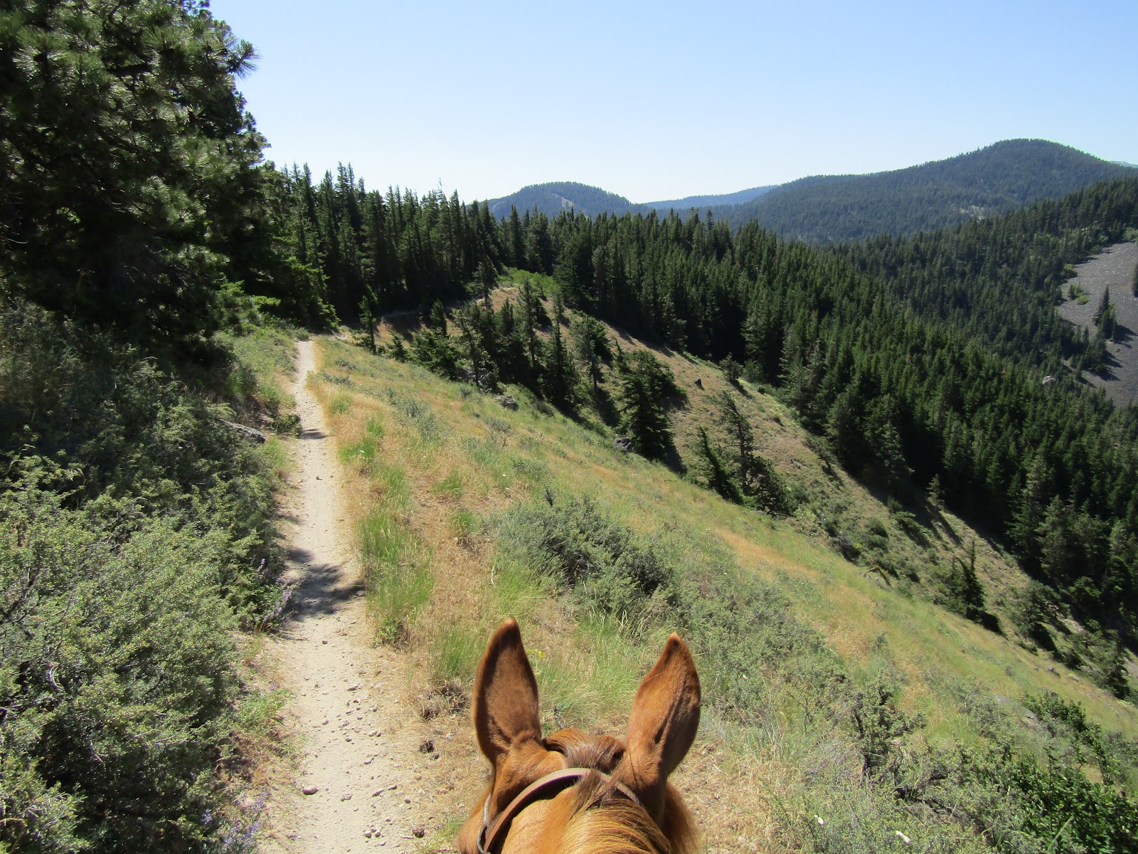
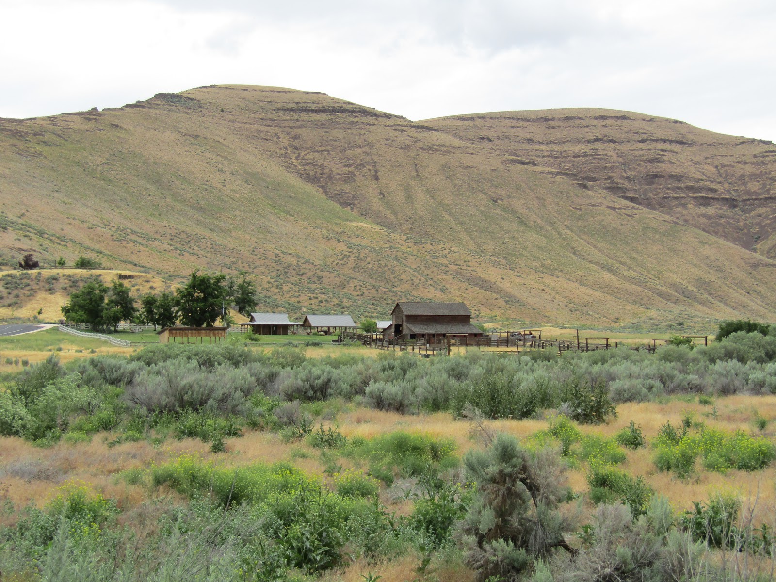
The trail leaves camp, eventually crosses and then follows Circle Creek for a mile and a half before you get into the rocks. On day one I took the junction to the left, this spit me out onto the dirt road that runs through the park and follows roughly along what used to be the California Trail that the emigrants used back in the day. The first thing I came to was the remnants of what was once the Circle Ranch, an old homestead the Tracy family built in 1904.
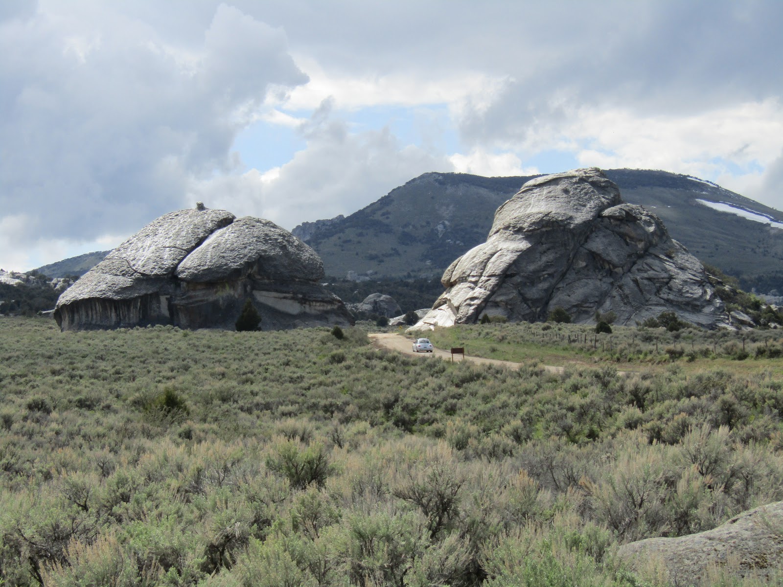
I then stayed on the road for as long as I felt like riding, checking out the different informational plaques set up along the way. A lot of the rocks have names and one called Camp Rock has what looks like graffiti on the backside of it, but it is actually bona fide signatures from emigrants passing through, they used axle grease to sign their names and the date, and although some have faded over the years, most are remarkably intact.
 |
| What was once the Tracy Homestead. |
 |
| Riding along the road checking out all the rocks. |
 |
| You can gauge the size of these rocks by the little bug driving past them. |
 |
| Informational plaques are set up periodically in the park. |
 |
| On Camp Rock the signatures of emigrants remain. |
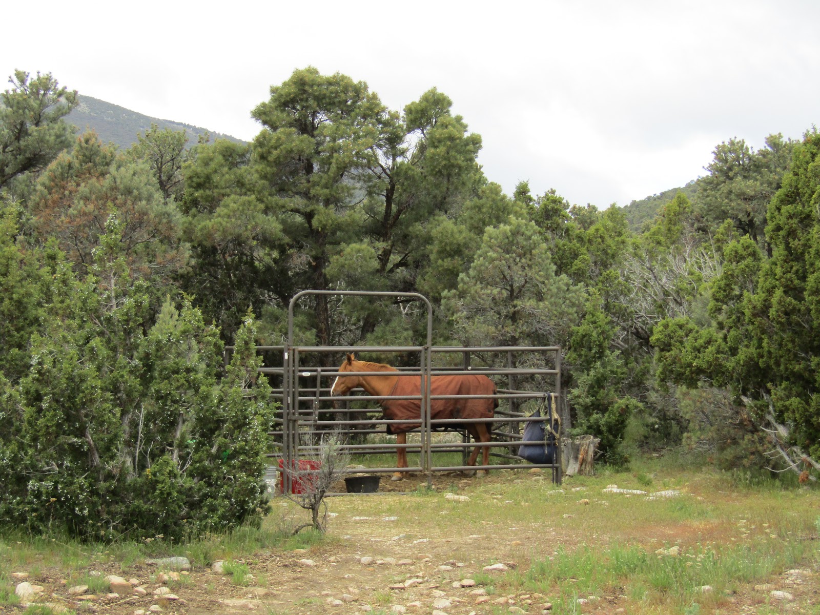
Another option for horse camping in the park is the Juniper Group Camp, I happened upon it as I was just about to turn around and head back. This site is out in the middle of nowhere, has a bathroom, hookups, (they run underground power out to here), and a really nice acre of pasture that has been fenced off to accommodate quite a few horses, although they would all have to be pastured together. There is a hydrant with non potable water, but when I tried it nothing came out, however the water trough in the pasture was full and clean, so I think if someone reserves this spot, it looks like they take care of keeping it full.
 |
| The Juniper Group Camp horse pasture. |
 |
| At the Juniper Group Horse Camp. |
 |
| This was once the site of a stage stop, there is a lot of history in this area. |
After my ride I arrived back at my site to find myself with some non horse camper neighbors, we started chatting and I made myself a couple of new friends. Sam and Sue were visiting the park so Sam could rock climb and they also planned to mountain bike and then do some skiing at a nearby mountain. That evening after dinner they invited me to come along and watch Sam and some of his friends climb, so we headed over to Bath Rock. I learned quite a bit about rock climbing, most importantly that I will never try it, but it was very fun and interesting.
 |
| Sam scales Bath Rock. |
 |
| Sunset at City of Rocks. |
This area has cactus, I was actually quite surprised to see it, and although it is not everywhere, you have to watch for it along the various trails in the park. On my second day I took a series of trails that headed into the heart of a whole conglomeration of rock formations.
 |
| The Circle Creek crossing. |
 |
| Quite a lot of cactus to keep an eye out for. |
Before you arrive at the park, you have the option of stopping at the visitor center in the tiny town of Almo. There you can get maps and info, but there is also a map at the equestrian trailhead and mapboards in the park at the various parking areas, and they show all the specific horse trails, plus you can ride on any of the roads. There are several "foot traffic only" sections which are trails that are not horse friendly, I ended up on a couple of them briefly by mistake and had to turn back. When you get to junctions, although they are marked, they do not tell you whether it is a horse trail or not. There is certainly enough riding here to keep a person busy, I did almost everything in three days of long rides, but there is also national forest bordering the park, and a whole other area nearby (you pass it on the way to City of Rocks) called Castle Rock State Park that I did not even visit on this trip.
 |
| On the Stripe Rock Loop Trail. |
 |
| The rock on the right is called Stripe Rock, it has a seam running down it. |
 |
| The view looking down from the Indian Grove Trail. |
 |
| There are markers at all the junctions, but they do not specify whether it is a horse friendly trail. |
On my third day I was able to climb up towards Graham Peak, at an elevation of 8,867 feet. I took the road on the way up and the trail on the way down. I did run into a snowdrift at one point left over from winter and had to do a little bushwacking to get around it. But most of all the fresh snow had melted by this time, except for at the highest points. It was Saturday by now and my once quiet days of riding became a different story as hordes of people descended on the park, mostly rock climbers. It was still possible to escape from everyone via the trails, but the roads and parking areas were very busy. Besides the campground that I stayed in, non horse people can drive into the park and camp amongst the rocks, there are some beautiful spots set up, and a lot of them are private and spread out.
 |
| On the Stripe Rock Loop. |
 |
| A lunch break at Bread Loaves. |
 |
| I decided to ride the road up to Graham Peak. |
 |
| On the way up to Graham Peak, in the Sawtooth National Forest. |
There are hot springs in town, and I was invited to go with my new friends on Saturday evening, but the one thing I did not pack was a swimsuit, so I reluctantly declined.
On Sunday I started driving back towards Oregon, stopping at the Wilson Creek Trail System located in the Owyhees, in Marsing, Idaho. There is no horse camp here but I had visited this place once before a few years back while on a road trip in my car, and I figured I could drive on past the main trailhead and find myself a nice level spot for dispersed camping.
At the trailhead there is plenty of room for parking, plus another big overflow parking area, a bathroom, and a brochure with a map of the trails that you can take with you.
 |
| The main trailhead on the left and the overflow parking on the right at Wilson Creek. |
As I was just starting to get set up, a couple came by on horseback and told me they were headed off to find the creek, when they came back a little later they said they had not found it, but the following day finding the creek was exactly what I did, and it was a beautiful ride.
 |
| My little spot in the Owyhees at Wilson Creek. |
 |
| A couple riders I chatted with briefly. |
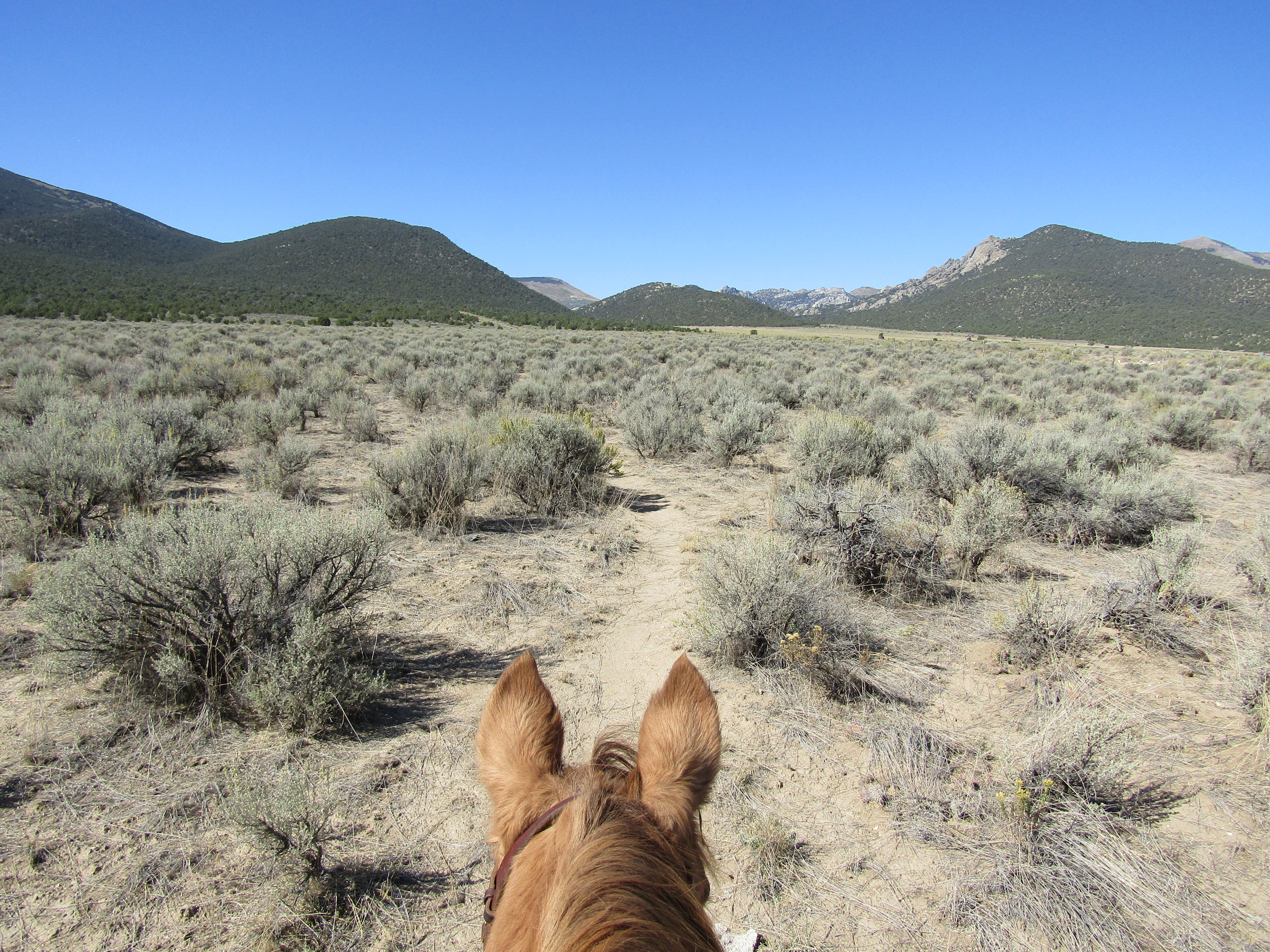
I did a large loop and the diversity that I encountered just in one day was quite something. Near where I parked it was fairly barren looking with just dirt and rock, then I rode into a canyon with steep cliffs towering above me, and lush grass along Reynolds Creek. A little while later I was among rolling grassy hills and wildflowers. I had some company during the ride, there are large Mormon crickets that reside there, they sang me to sleep at night, but on one particular stretch of trail through some taller grass, the ground underneath me suddenly started moving, with all of these big, kind of creepy looking insects, trying to get out of my way.
 |
| Kind of a barren landscape where I camped. |
 |
| Lush greenery by Reynolds Creek. |
 |
| A beautiful canyon with Reynolds Creek running through it. |
 |
| Wildflowers in the Owyhees. |
 |
| A partridge, but no pear tree. They cluck, sort of like a chicken. |
 |
| The trails are marked and numbered. |
 |
| The Mormon crickets, are large and slightly creepy looking, but harmless. |
I spent one more night, so I could drive back at a leisurely pace the following day.
On May 17th when I had originally left for my trip it was snowing as I was driving across Oregon. In complete contrast a week later, I drove home in over 90 degree weather!
Update: In 2024 I returned to Bruneau Dunes and City of Rocks on my way to Colorado. I got to Bruneau late morning and it was HOT. Last time it had been very cold, this time it was the complete opposite. I had planned and packed for cooler weather, since that would usually be the case in late Sept/early Oct. I decided to set off for a ride right away, since it was only going to get hotter as the day progressed.
I headed straight towards the big dune, following alongside it until I ran into a potentially terrifying orange wind sock, randomly situated where you would least expect one. My pony's heart rate soared, but the terror lasted merely a minute and we continued on. We came across Big Lake and then I rode straight down the paved road until I got to another trail over by Small Lake. There are designated equestrian trails, but not everything is perfectly marked and it didn't seem like it was a problem to ride on the other trails. I would not recommend riding cross country though, I did that briefly and there are way too many critter holes to fall into.
 |
| Riding towards the Big Dune. |
 |
| Random wind sock type of thing. |
 |
| Alongside Small Lake. |
 |
| Small Lake. |
When I got back I paid my camping fee for the night and when I returned to my truck I noticed something on my windshield. It turns out a park employee had ticketed me for not paying a day use fee. Just to be clear, the horse camp turn off is before you get to the fee booth, there are no instructions about a day use fee, and there is nowhere to pay for it. Possibly they didn't realize I was camping, but keep that in mind if you arrive and don't pay for camping the instant you get there.
The camp has changed a little bit since 2017, they have added a water trough and frost free spigot next to the corrals, so you don't have to haul water as far. They have rounded up the out of state camping fee to $24.00 per night. The loop road is one way, but if you drive in that way, most of the spots will be on the downhill slope and harder to get into, which makes it problematic for getting level. So you may have to break the rules and drive in the opposite way.
That evening a large group of non horse people arrived and set up camp, it was a few adult men with a whole plethora of teenage boys. Long story short, one of the boys wandered off towards the sand dunes, which was not close, and it was about to get dark. Kids like to slide down the dunes on sleds. Nobody seemed to notice he was missing for awhile, then when they did, a search commenced. He was found after dark and all was well, but it was entertaining for me and my horse. She thought the flashlights bobbing around from afar were snort worthy.
The next day I headed over to City of Rocks. This time instead of camping in the official campground like I did last time, I camped at Castleview RV Park.
 |
| Castleview RV Park |
This is a great place to camp, although very primitive. There are 15 numbered graveled spots in a loop, but there is also a big open field beyond the loop, which is a great place to pull in with any sized horse trailer. There is a well with a frost free spigot at the entrance to the camp, but when I tried it, no water came out, however there is a dump station right nearby, on the campground road. It is $10.00 per night and you pay in a locked metal box with slots in it corresponding to each site. There is no bathroom and no other amenities. There is a cell tower on a hill nearby, but it clearly is not Verizon, the only signal I was getting was coming from down in the valley.
There had been ALOT of flies at Bruneau Dunes, and in the cooler morning while they were all still sleeping in my trailer, I had no choice but to put my horse in there with them, and away we went. So when I arrived at City of Rocks and opened the back door, out they all came. They stayed with us for the rest of that day, but by the next day they were gone, perhaps back to Bruneau!
There is trail heading towards City of Rocks beyond the camp and even though this particular piece of land is fenced at the front with a cattle guard, the back side is not.
 |
| The trail that leaves from the backside of camp. |
Then after about a mile or so, and after passing through a wire gate and cattle guard on the road to the campgrounds, you will come to the equestrian trailhead. Since I already had ridden the vast majority of City of Rocks in 2017, I concentrated on a couple of trails I had skipped the last time.
 |
| On the Geological Trail. |
 |
| City of Rocks. |
It was still very hot and I had started at noon so I only rode for about 4 hours. As I was on my way back a fighter jet went over me really low, he was in stealth mode, but I spotted him coming. You can’t hear them at all and then you get the giant sound wave that hits you, which could have freaked out a lot of horses, but Rina was fine. It was actually pretty cool watching it approach me silently and then he did a little flip upside down, just to impress me, I am sure! Two more went over after the first one, but they were flying much higher.
That night a ferocious wind blew and unfortunately one of my trailer vents isn't working properly, the one directly above my bed, so it was not a restful sleep, as the trailer shook and the vent flap flew up and banged back down periodically.
My mission for the next day was to make it over to Castle Rocks State Park. I was under the impression I could ride there from my camp spot, and as the crow flies it looks doable. It is not, there is no direct route even though I was looking right at it, I had to ride on roads for quite awhile, so by the time I arrived, there was no time to do the actual trails.
 |
| Castle Rocks State Park |
 |
| An old homestead along the road. |
If I could go back and do this differently I would have driven to the park on my way in on the first day, done the trails right away, and then rode out from camp the next day. In any case the park has a $7.00 entry fee and enough horse trails to do about 7 miles or so.
As I was finally arriving at the entrance, some very excited people stopped so their teenage daughter could pet my horse. They were French, from French Polynesia, but they love traveling through the western states. It must be such a different world for them.
 |
| Curious horses came to say hi, as I rode by. |
After admiring the rocks from a cow pasture right at the base, I rode back taking a different route right through the tiny town of Almo.
 |
| Castle Rocks up close, from grazing land inside the park. |
 |
| Back at camp, had the place to myself. |
The next day I moved on to my next destination, but I would recommend this area, it is a fun place to ride and there are hot springs in Almo, although for my trip the weather was far too warm for me to want to partake.