Thursday, January 14, 2016

Badlands Rock Trail, Oregon Badlands Wilderness, Oregon


The Badlands which became designated wilderness in 2009, is great for winter riding, with 29,000 acres and several different trailheads to choose from. The Badlands Rock Trailhead is the largest, as far as parking, and there are several riding options from there on mostly flat and easy trails. For another ride on the north side, check out the Tumulus Trail .

The sign just before the 17 mile marker.

From Bend OR, drive east on Hwy 20 towards Burns, just before the 17 mile marker take a left
at the Oregon Badlands Wilderness sign, cross over a cattle guard and continue on the paved road for one mile.
Turn left into the large parking lot for Badlands Rock Trailhead. There are two hitching posts on the south side of the lot, but no bathrooms or water.

Sign at the parking area.

Nice large parking lot.

There is a large mapboard at the beginning of the trail. The metal boxes used to have paper maps you could take with you, but the BLM are no longer printing them at this time. However you can go to the BLM website and print out your own version.

Mapboard at the trailhead.

This has been an especially wet winter for Central Oregon, but after snow just recently melting and a lot of rain the day before, the trails are dry and safe. You are riding through volcanic ash which is soft and does not get very slippery. In comparison, I actually got stuck in a muddy mess in my own driveway when I got home! Another bonus is that a lot of the time the Badlands will be several degrees warmer than Bend.

Nice dry volcanic ash trails.

To do the 8 mile Badlands Rock Loop take a left on the Homestead Trail at the first junction.

Signs the Fobbits have installed.

For about 4 years I have been a Fobbit...what is that you ask? The Fobbit's are a volunteer group that spend a lot of hours in the Badlands doing garbage clean up, taking out old fence lines, and we have installed all of the signs at the junctions. When I go out to ride or hike, I check on them, making sure they are still standing. In the past there has been some vandalism (apparently people like to take signs home) but it's gotten to be less of a problem recently. I also keep an eye out for any "rule breakers", there are no motorized vehicles allowed in this wilderness and that includes anything with wheels, like bicycles and strollers.

Views of Horse Ridge from the Homestead Trail.

On the Homestead Trail.

Lava formations.

When you get to a second junction take a right, you will now be on the Flatiron Rock Trail.
Soon you will reach Flatiron Rock which is a fun formation and you can ride right up into it.

The trail into Flatiron Rock.

Rina surveys her domain from Flatiron Rock.

Views of Badlands Rock and beyond, from Flatiron Rock.

Flatiron Rock.

After playing around up on top for awhile go back to the trail, and take another right on the Castle Trail.

The sign for the junction to the Castle Trail.

There will be another sign eventually, next to another lava formation called Castle Rock, just follow the arrow to the left, and the trail continues on to Badlands Rock. Badlands Rock is not accessible by horseback, but hikers can climb up onto it.

Badlands Rock.

From there you continue to the right again, on the Badlands Rock Trail and this will take you back to the junction you started from, and the parking lot.

I have not been able to ride as much as I normally do this winter, and apparently this has affected my horse's mental state. We were on the trail when we both spotted something on a bush. I quickly realized it was a hat someone had put there, but Rina was quite concerned, after plucking it off the bush and letting her smell it, she was still very skeptical, so I told her if she was going to be silly, she could wear it!

Silly pony.

Heading back on the Badlands Rock Trail.

The three way junction at the end of the loop.

My timing was impeccable on this particular day, I finished riding just as the rain started.
Happy trails!

GPS COORDINATES TO BADLANDS ROCK TH

Saturday, November 7, 2015

Dry Creek Horse Camp, Ochoco National Forest, Oregon

Well my high country riding is over for this season, but a trip into the Ochoco's is
always a good choice.
I've never actually camped here since I live close enough to drive over for the day. I usually ride here in the spring, since snow melt happens early, but this is a nice November ride as well.

To get there: From Prineville take Hwy 26 east for 8 miles, then take a left on Mill Creek Rd. Continue for 5 miles, then take a left on Rd. 3370, there will be a sign for Brennan Palisades. (There is a gate here that is locked from Dec. 1st to May 1st. So if you want to camp you will have to wait until it opens, or if you just want a day ride, there is a spot to park in front of the gate, and from there you can ride to the camp or on any of the trails.) In 2.5 miles take a left at the sign for the horse camp.


The Ochoco's need to be dry for good riding, if it is wet the ground becomes extremely muddy and slippery.

The sign for the horse camp.

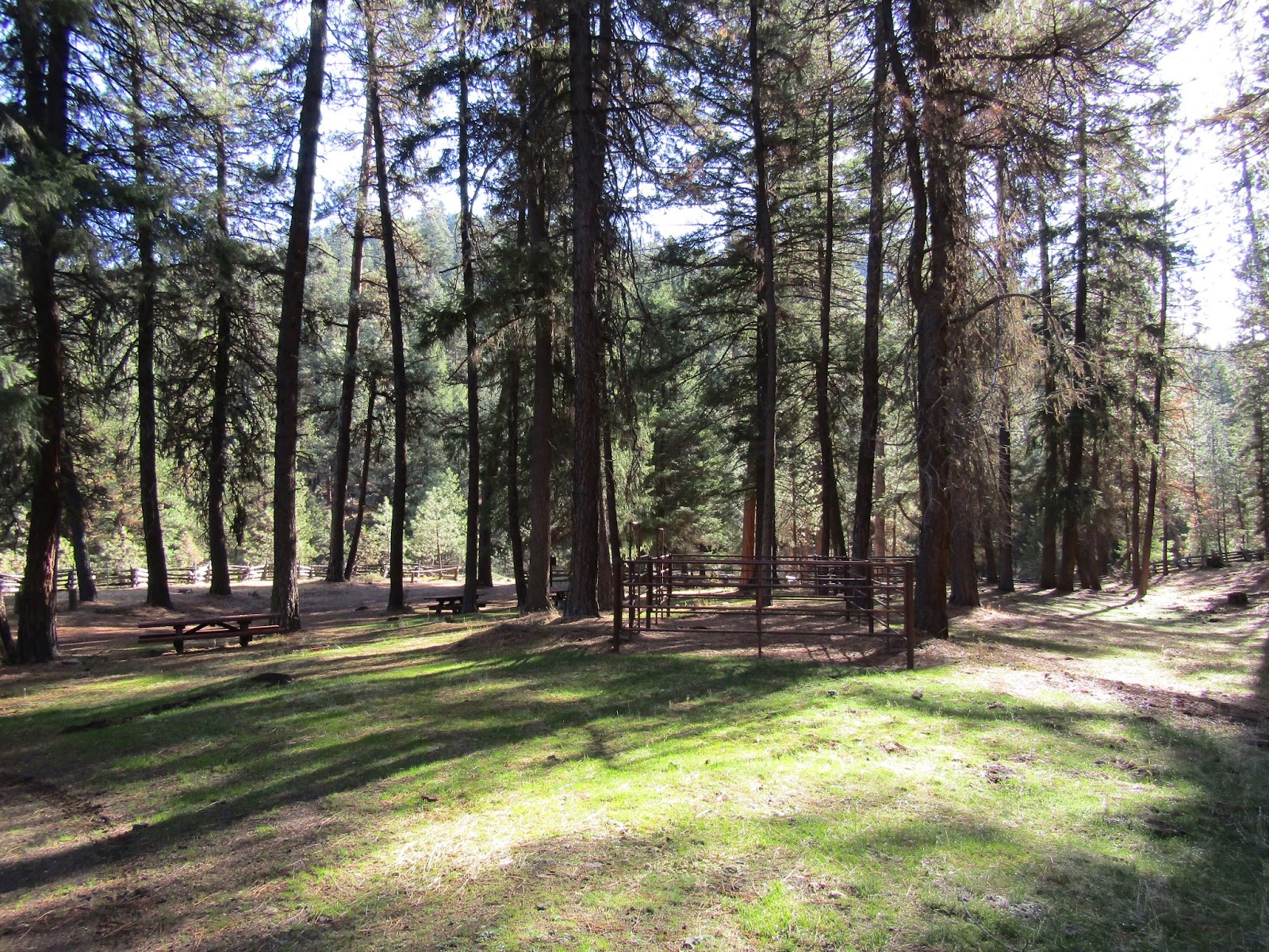
Dry Creek Horse Camp has five sites all with steel corrals. There is a bathroom and a manure bin. The creek has plenty of water in it early in the year, but best not to count on it for stock water, it's called Dry Creek for a reason. There is no potable water, no garbage and no fee. The camp is on a hill so most of the spots are not very level.

Dry Creek Horse Camp.

Dry Creek Horse Camp.

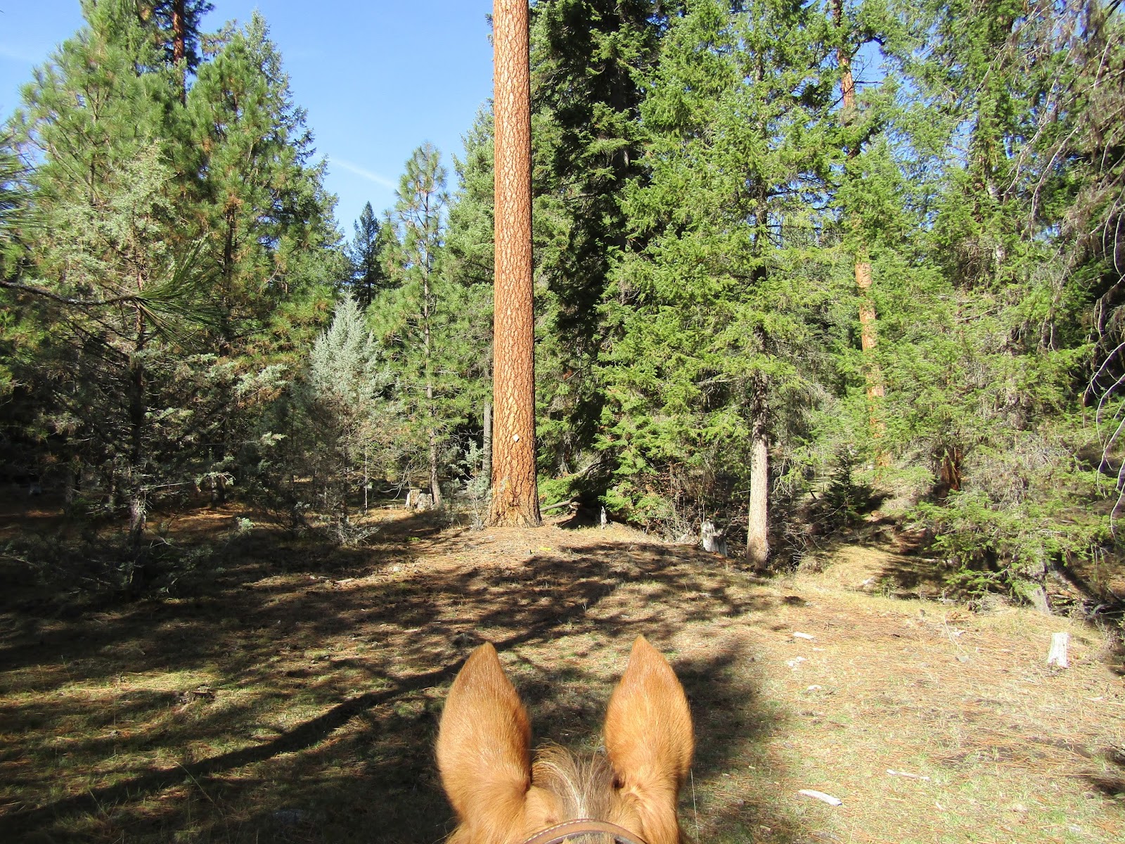
The main trail from here is the Giddy Up Go Loop. It leaves directly across from the camp and you have several choices on which way to go. Across the creek would be how to ride it counterclockwise, or you can take the far left trail which is the clockwise way....although just continuing to ride up the road the camp is on, will also get you there, in fact the far left trail will eventually end up on this road. Lastly there is a well used trail in the middle of these two, this is the tie trail and it will make your loop shorter if you choose. I rode it clockwise on this day.

Giddy Up Go Loop.

The trail turns into dirt roads at times, some two tracks and then more trail. Several years ago it was not well marked. A friend and I attempted it, lost the trail for a long while and then ended up finding it again, but for that reason didn't actually get to ride the the whole thing. Now it is very well marked, and more people are obviously using it. The original markers are yellow wooden diamonds on the trees, and there are also a few white diamonds. 

On the Giddy Up Go Loop.

Giddy Up Go Loop, partly on dirt roads.

Approx. halfway there is the option to take the tie trail back for a shorter loop.

Yellow diamonds mark the trail.

Most of the trail is through forest although there are some views at the top of Steins Pillar and surrounding mountains.
The loop is 12 miles, there is a sign at the trailhead that says it is 7, which is not correct. Most likely this is referring to only one side of the loop.

Views from Giddy Up Go Loop.

Steins Pillar.

Giddy Up Go Loop view.

There are a couple of collapsed dwellings on the way back.

When I got back to camp to have a snack break, there were a few ladies riding Peruvians that I said hi to, and then I continued on to do the other trail to Brennan Palisades. This is a short ( less than 5 miles round trip ) trail that runs along beside the creek, crossing it several times. It eventually comes out into a fenced in meadow and in the spring it's probably better to skirt this area, but right now it was dry enough to ride through. This trail is not marked, you are basically just riding along beside the road you drove in on, until you get to the road that goes to the Palisades, then it's about a 1/4 of a mile up that road. That is the only real destination, although I have explored in the past by continuing to follow this road which climbs up for awhile but then dead ends.

The meadow that is very close to Brennan Palisades.

Brennan Palisades sign.

Brennan Palisades.

If you are feeling adventurous there is a trail that leads up into the Palisades. There is a lot more to be seen from up there than from down below. From the top you can then follow a trail back to the horse camp. Most of the trail is actually in good shape, but there is a section with some downed trees, and a few areas you might lose the trail briefly. It will come to the fence line by the camp, and you just ride down to the entrance from there.

Up on top of the Brennan Palisades.

Other than these two options, there aren't any other trails, but you can continue riding down the road you drove in on. There is an old barn to visit, or just check out where the many random dirt roads in the area go. I have ridden up to the Green Mountain OHV trail from road 3380 and explored around there as well.

Old barn on the way to camp.

On the Green Mountain Trail.


Another ride that is nearby, but you would have to trailer over to, is Twin Pillars


Friday, October 23, 2015

Chambers Lakes, (Camp Lake) Three Sisters Wilderness, Oregon

I am lucky to live here, especially when I can ride into this kind of beauty on a sunny day at the end of October, and it being a relatively short drive from my house.

Camp Lake.

In 2011 I had tried to ride this trail for the first time, and I got to within a mile of the end, before I was brought up short by a giant snowdrift. In 2012 the Pole Creek fire swept through there, and the trailhead was not accessible for quite awhile.

From Sisters: Drive 1.5 miles west on Hwy 242 and take a left on Road 15. This is the same road that you take to get to Sisters Cow Camp.
It is 10.5 miles to the Pole Creek Trailhead and the road turns to gravel after the first 2 miles. Stay on the main road, the junctions are marked. This road used to be really washboard and slow going, but they were grading it while I was driving up there, so it was considerably better, but of course it depends on when you go.

The parking area has a couple of large spots for horse trailers, but the trick is getting turned around. I assumed there would be no one up there on a Wednesday in the fall, but boy was I wrong, the parking lot was almost full. If no cars are there you can easily turn around, but since that is not usually the case, there is a small side road you can use to back into.

A good large spot for parking trailers.

The always full parking lot.

The first part of the trail is the burned section but on the plus side, there are now views of North Sister that were not visible before the fire.

The Pole Creek Trailhead.

The burned section of the Pole Creek Trail.

Views of North Sister.

At the first trail junction you come to, stay straight, where the sign says Green Lakes.

First trail junction.


The next trail junction comes up right after crossing  Soap Creek, this is where you leave the Green Lakes Trail and go to the right towards Camp Lake/Chambers Lakes.

The third trail junction is just after you cross the north fork of Squaw Creek, which is filled with silt. Here you have the choice of a 1.6 round trip detour to visit Demaris Lake.
Or if extra mileage is not on your agenda, stay to the right here instead.

North fork of Squaw Creek.

The sign for the side trip to Demaris Lake or go right to Camp Lake.

Demaris Lake.

Eventually you will climb out of the forest and the views really get good from here.
You will have North Sister and Middle Sister on your right, off to the left will be Broken Top, then once you get to Camp Lake, South Sister looms above.


North Sister.

This is the area where I had to turn back in 2011, because it was full of snow.

Broken Top.

Middle Sister and North Sister.

The final destination is the beautiful gem that is Camp Lake. I spent an hour just walking around and checking out the whole area. I was prepared for it to be windy, since it's supposed to really blow most of the time, but I was lucky, and it was quite balmy and calm. The rest of the Chambers Lakes are up above Camp Lake but it's probably best to not continue on. The user trails that lead out of there are more for hikers than horses, steep, rocky and primitive.
This whole ride including the side trip to Demaris, is just under 16 miles.

South Sister.

Camp Lake. There is a trail that leads up the cliff but it's not really horse friendly.

Found some snow.

My good pony waits patiently for me to quit monkeying around on nearby hills.

Camp Lake from a nearby hill.

My friend Krista was doing an exploratory ride on the same day as me, but coming from the west on the PCT and we made a plan to see if she could make it into the area where I was, from her side, but although she got close, the trail was much too rocky and she had to dismount just to get down some sections of it.
So we did not see each other after all, but we both had great days in the wilderness!

Krista's photo: Trying to get Phoenix down some rocky trails. 


GPS COORDINATES TO POLE CREEK TH