After my last camping trip got cut short, and the other place I was thinking of going had thunderstorms in the forecast, I had to find another place that was going to have accessible trails this early in the season and enough riding for several days. So I got ahold of someone I know who lives over near Yakima WA and asked her for ideas and she suggested the Teanaway. (Thanks Susie!)
It had been on my list, ever since I went to
Cayuse Horse Camp and the camp host told me I would like the riding from De Roux, and so I figured, no time like the present!
 |
| Gallagher Head Lake. |
I wanted to visit more than one place and there are quite a number of trailheads to pick from but Susie suggested I try Miller Peak and Stafford Creek. Although there is camping at Millers Peak, which I drove through first to check out, Susie had also mentioned there is a nice dispersed spot between the two trailheads and it turned out to be perfect, so I camped there. There were, of course, no amenities but it was right next to Bear Creek for easy access to stock water.
 |
| My dispersed camping spot between trailheads. |
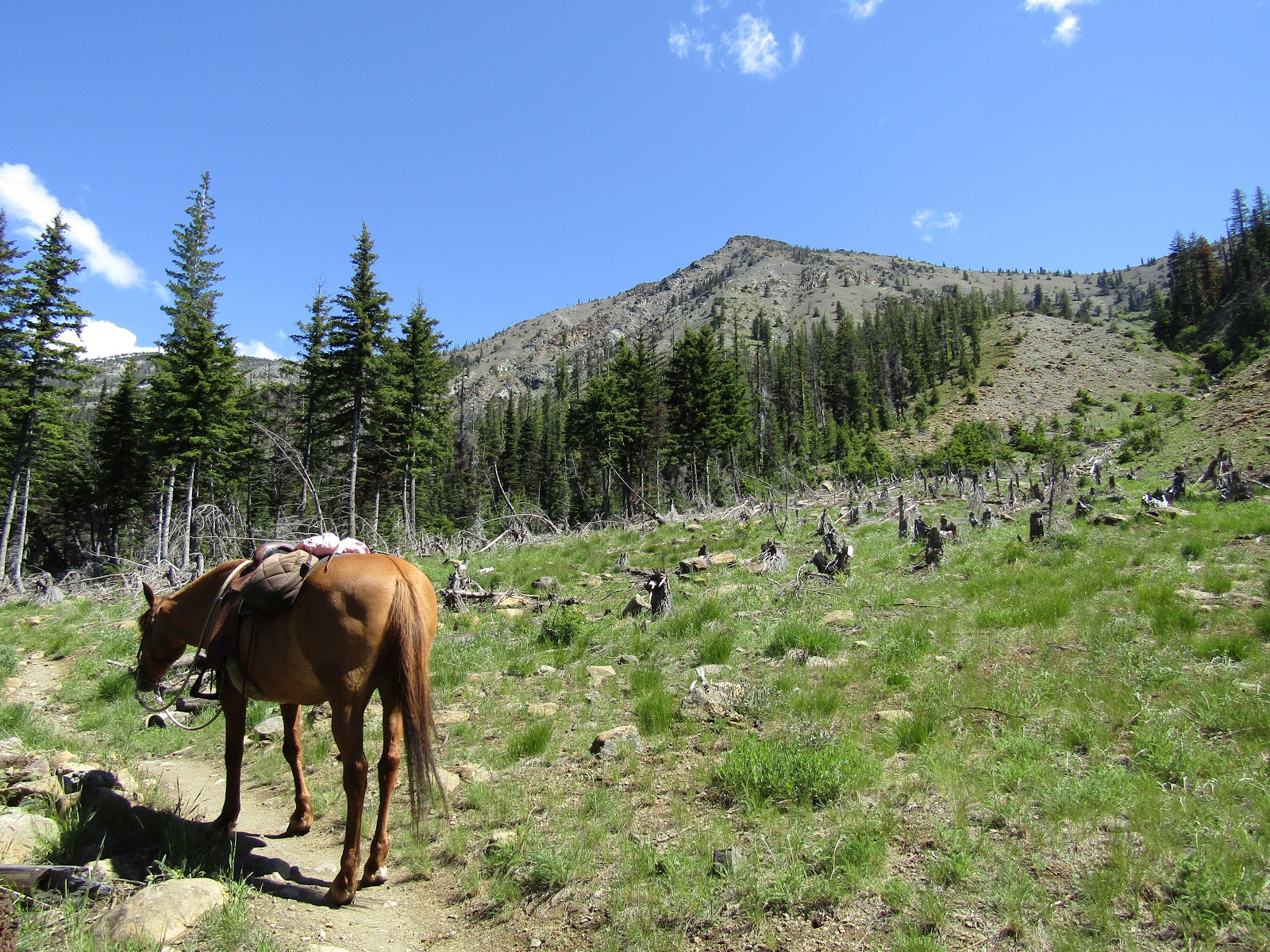
On my first day I decided to do the Miller Peak Trail and loop back down the Iron Bear Trail which is a 13 mile ride with about 3800 feet elevation gain. This trail is in the national forest and is shared with motorcycles. On the plus side, the trails had been cleared, ( the FS website was incorrectly stating they were not ) on the minus side it was the weekend and I had already heard a couple of motorcycles pass my campsite earlier in the day, and I was hoping I was not going to run into any of them on a cliffy section of trail.
Miller Trailhead has three spots for camping, but only two that you could fit a trailer into easily. There is a bathroom with a garbage can, and stock water from the creek. You need a NW Forest Pass to camp or park there. No corrals, potable water or manure bin.
 |
| You can camp at Miller Peak Trailhead. |
I climbed steadily until I reached Miller Peak, where there are some great views. The actual loop bypasses the peak itself, but I rode the extra mile or so to get to the top. The last little bit was a rocky scramble, so I stopped just below it.
 |
| The Miller Peak Trail follows Miller Creek for the first part of the ride. |
 |
| Views from the Miller Peak Trail. |
 |
| Just below the very top of Miller Peak. |
 |
| Heading back down using the County Line Trail. |
I took a break at the top, then went back to the junction and proceeded to do the rest of the loop. At this point I heard motorcycles coming. It's a pretty rough trail and in my opinion, they are nuts to want to do it on a motorcycle, but they probably think I am nuts to do it on a horse.... in any case, they have no choice but to go fairly slow, so I had time to get off the trail. I ran into a couple more later on, and they stopped and turned their bikes off. I kind of doubt it's quite this busy during the week, but it was a Saturday. Also the area had just opened to motorized use as of June 15th which just happened to be the day I rode it.
 |
| Views from the County Line Trail. |
 |
| The Stuart Range is partially visible from one section of trail. |
On my way down I got hit by a couple of storms. I waited the first one out under a tree and did not really get very wet BUT the rest of the trail was very brushy, so as I continued riding, I got soaked anyway from all the water getting dumped on me from the foliage. During the second storm I found an even better tree and a couple of ladies that were hiking huddled under there with me for awhile. It wasn't cold out, but I was delighted to get back to camp and get into dry clothes.
The weather was fantastic the following day and so I rode over to the Stafford Creek Trailhead.
Stafford also has a couple of camping spots, one you could probably fit a trailer into, but I wouldn't recommend it, this is a busy place with cars lined up on both sides of the road. There are plenty of large dispersed camping spots on the road just before getting to the trailhead that would be preferable. There is a bathroom with a garbage can and stock water from the creek. No corrals, potable water or manure bin. You need a NW Forest Pass to camp or park there. There is a fee station where you can buy a day pass if you don't have the yearly one.
This trail climbs steadily, but not as steeply as Miller and it is gorgeous all the way up. This is NOT a motorcycle trail but mountain bikers can use it. I kept running into backpackers in droves on their way back down, after spending a soggy night on the mountain. Trail runners were passing me on the way up, and one guy asked me if I was going all the way to the top and I said yes.
 |
| On the Stafford Creek Trail. |
 |
| On the Stafford Creek Trail. |
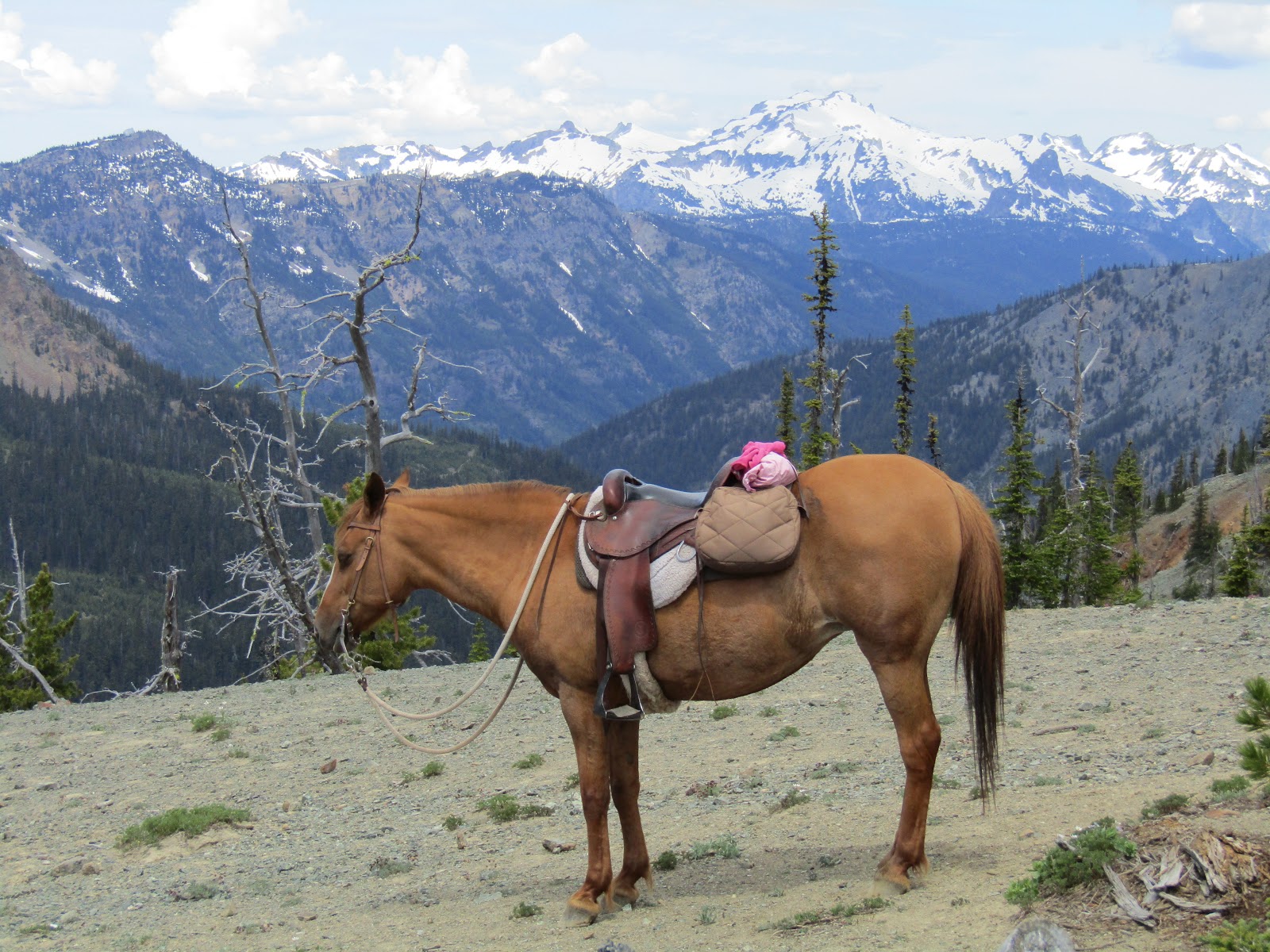
About 3/4 of the way up, there is a nice meadow where all the backpackers put up their tents. After the meadow it becomes very barren for awhile and then you climb over a ridge to Navaho Pass and BAM! you get hit in the face by a view of the Stuart Range that will take your breath away. I hung out up there for awhile and got a kick out of watching the hikers reactions as they saw it for the first time.
I took a lot of pictures but it is one of those places where a camera just can't capture the vastness and all of the small details.
 |
| It just gets prettier and prettier on the Stafford Creek Trail. |
 |
| The meadow where the backpackers camp. |
 |
| Gets a little barren near the top. |
 |
| Wow....the Stuart Range is amazing. |
 |
| The hikers behind my horse are impressed with the view, but Rina... not so much! |
As I was taking a break the trail runner I mentioned before came by again, and I asked him where he had been. He said you can continue just under a mile up to Navaho Peak and the view from there is amazing. Normally I would have been all over that idea, but he said it was very steep and my horse was looking a little wilted from all the climbing of the last couple of days, so I reluctantly decided not to do it. Instead we headed back down and it was considerably less busy on the way out.
The following day was a "pack up camp and drive over to the next destination day" and a day off for my horse. I arrived at De Roux trailhead/camp around noon, and it was deserted so I picked a spot and got all set up. I twiddled my thumbs for the rest of the day hoping my horse was getting nicely rested up for our next couple days of riding.
De Roux has five sites, some with highline poles set up, a bathroom, and stock water from the creek. The last two spots have the easiest access to the water and are the most roomy. There are also a few hitching rails and it is free to camp if you have a NW Forest Pass. There is a fee station at the beginning of the spur road that leads to camp, where you can buy a day pass. Again, no corrals, potable water or manure bin.
 |
| De Roux Trailhead/Camp. |
 |
| My spot at De Roux. |
My plan was (hopefully) to do a loop from the Boulder De Roux Trail to Gallagher Head Lake, up Fortune Cookie Pass ( love the name) and then down the Esmeralda Basin Trail. However I knew there was a good chance that would not happen, even though the elevation wasn't any higher than the two previous rides I had done, this area had more valleys and shaded areas where snow could be lingering.
It's a decent climb to get to the lake with lots of small waterfalls to catch glimpses of through the trees along the way. The trail had been cleared except for one log and it was easy to get around. Motorcycles can use this trail, but I did not see any all day. When I was less than a quarter of a mile from the lake I started to hit big snow patches. It took awhile, but we got either through or around them and finally made it to the lake! Once there, I rode a bit further but trying to follow the Fortune Creek Jeep Road past the lake the snow just got deeper and deeper. So instead of doing the loop I followed the jeep road in another direction, climbing up to a high point for some awesome views.
 |
| The bridge over De Roux Creek was looking a little sketchy so we went through the water. |
 |
| At the junction for Gallagher Head Lake. |
 |
| Views from the switchbacks up towards Gallagher Head Lake. |
 |
| At Gallagher Head Lake. |
 |
| At Gallagher Head Lake. |
 |
| Riding on the jeep trails above Gallagher Head Lake. |
 |
| Another view of the Stuart Range from afar. |
 |
| Looking way back down the valley we had come up. |
Later that day back at camp, a couple of ladies on horseback ponying a pack mule rode by and wanted to talk to me. They wanted to know which trail I had done and whether it was cleared. It turns out they work at High Country Outfitters which is located on the main road just before the turnoff to De Roux. They were clearing trails and asked me for a favor, whatever trail I did the following day, would I leave them a note and tell them what the conditions were, so they could plan accordingly.
I had a choice for my last day of riding. Go up the Iron Peak Trail and possibly do a loop from there or go up the Esmeralda Basin Trail, which was where I was supposed to have looped around the day before. I picked the latter, out of curiosity to see what I had missed.
This trailhead is actually not right at De Roux, but there is either an access trail to get to it, or you can ride the road. Although the parking area is plenty big enough, you are not allowed to take trailers up there.
 |
| Riding the road to Esmeralda I noticed some climbers on the cliffs way above me. |
 |
| Esmeralda Basin Trailhead. |
This is a fairly easy trail compared to some of the others I had already done, and it gets quite a bit of use. I dutifully counted downed trees along the way for the outfitter ladies, 13 in all, but they were very easy to get around, since most of the trail is very wide except for a switchback section near the top. This is not a motorcycle trail, but mountain bikers can use it. After passing a couple of beautiful meadows, doing the switchbacks, and then skirting a very large snow patch, I arrived at the top. I left my horse below me and hiked up a small hill to get the full scope of the views in every direction.
 |
| On the Esmeralda Basin Trail. |
 |
| At the summit of the Esmeralda Basin Trail. |
 |
| More views from the hill I climbed. |
 |
| I saw the tip of this mountain the day before, but who knew it was actually this big! |
 |
| From the summit of the Esmeralda Basin Trail. |
 |
| Heading back down the Esmeralda Basin Trail on the narrower section. |
On the way down I detoured briefly up a trail with a sign for Lake Ann, but after going up some rocky switchbacks, it leveled out and I came upon a lot of snow so I had to turn around.
I was originally going to stay another night but since my ride that day was much shorter, I was done much earlier than normal. Also once I reached camp it started to get stormy, so I left a note for the outfitter ladies (hope they got it) packed up and drove half way home.
Brooks Memorial State Park is conveniently located in the middle of most of my trips to Washington. I have stopped there before, just to rest, but this time I spent the night, although it is right next to the highway and not exactly peaceful and quiet, it was nice to not have to drive as far the next day. For
Brooks Memorial info.
GPS COORDINATES FOR MILLER TH
GPS COORDINATES FOR STAFFORD CREEK TH
GPS COORDINATES FOR DE ROUX


No comments:
Post a Comment