The Quincy Wildlife Area in Washington is known by a few names such as Ancient Lakes and Burke Lake and over the last few years I had seen other people's pictures and heard enough about it, that I figured it was time to check it out in person.
 |
| Ancient Lakes. |
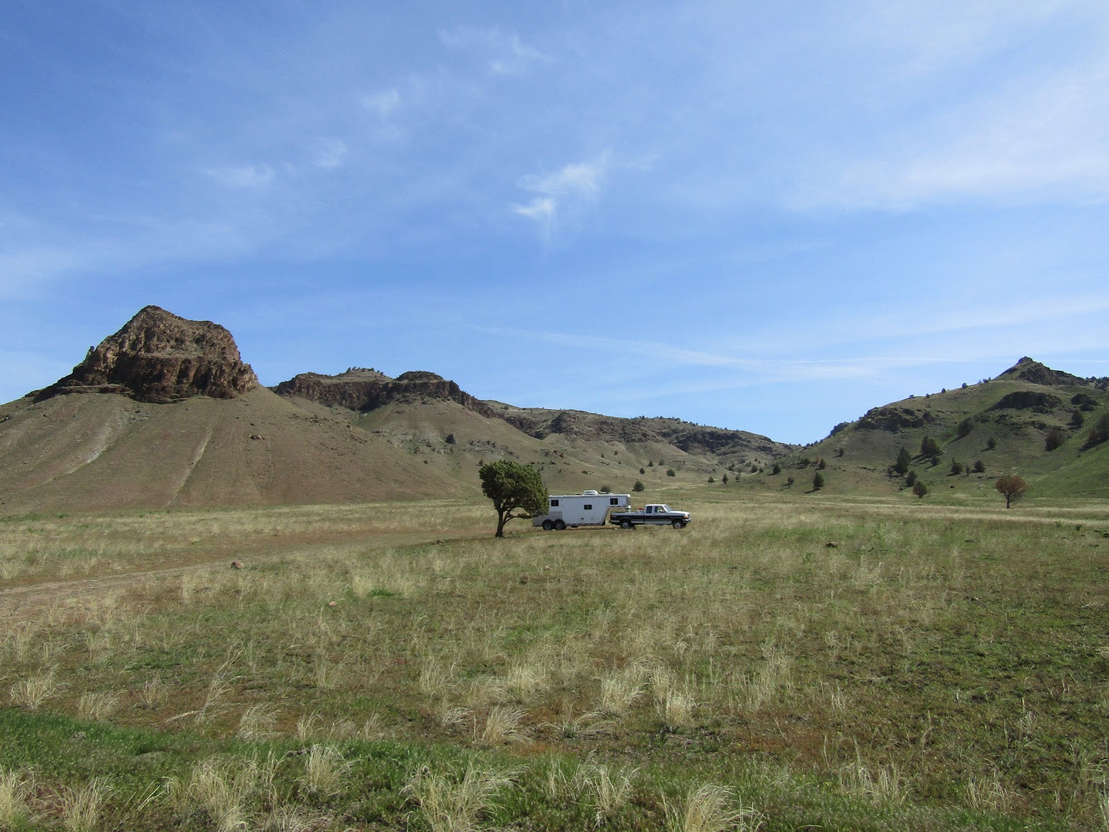
April turned out to be a great time to be there, good weather, not hot enough for the rattle snakes to be out yet, and as it turned out a lot of other people had the same idea. I arrived on a Tuesday and was surprised to see as many people camped there as I did, mostly fishermen. The main road runs through the area for about 4 miles, on each side of the road there are either trailheads or parking areas next to lakes. If you drive through the parking areas, there are smaller roads that lead to plenty of camping spots. When I first arrived I parked in a pullout off the main road and figured I could definitely camp there, but I would go for a ride first and if I saw a better spot, I would move my rig. As it turned out I chose to stay where I was. Most of the better spots where I could have put up a corral were taken. I also had a bit of a wind break beneath a small hill, and I soon learned it can get mighty windy on occasion! During the next couple of days I saw many horse trailers arriving, and I noticed that most of them camped up along the south side of Burke Lake right before getting to the reservoir.
 |
| My camping spot. |
To get there: This area is between George and Quincy WA. Take exit 149 from 1-90, in five miles take a left on NW 5 Rd. also called White Trail Rd. In just over 3 miles look for the sign on a corner that says "public fishing" and take a left onto the gravel road.
The gate into this area is closed October 1st through March 1st. You can still ride or hike there but motor vehicles aren't allowed in during that time.This area is dispersed/primitive camping, there are no corrals or amenities. However there are numerous lakes and ponds everywhere you look, so it is possible to get stock water that way. Also there are quite a few bathrooms throughout the area. It is free to camp there but you need a Discover Pass. Trees are few and far between, so it would be hard to highline, but some people get creative and attach a rope from their trailer to a rock on a hill. If you don't like primitive camping or you want an easier way to get into some of the lower trails, there is a horse camp on property nearby. I did not ride over to see it, but this is the link with info about it.
Bishop Recreation Area
 |
| Quincy Lake. |
The camping areas are at the highest level of the area, then the land drops off to several other levels of benches, with lakes and waterfalls all the way down to the Columbia River.
I started riding over to Stan Coffin Lake first since I had seen some large white birds while driving in, which turned out to be pelicans, and I wanted to see them up close.
I then rode over to the trailhead for Ancient Lakes. I didn't get very far before finding the trail to be impassable to horses. I figured there must be another way to get down to the beautiful lakes I could see below me and I did indeed figure that out eventually, but for the remainder of the first day I went back and rode alongside Quincy Lake and then over to Burke Lake. I learned that you have to be a bit of a detective to find the horse trails, nothing is marked or signed but the regulars that ride there have made trails that go everywhere, you just have to find them. Sometimes a small pullout along the road with a parking spot, but no obvious signs of a trail, will actually have a trail at the far end of it. I just decided to follow every trail I saw, and look for telltale hoofprints.
 |
| So many lakes in every direction. |
 |
| Pelicans on Stan Coffin Lake. |
 |
| Looking down onto Ancient Lakes from the trail that becomes impassable to horses. |
 |
| The first waterfall going down into Ancient Lakes. |
 |
| Quincy Lake. |
 |
| Quincy Lake. |
As I was just about to get back to my camp spot, a lady saw me riding by and came over to chat. Although she did not have her horse with her, she wanted to come back and ride at some point, so she was asking me about some of the trails. I told her I would let her know what I found out the following day.
In the morning I decided to ride to the south gate of the main road. The south gate used to be unlocked and you could drive in from that direction as well, but unfortunately due to vandalism it is closed indefinitely. On the way over there I started down the trailhead to Dusty Lake and again realized this was not really a horse trail, so I came back up and continued on. The main road narrows and then follows along the shores of Evergreen Reservoir for awhile. After passing the gate, I found a trail that was heading in the direction I wanted to go, so I followed it until I got to the power lines that run up above the Columbia River. I stood on the edge and looked out at the two ravines or coulees as they are also called, that go into Ancient and Dusty Lakes.
 |
| Looking down onto Dusty Lake from the main trailhead. |
 |
| Views from the trail that's by the south gate. |
 |
| Someone's former home. |
 |
| Looking down onto the Columbia River. |
 |
| The view back over towards the two ravines/coulees. |
A trail continued off to the south, so I kept going, thinking maybe it would just go to another view of the river, but instead I found a trail that dropped me down off of the plateau I was on. At this point I was directly below the Gorge Amphitheater which is an outdoor concert venue that has been considered one of the most scenic concert locations in the world. I can see why.
From there I could have ridden over to the two ravines, but it was getting late, the wind had really picked up through the gorge, and I got caught in a little rainstorm.
 |
| Deer on the way down towards the Columbia River. |
 |
| The Gorge Amphitheater. |
 |
| Evergreen Reservoir. |
On my way back I ran into Elaine, the lady I had met the day before, and her husband Phil.
We chatted for a bit and I told them where I had gone that day, they said they were going for a walk and would go over to where the other horse people were camped and ask them which trail I should take that would be a more direct route down to Ancient Lakes. Later they came by and told me where it was, which turned out to be very close to my camp spot! So the next day that is where I went. The trail has an amazing view of the lakes from above. I was riding around down below when five ladies on horseback came down the trail as well, we waved at each other, but weren't close enough to say hi. Coincidentally although we went in different directions we saw each other again later in the day since we were all heading back at the same time.
 |
| From the ledge overlooking Ancient Lakes. Hard to tell scale in pictures but the little dots above my horses right ear are tents. |
 |
| Ancient Lakes. |
 |
| Some ladies ride along the trail below me. |
After admiring the lakes for awhile, I started riding towards the Columbia River, I had to drop down onto another bench, riding over a lava field for awhile. There are so many trails and roads down below you could really explore all day. I went north briefly but eventually I turned around because I wanted to go and see Dusty Lake.
After hanging out at the lake for awhile I was riding back and got hit by a brief hail storm. As I was cantering along a piece of hail got me right in the eye, although it wasn't especially painful, I had to keep my eye shut for awhile until it melted!
After my ride I walked over and visited with Phil and Elaine for awhile.
 |
| On the lava field heading down onto another bench. |
 |
| Just above the Columbia River. |
 |
| Taking a rest on the way to Dusty Lake. |
 |
| Dusty Lake. |
 |
| Dusty Lake. |
 |
| On the way back into Ancient Lakes after the hail storm. |
I did two 6 hour rides and a short 2.5 hour ride in three days and I still could have explored more of the area.
But the next day the plan was to drive halfway home stopping at Brooks Memorial State Park, and ride the 9 miles of equestrian trails that they have. But once I got there it was cold and raining and I became uninspired pretty quickly, so I hung out for awhile and took a break while my horse mowed their grass.
Brooks Memorial is on Hwy 97, but the signs and arrows pointing towards the state park are NOT where you turn to get to the horse camp, it is actually on the opposite side of the highway. After passing by the ranger station, take the right turn at the fork towards the group camp. There are only two camping spots with nice larger pipe corrals, a porta potty, plus another bathroom a short walk away in the group camp, water spigots, and a creek. The downside is the highway is right beside the camp.
Update: I stopped there again in 2023 and the only horse camping left is the group camp that you have to reserve, which has corrals. What was once the small horse camp is no longer, the corrals are gone, and there is just a porta potty and a good sized day use area for parking to ride the trail.
 |
| Brooks Memorial State Park Horse Camp. |
What a great first trip of the season!
Happy Trails!
GPS COORDINATES TO ANCIENT LAKES
GPS COORDINATES TO BROOKS MEMORIAL