 |
| Red's Horse Ranch. |
I did nothing but drive the first day arriving at camp at about 4:30 pm. On the forest service website and also in my hiking book the description of the gravel road leaving from Cove, OR to the camp makes it seem relentlessly steep and washboard, but I found it to be a decent road, of course everything is subjective, but I've personally driven worse roads than this. ( Don't be mad at me, if you end up hating this road! )
Moss Springs is a large camp with an interesting set up, there are 8 official campsites, one large parking/day use area and then 4 other day use areas that you can also camp in. At first I wasn't sure what to make of it, because the day use areas are nicer than the camp spots, in fact three of them have corrals whereas only one of the actual campsites has a corral, the rest only have either star feeders or hitching rails. The corrals are larger than normal, slightly dilapidated, and are not divided.
The funny part is, you have to pay $5.00 per night to camp in the campsites but the day use areas are free, if you have a NW Forest Pass. There are two bathrooms with garbage cans, stock water from a stream, which is close to the entrance to camp, but no potable water and no manure bin.
 |
| One of the corrals at Moss Springs Horse Camp. This is a day use spot. |
Although there were a number of vehicles parked in the lot and also in a few of the camp spots, I soon realized there wasn't a soul around. This is a popular place to pack in and/or backpack, so everybody was out in the wilderness already , and I spent a quiet evening alone.
 |
| Large parking area at Moss Springs Horse Camp. |
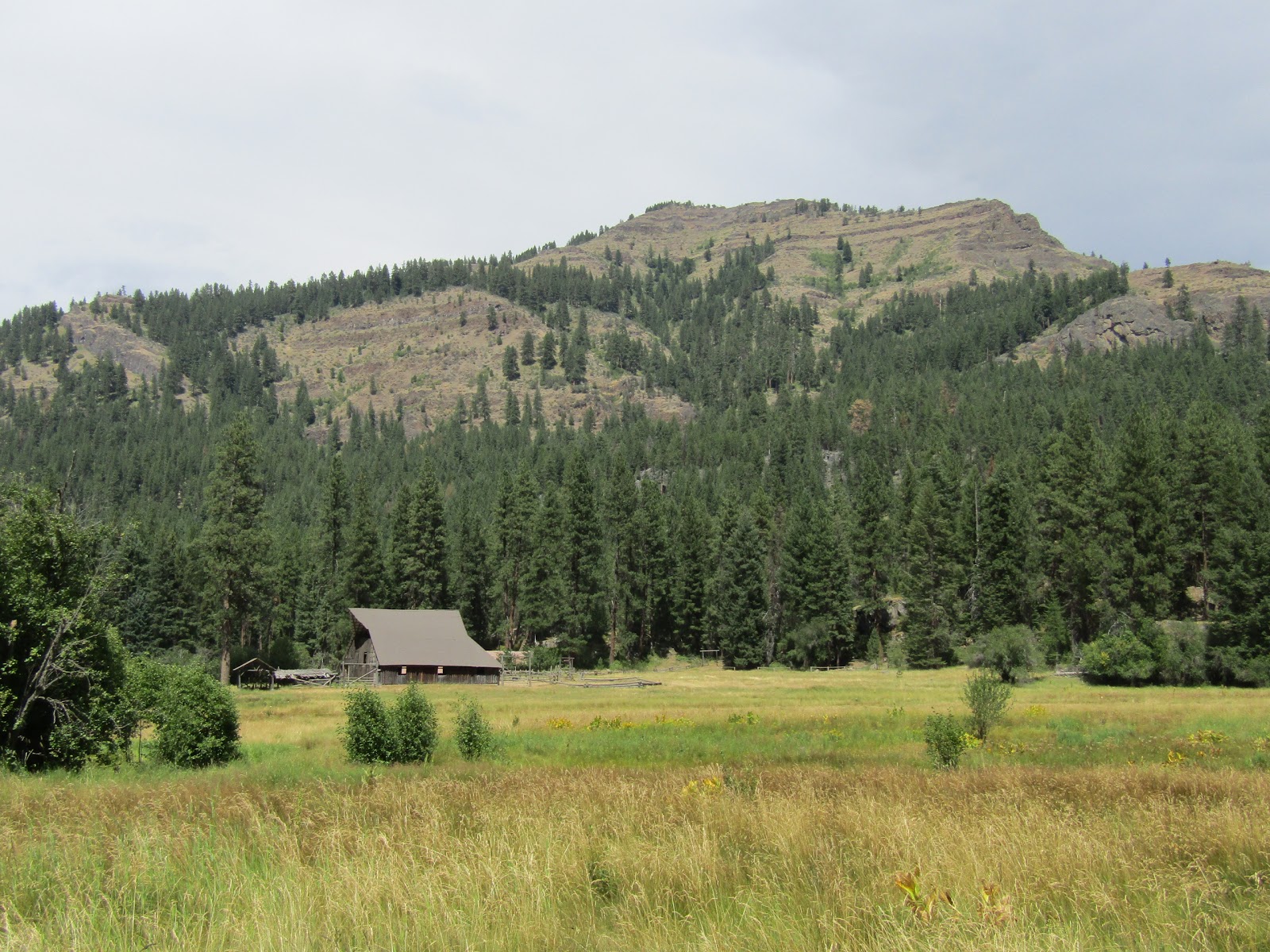
Although I had never camped there before, I had heard about Red's Horse Ranch so that was my destination for my first day of riding. It's 8 miles one way along a mostly forested trail, you follow the Little Minam River for awhile until reaching a ridge where you drop down to a beautiful valley. Red's Horse Ranch, the Minam River Lodge, as well as a couple of airstrips are all situated along the Minam River.
 |
| The trail splits 100 yards in from the trailhead, at Moss Springs Horse Camp. |
 |
| On the trail to Red's Horse Ranch, looking down on the Little Minam River. |
 |
| The airstrip at Red's Horse Ranch. |
 |
| The caretaker's horses at Red's Horse Ranch. |
 |
| Riding over to Red's Horse Ranch. |
As I approached the ranch a guy came over and said hello, followed soon after, by his wife. About an hour later I was still chatting with them. Roger and Debbie filled me in on the history of the area and the ranch which is now owned by the forest service. It is maintained by volunteer caretakers that are only allowed to stay one week, so every week new people come in and take over. There is no shortage of people wanting the opportunity to do this, and Roger and Debbie have been doing it for ten years. They look after the place, fix things, and greet visitors such as myself. They have potable water and restrooms for the public, and you can let your horse have a drink at the trough, but you cannot stay in any of the buildings.You can however pack in, and find a nice place to camp right nearby along the Minam River, or at the end of the airstrip where there is an old cabin.
From the forest service website:
History of the ranch
There was a plane parked at the end of the field so after saying goodbye to Roger and Debbie I had myself a nice gallop along the airstrip and then met the fellow that owned the plane whom I also had a chat with for awhile. He was planning to set up a tent and spend the night, and was mostly there to fly fish. A lot of planes fly into this area to visit Minam Lodge which is just a half mile or so from Red's Horse Ranch. After yet another gallop along the airstrip, I rode over and took a look at the lodge as well. Not too long ago you could ride in and stay there for a reasonable rate, but a year ago it acquired new owners, and it will now cost you an arm and a leg. There are no roads that reach this area, but with people flying in, pack outfitters taking people down on horseback, and backpackers hiking in, they seem to have a lot of visitors.
 |
| Rina checks out her first plane up close and personal. |
 |
| The old cabin near the end of the airstrip. |
 |
| The Minam River. |
 |
| The Minam Lodge. |
I do not pack in, but I was definitely reluctant to leave this valley, it would have been nice to stay overnight and go on a couple of excursions from there, but eventually I had to head back. There were a couple of new people at camp who had arrived in my absence, that were planning to pack in the next day. I talked to the guy about the trails for awhile, and he also filled me in on the status of camps and trails in the area of Washington that he lives.This turned out to be a very social trip for me, I was meeting new people non stop.
Before leaving home I had printed out a trail map from the forest service website, and I planned to do a large loop the following day. There is also a map on the board at the trailhead which turned out to be more accurate than the one I had. I heard that Back Country Horsemen had just recently been out clearing trails, so of course I am thankful to them that I was able to do this loop with no issues.
I followed the Lackey's Hole Trail to Cartwheel Ridge, then followed it to the junction with the Art Garrett Trail. I explored a few other side trails along the way but turned back, most were not clear, and then I finally finished the loop, staying in the saddle a pretty long time, just over 9 hours.
 |
| On the Lackey's Hole Trail. |
 |
| On the Lackey's Hole Trail. |
 |
| On the Lackey's Hole Trail. |
 |
| On the Lackey's Hole Trail. |
 |
| The view from Cartwheel Ridge. |
When I got back to camp there was another guy that had arrived, who came over to ask me about the trail conditions and we visited for quite awhile. Taylor is a retired forest service employee who currently lives in Montana and came over to Moss Springs to do a 10 day pack trip. He had worked in this area many years ago in the 80's and it was his first trip back since then. He was using three grey Scottish Highland horses/ponies, can't say I remember ever having seen that breed in person, but they are very cute and nicely built.
On my last day, I explored a trail that left straight uphill from my campsite, it was not cleared but I was able to get through, until it ended in my very own private meadow. Then I went back and followed the road for awhile that continues past the camp, and apparently leads to a couple other trailheads, although I did not go that far. I turned around after I got to a viewpoint way down onto Cove and La Grande. On my way back I saw a small herd of deer which of course is not a rare sight, but one had a tracking collar around it's neck, which is a little unusual to see.
Lastly I rode over to the Moss Springs Guard Station which is no longer being used, and I also checked out an area where some of the outfitters camp overnight.
Later that afternoon a thunderstorm rolled in, not really affecting me, other than a brief bit of rain. I could see it wreaking havoc over on the ridges I had just been on the day before.
 |
| The little meadow at the end of the unsigned trail behind camp. |
 |
| Deer with a tracking collar. |
 |
| The Moss Springs Guard Station. |
The next day I got packed up and drove back down into Baker City and was about 5 miles out of town on the highway on my way to North Fork John Day Campground when there was a heck of a noise suddenly coming from the right side of my truck. I slowed down not really knowing what was going on, but finally I clued in that I had blown a tire. That's a first for me, I actually was surprised it was a truck tire and not a trailer tire, since I've found most trailer tires are not very sturdy.
I was lucky that it happened on a flat stretch of road and there was also an area to limp across to the other side of the highway and be out of the way of traffic. I got out my manual and was trying to figure out how to get the spare tire out from under my truck, not as easy as it sounds, when a nice fellow named Doug stopped to help. He managed to get the spare off and was just started to jack up the truck, when another guy pulled over that worked for a tire company, and he just happened to have air and everything we needed to get everything changed over lickety split. Of course I offered him some money, but he refused, two very nice guys who saved me a lot of trouble!
I got back on the road and drove up past the small town of Granite to my next destination.
By then it was a Saturday and the camp was quite full, although not with any horse people.
North Fork John Day has 14 regular spots, 5 walk in tent spots, and one group site. Four of the spots and the group site are situated on a loop at the end of camp, which is the only area you can have stock. I was told that I could actually camp with my rig anywhere, but clearly a person would want to be close to their horse, so really the four at the end are the best choice because they are nearest to the two steel communal corrals, There are three bathrooms, a large day use area with a loading ramp, and along with the corrals there is a star feeder and hitching rails in the middle of the loop for anyone to use. It is $8.00 per night and the group site is $25.00. There is no garbage, potable water, or a manure bin.
 |
| The steel corrals at North Fork John Day Campground. |
After driving through and checking out the situation I actually chose NOT to camp there, I did not see an empty spot near the corrals, so I drove back up the highway about a 1/4 of a mile, to a great dispersed site I had seen on my way by, with a creek across the road and lots of grass.
A little later a guy stopped in on a motorcycle and introduced himself as the camp host. I asked him some questions about the camp and then I walked down later to get a better look at it. He saw my portable electric corral and mentioned that I could put that up in the stock area if I wanted to use it instead of their corrals, so my horse could have grass, but I was happy where I was, and all set up for the evening already.
The next day I rode on over to the camp and onto the North Fork John Day Trail and proceeded to do the 13.5 mile loop.
This trail follows along the river passing several old miners shacks, and the Bigfoot Hilton, which is also an old miners shack that has since been used as a shelter, but now is pretty dilapidated. A lot of these buildings are hidden near the river in the foliage, and you have to keep your eye out to spot them. Eventually you come to the junction with the Crane Creek Trail which I took to continue my loop. From there I rode through some nice meadows to the Crane Creek Trailhead, which is another option for riding this loop, instead of parking at the horse camp. The last part of the ride is along the N. Crane Trail where I got some views of the nearby Elkhorn Range in the Blue Mountains. The trails were all cleared except for a couple downed trees near the very end, that were no problem to get around.
 |
| On the North Fork John Day Trail. |
 |
| The Blue Heaven Mine. |
 |
| Rina at the Bigfoot Hilton. |
 |
| A rocky section along the Crane Creek Trail. |
 |
| The Elkhorn's in the distance from the N. Crane Trail. |
Although originally I had planned to spend a second night, just to have a leisurely drive back the
following day, I decided to leave after my ride instead, and arrived home safely with no further mishaps with tires!
GPS COORDINATES TO MOSS SPRINGS
GPS COORDINATES TO NORTH FORK JOHN DAY
following day, I decided to leave after my ride instead, and arrived home safely with no further mishaps with tires!
GPS COORDINATES TO MOSS SPRINGS
GPS COORDINATES TO NORTH FORK JOHN DAY