I am forced to be a little more creative this year with my camping plans due to snow still sticking around in the higher elevations, so I decided to check out the Klickitat Wildlife area outside of Goldendale WA. If you like wide open spaces where you can see for miles, grassy fields, oak trees, and wildflowers, this place delivers.
 |
| The Klickitat Wildlife Area. |
I often like to do rides on the way to, and from, a camping destination, and for years I have known that you can ride along the Lower Deschutes River in Oregon, right where it flows into the Columbia Gorge. I've hiked a short portion of it, but I wanted to do the whole 22 miles on horseback.
The Deschutes River Recreation area allows horses on the Old Railbed Trail only between March 1st and June 30th every year, and you have to have a reservation. It was somewhat confusing getting the reservation, I called a number which was the wrong number, then I was told to call the park directly, and the park told me to call the number I had already called. Long story short, to bypass all of this, the actual number is 1 800 551 6949. I paid my $8.00 and then got a never ending series of emails with instructions, a confirmation letter, then a pre-registration email, and finally the actual paper to print out and take to the park with me.
When I got there I followed the rules and checked in with the park host, who was a nice enough fellow, but he obviously didn't give a rip whether I checked in or not. The parking area for trailers is small, only enough room for two rigs, there is a manure bin to clean up after your horse, and there are bathrooms nearby.
 |
| The horse trailer parking lot at the Deschutes River Recreation Area. |
 |
| The Old Railbed Trail starts right at the parking area. |
I started off on the trail and rode the entire 22 miles, mostly in solitude, only seeing a couple of cyclists the entire day. I was lucky enough to stop and observe a couple of bald eagles fishing in the river.
Approximately halfway, there is a hitching post, and there are also a few bathrooms along the way. I believe they used to have water troughs set up for horses, since they don't want anyone riding down to the river, but although I did see a couple of them here and there, they were empty and falling apart.
At one point a train went by on the opposite side of the river, so not particularly close to us, but my horse had never seen one before, and got her panties in a twist about it for a little while.
Eventually I came across the old Harris Ranch and a little further past that, a railroad water tower built in 1909. Although the trail does continue on, this is where horses are supposed to stop, it was a long enough ride at this point anyway, so I headed back.
 |
| Looking back to the north along the Old Railbed Trail. |
 |
| On the Old Railbed Trail beside the Deschutes River. |
 |
| A bald eagle with his catch of the day. |
 |
| An abandoned boxcar on the Old Railbed Trail. |
 |
| A train across the river. |
 |
| At the Harris Ranch a house still stands ...barely. |
 |
| At the Harris Ranch. |
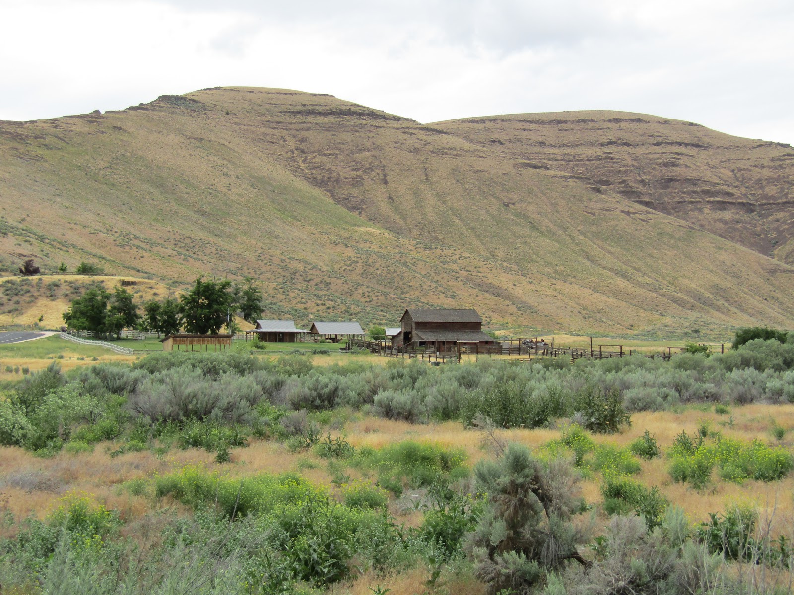
I then drove over the gorge and into Washington to The Klickitat Wildlife area which has dispersed camping only. As you drive up Grayback Rd. there are four designated camping areas along the way and then the road ends and it becomes more of a 4x4 track. This is nice because mostly no one drives in, unless they are wanting to camp, and so it was very quiet, and I did not see or hear a single other soul the entire time I was there. I chose the third campsite because it was tucked far back off the main road, but the fourth spot is probably the best one, with a fantastic view of Mt. Adams. It is free to camp but you have to have a Discover Pass, and there are no amenities whatsoever. My spot actually had a pond next to it, surprisingly, since all the small seasonal creeks had already dried up. The ground was so dry it took me three times as long to get my portable fence posts into the hard cracked earth.
 |
| My camping spot at the Klickitat Wildlife Area. |
The next day I decided to ride uphill to Grayback Mt. a good idea, since it turned out to be the only day I got good views of both Mt. Adams and Mt. Hood. The weather forecast had changed rather drastically between the time I left home and actually got to my destination! From sunny and nice, to cloudy with possible rain.
 |
| The Klickitat Wildlife area. Views for days. |
 |
| Views of Mt. Adams in the Klickitat Wildlife Area. |
 |
| Lots of wildflowers as I rode up towards Grayback Mountain. |
 |
| Almost to the top of Grayback Mountain. |
 |
| On top of Grayback Mountain. |
On the way back down Grayback Mt. I soon learned there are rattlesnakes in the area. I was surprised to see this guy since it wasn't very warm out, but he notified me of his presence, as they do, with plenty of warning. (anyone afraid of snakes can skip past this next photo)
After reaching the bottom of the mountain I rode to the east, exploring the many miles of hardly used forest roads, and stumbling across a couple of off the grid residences in the process. I then started heading cross country in the direction of my trailer, and came out right at it, BUT on the wrong side of a fence, skip to another hour later when I finally managed to find my way through.
The following day I rode down Grayback Rd. crossing over Glenwood Hwy and into another section of land along North Breaks Rd. which also has primitive camping areas for the first half of a mile. I rode up above the canyon looking down on the Klickitat River, but eventually I came across private property fences that blocked my way. As I was heading back, it started to rain, so I found a large accommodating Ponderosa and proceeded to wait it out...and waited, and waited... finally realized it wasn't going to stop, so I made my way back to camp getting pretty soaked in the process.
 |
| There were a lot of these bushes, in either white, blue, or shades of purple. |
 |
| Looking down on the Klickitat River. |
 |
| Sitting under a Ponderosa waiting in vain for the rain to stop. |
On the last day I was ready to head back to Oregon, hoping to find some slightly better weather at my next stop. Cottonwood Canyon State Park which sits along the John Day River opened in 2013, and has a people campground, several trails to hike or bike on, and The Lost Corral Trail which is open to horseback riding.
This park is located between Wasco and Condon Oregon, and although there is no horse camp, it is a nice detour of about 16 miles east of Hwy 97 if you happen to be passing by. Horse trailer parking is actually just past the sign for the park, over the bridge, in the JS Burres day use area. This lot is very large and was very full when I was there, but I saw no one on the trail, the vehicles all belonged to boaters.
 |
| A very busy parking lot on this particular day. |
 |
| Cottonwood Canyon State Park. |
The Lost Corral Trail is 8.6 miles round trip along the river and I had a sneaking suspicion that once I reached the end there might be.... a corral....and there was, although not an especially exciting one, just a bunch of panels to contain cows. There is a little loop at the end you can continue on, to take in a bit more scenery. I started out on the loop but only made it a few feet before two large snakes slithered out of my way. They had very dark bodies unlike the rattlesnakes I am accustomed to seeing, but sure enough they had rattles, so I backed my horse out of there. It was very overgrown and hard for me to see them ahead of time, and these two apparently were not feeling threatened, and did not feel the need to warn me, so I went the other way instead, where there was more visibility. I saw one more rattler on a short side trail, who did buzz at me, and then I headed back.
 |
| On The Lost Corral Trail. |
 |
| The John Day River along the Lost Corral Trail. |
 |
| On the Lost Corral Trail. |
 |
| The loop trail once you reach the corral area. |
 |
| The corral is tucked up against the rocks. |
 |
| On the Esau Loop Trail. |
What a fun trip! Now I have to figure out where to go next...melt, snow, melt!
GPS COORDINATES TO THE OLD RAILBED TH
GPS COORDINATES TO GRAYBACK RD
GPS COORDINATES TO THE LOST CORRAL TH