After unforeseen circumstances forced me to delay this trip on three different occasions, I finally got to leave on a Saturday and head over to Northern California to Hidden Horse Equestrian Campground, also known as Carter Meadows, in the Trinity Alps. I was slightly concerned about getting a spot on a Saturday but I had no issue, in fact the place was pretty quiet during my entire stay. Although this was only my second time camping in California I have to say I am impressed with the effort they have put in to make the camps as nice for horse people as they can, adding a few extras you don't normally find, especially out in the middle of nowhere.
 |
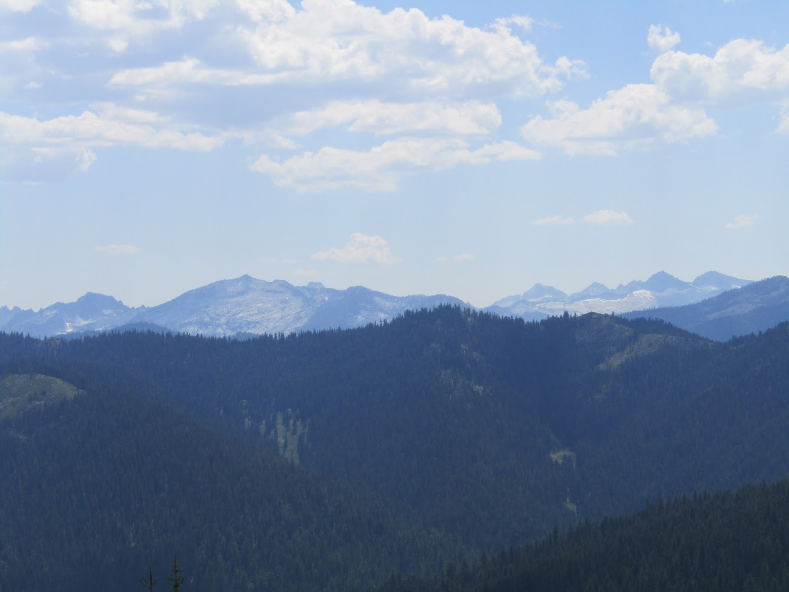
| The Marble Mountain Wilderness. That is marble, not snow! |
Hidden Horse has 6 sites with log corrals, except for spot #6 which has steel corrals, and is the only one that can be reserved. There are potable water spigots in each site, plus a couple of extra ones by the bathrooms. Spot #5 is accessible for people with disabilities.
There is a manure bin, with a couple of muck buckets, two bathrooms, two bear proof trash receptacles and a recycling bin. There is a $10.00 per night fee, and they do not charge extra for more than one vehicle.
Across the creek, close by, but not in view, is the Carter Meadows group camp with 12 steel corrals, a water trough, potable water spigots and a bathroom. There is also a large group cooking area.The gate is locked, since it is reservation only, so you can't just drive in there, but it is a really nice option for larger parties.
 |
| Hidden Horse Equestrian Campground. |
 |
| Hidden Horse Equestrian Campground. |
While at camp that night I could hear some clanging noises nearby, and after awhile I felt the need to investigate, it sounded like cowbells to me, and that is indeed what it turned out to be. There's a meadow near the group camp and the cows were grazing there. I heard them a lot more in the next couple of days, while riding. I'd be perched atop a mountain pass and hear a cowbell way down in a valley below me.
Early the next day I went outside and discovered my horse was not actually in her corral. Instead she was standing under a tree, so I gave her a good morning smooch. I was not concerned since she is not a horse that heads for the hills when loose, and she doesn't even care to do any canoodling with any other horses in the vicinity. But it was a bit of a mystery as to how she got out, since she is not an escape artist. I put her back in and watched her for awhile and the mystery was solved. She has always liked to itch her butt and neck on things, and this resulted in her sliding the gate open ever so slowly. The lever latch on the gate was a little sticky, and I hadn't closed it all the way, so I fixed it, and had no further issues after that.
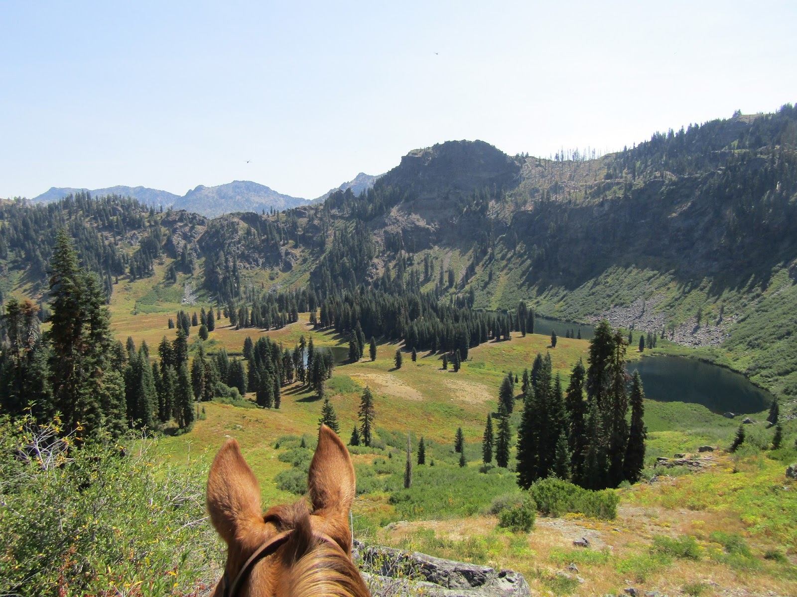
There is a map board at the trailhead and it was very helpful. I took a picture of it with my phone and referred to it while riding. There are a lot of options on the map with many loops that go on seemingly forever. My first ride was north on the PCT taking a detour over to see Syphon Lake, then past Jackson Lake, way below me, and then into the Russian Wilderness.
 |
| On the PCT. |
 |
| On the PCT. |
 |
| Taking a side trip over to Syphon Lake. |
 |
| On the way to Syphon Lake. |
 |
| Syphon Lake. |
This country is very similar to the Wallowas's in Oregon, but most of the trails aren't quite as difficult and the road driving in is paved, although there are a lot of steep sections with a few hairpin turns thrown in for good measure.
 |
| The Russian Wilderness. |
 |
| On the PCT in the Russian Wilderness. |
 |
| Jackson Lake, Mt. Shasta in the distance. |
On my way back I ran into a hiker carrying a sun umbrella which was a shiny silver metallic color. Rina is a very seasoned trail horse and has seen every configuration of backpack known to man, people covered head to toe in mosquito netting, strange headgear etc. but an umbrella was a little different. This guy was prepared though, having already had an encounter with a horse that was not pleased to see him, so he folded it back up quickly, and no harm was done. An hour later, I kid you not, umbrella guy #2 came hiking up the trail. This time I had to holler at him to fold it up, which he was happy to do. At the very end of this trip I saw yet another guy sporting an umbrella, so my conclusion is, it is the new thing hikers are carrying and it may be best to get your horse used to them at home to be prepared for a possible encounter!
The following day I went over to Trail Gulch, visiting Trail Gulch Lake first and then looping back down Long Gulch passing Long Gulch Lake along the way. I had wanted to do a longer ride but once I got to the top of the loop, I was on a ridge and all the other loops from there were all straight back downhill in different directions which meant I would have had to climb all the way back up, so I made the decision to stick with a shorter ride that day, just over 5 hours.
 |
| Riding up Trail Gulch. |
 |
| Trail Gulch Lake. |
 |
| Views from the top of the Trail Gulch loop. |
 |
| Looking down on Long Gulch Lake. |
The following day I went back to the PCT and headed south this time knowing that I also wanted to detour over and check out South Fork Lakes. The trail to these lakes is steep and rocky and turned out to be quite the climb, so it took a little longer than expected. I knew there was a way to do a loop once up there, but although I started out on the Saloon Creek Trail, it wasn't very well used and had not been cleared, so I turned around and went back down the same way. Continuing to ride along the PCT I found myself in some very pretty country. I could see across in the distance to some other mountains that make it pretty obvious why they are called the Trinity Alps.
 |
| Trinity Alps sign on the PCT. |
 |
Lower South Fork Lake.
|
 |
| Upper South Fork Lake. |
 |
| Our spot for lunch after the steep trip up to South Fork Lakes. |
 |
| Rina spots some hikers coming on the PCT. |
 |
| Some of the "Alps" in the distance. |
 |
| On the PCT. |
It was a pretty busy day on the trail, I met and chatted with a young German guy hiking the PCT backward, north to south. Then a hiker warned me about a guy up ahead sleeping on a rock, but when I got close I realized she was actually a girl with extremely hairy legs, I imagine shaving is not really a priority while hiking across three states. A couple of guys wanted to take my picture because they said they don't see horses often. Unfortunately I also met a guy who had an attitude problem about horses, and apparently thought he was an expert on them as well, he was a piece of work, not everyone is nice.... but most are.
That night my solitude was interrupted by a couple of ladies and three kids that came in and camped right next to me. They stayed for two nights, but rode just for one day, strapping the smallest kid on the largest possible horse. Meanwhile I gave my horse the day off and hiked up to Hidden Lake.
I was hoping for a nice swim once I got there, and although I did jump in a couple times, it wasn't a great swimming lake, too shallow, and too many dead trees.
 |
| While hiking I was looking across at where I was riding the day before. |
 |
| Cows invade camp in the morning. |
The next day it was time to pack up and do the hour or so drive to my next destination, Lovers Camp in the Marble Mountains. I stopped in the tiny town of Etna for fuel and hurried back up to the high country, as it was HOT in the lower elevations. The last 8 miles of this paved road is narrow, one lane and fairly steep.
Lovers Camp is a trailhead, with two separate parking lots, one for cars and hikers with walk in camp spots, and then an area for horses. I tucked my rig into a corner and made myself at home. There are four very large steel corrals, each corral has it's own water trough that you can fill with a spigot, but the water is not potable. There is a bathroom, but no garbage or manure bin, and they do not charge a fee for camping or parking.
The Canyon Creek Trail leaves from there, and it is a popular area for horse use. During the time I was there different rigs (oddly, most people had the exact same truck as me) came and went, with the majority of people parking and then packing in.
 |
| Lovers Camp. |
 |
| Lovers Camp. |
There is a map board at this camp as well, and this one is even better than the one at Hidden Horse. This one shows other trailheads in the area that also have corrals for horses, in fact I plan to return and camp at another one in the future.
Also besides the red lines used to mark trails on the map there are some black lines as well, which are trails unsuitable for stock, which was nice to know about ahead of time.
My horse was pretty perky after having a couple of days off, so we headed up the Canyon Creek Trail. This trail splits after a short while and there are two valleys you can ride through, Marble Valley and Red Rock Valley. I picked Marble Valley and the Sky High Lakes. I talked to a forest service lady I met on the way up, I told her how much I liked the huge corrals at camp and the easy access to stock water, and she said her husband had welded those corrals.
The lakes themselves are nice, but the whole valley is just gorgeous, even in mid August it was still so lush.
I met some ladies that were camping in the meadow, they were walking at the time, but warned me that several of their horses were loose, on purpose, up by their camp. I rode on past the loose horses and two of them tried to follow me briefly.
After exploring this area, I continued on to the PCT, getting a great view of Marble Mt. and took a side trail over to Big Elk Lake. This trail runs through a pretty recent burn area for awhile, but the lake itself is unscathed. I then rode past the Marble Valley Cabin on my way back to camp.
 |
| Sky High Lakes Valley. |
 |
| Lower Sky High Lake. |
 |
| Frying Pan Lake. |
 |
| Looking down on the Sky High Lakes. |
 |
| Marble Mt. from the PCT. |
 |
| Marble Valley Cabin. |
There were enough choices of places to ride, that I had to narrow it down, I couldn't do it all, so the following day I chose to go up Red Rock Valley and then took a side trail towards Little Elk Lake and beyond. On the map I could see that the trail might be a little steep, which turned out to be true. I climbed up, then down, then up, then down, quite a few times, by this time I was starting to think maybe I should have done a different ride, since it wasn't especially scenic.... when I finally arrived at Deep Lake, and oh my,what a treat that was. A gorgeous lake nestled between mountains in a lush green valley. The pictures I took do not do this place justice. I hung out there for about an hour while Rina contentedly munched the tall grass.
 |
| Deep Lake. |
 |
| Lunch time at Deep lake. |
On the way back I ran into a bow hunter, I was surprised to see him since I did not realize that California's bow season had already started. We talked for a minute and that is when I realized he was going in completely the wrong direction, so before he trudged along for miles and got lost, I redirected him towards the PCT, he wasn't thrilled to learn he had just climbed a rather long steep hill for no reason.
Later that evening back at camp, a truck drove in with four large goats in the back. Three guys got out and introduced themselves. Doug, Dave and Michael are also bow hunters and they use the goats to pack in some of their stuff. We proceeded to sit around shooting the breeze for the next few hours, nice guys, even though I think they figured out quickly that I am not a hunter, and never will be.
 |
| One of the pack goats coming to say hi. |
On the last day I rode back up through Marble Valley onto the PCT and went north. Fairly soon I was riding right through the marble, then along a ridge line for a long time with great views. And lastly, my destination for the day, which was Paradise Lake.
 |
| Riding through the marble on the PCT. |
 |
| On the PCT. |
 |
| On the PCT. |
 |
| The Marble Mountain Wilderness. |
 |
| Paradise Lake. |
That night a guy suddenly appeared at my trailer door and asked me where I had ridden that day and whether I had smelled smoke. The short version is, he was out for a brief hike and was going to take a swim in the creek when he smelled something burning. Turns out a campfire had not been put out properly and was still smoldering. He extinguished it, subsequently diverting potential disaster. As we talked, I realized that I had ridden by their campsite the day before and had seen the likely culprits. I described them, although there was not much that could be done about it at that point, and he said he would report it to the forest service the next day.
I spent one more night, and then drove home the next day, a very fun and diverse trip, so glad I finally got to ride in these two areas!
GPS COORDINATES TO HIDDEN HORSE
GPS COORDINATES TO LOVERS CAMP