A lot of the horse camps in Southern Oregon stay open until the end of October. Last year I headed over to
Fourmile Lake Horse Camp and did some riding in the Sky Lakes Wilderness. I knew I would eventually be back to check out some more of this area, and fall is a great time to do so.
 |
| Sunset on Mt. McLoughlin from the day use area at Willow Prairie Horse Camp. |
I started by driving over to the Varney Creek Trailhead in the Mountain Lakes Wilderness. I have a friend who is a ranger and works in this area, and she informed me that this 17 mile loop had been cleared and was ready to ride. The first week of October was a little chilly which meant some snow had dropped in the higher elevations, and as I was driving towards my destination I could see the evidence on the highest peaks and wondered whether I should have done this ride on my last day instead, to allow time for some melting to occur. Oh well, too late to change plans now.
The Varney Creek Trail leads 4.4 miles up to a junction where the Mountain Lakes Loop starts. First I came upon Lake Como, and then I rode up over a ridge and was looking down on the stunning Lake Harriette.
 |
| Lake Como on the Mountain Lakes Loop. |
 |
| Lake Harriette on the Mountain Lakes Loop. |
From here the trail climbs to a junction with another trail that goes to South Pass Lake. Originally my plan had been to add this extra 3 mile detour, but this is the area where I did indeed start to hit some snow patches. I can walk my shod horse across snow for about 10 seconds at which point it balls up so badly in her feet that I have to get off and dig it out, so it was not worth the extra headache.
 |
| At the South Pass junction, we hit some snow patches. |
 |
| On the Mountain Lakes Loop. |
 |
Aspen Butte on the Mountain Lakes Loop.
|
 |
| Mt. McLoughlin. |
The trail then goes past Whiteface Peak and starts to zigzag back down. Near the end of the loop is where I discovered cute little Eb and Zeb Lakes.
 |
| Views from the Mountain Lakes Loop. |
 |
| Views of Upper Klamath Lake in the distance. |
 |
| Zeb Lake. |
Getting back to the truck I had just enough time to make it over to the camp and get set up before dark.
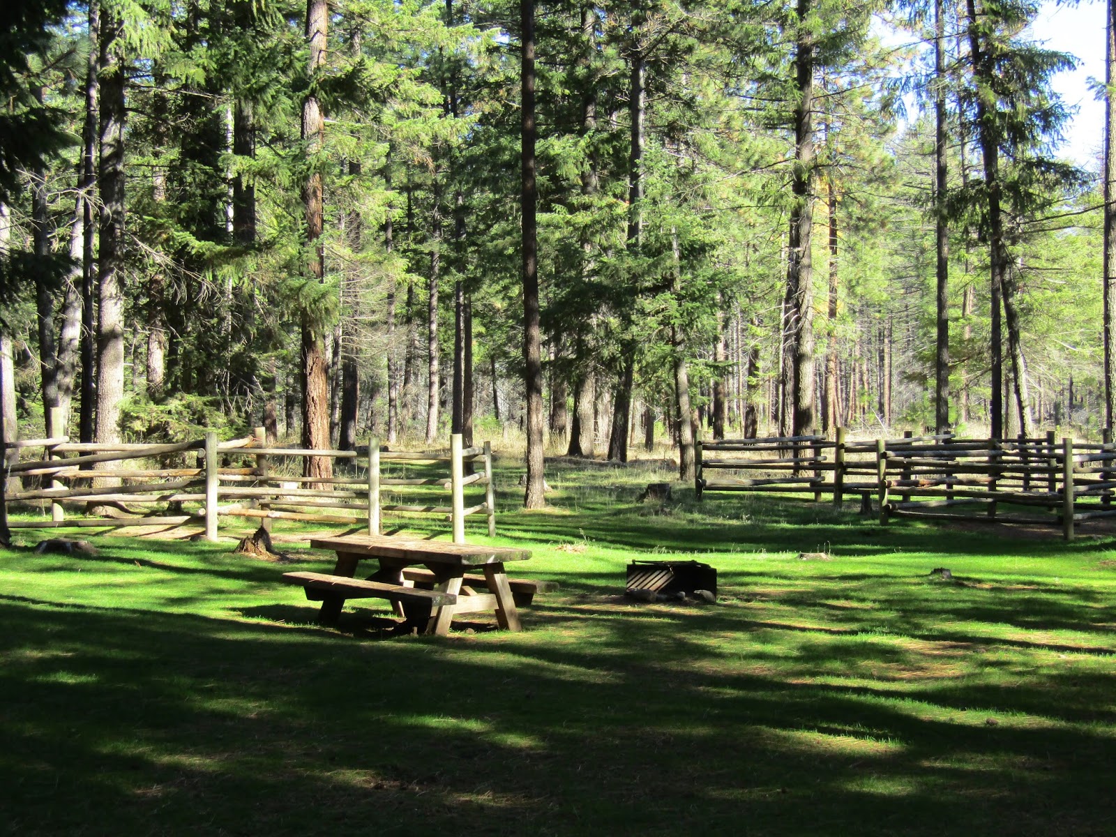
Willow Prairie Horse Camp is conveniently located between Medford and Klamath Falls and has 10 sites plus another site for the camp host. He was actually still there and will be until it closes. There is a bathroom, a large garbage container, and smaller recycling can, and a waste water dump. There is a trailer to deposit manure into, with it's own wheelbarrow. Several water troughs are positioned around the camp that make it easy to have access from any spot, and there is also a hand pump with potable water.
Update: in the summer of 2022 some horse campers reported to me that there was no potable water when they were there.
Most of the spots are roomy enough for bigger rigs, they all have four horse log corrals except for spot #5 which has six corrals. This camp is well maintained and looks like it gets a lot of use. It's $10.00 per night and you can reserve these spots online, although late in the year it is not necessary. There are signs at each spot that will say whether it is reserved or vacant. They are allowing non horse people to camp there as well.
 |
| Willow Prairie Horse Camp, spot #9. |
Across from the camp is a large day use area, with a set of two corrals, and a lovely view of Mt. McLoughlin.
Tucked back beside Willow Prairie meadow is Willow Prairie Cabin which you can rent, it also has it's own set of corrals, (there were four but one has fallen apart), and a water trough.
 |
| Willow Prairie Cabin. |
 |
| Willow Prairie Meadow from the cabin. |
The next morning as I was getting ready to ride, a guy that was camped there came by, said hello, and asked me if I was planning to wear any orange, which reminded me to grab my vest. He was a hunter that was just about to leave, but he said there were a lot of other hunters out in the woods. I was already wearing red, but I put my neon orange vest over top of that, and then went about bedazzling my saddle with bright green streamers of flagging tape. After all that preparation, and wearing this gaudy ensemble daily, I did not see a single hunter in all four days of riding!
The trail system here is a bit like a maze, but it's not particularly difficult to navigate especially if you stick to the main marked trails.There are a lot of other trails and roads going off in every direction from the main trails, and some are heavily flagged, it's as if someone bought out an entire store of flagging tape.
There are paper maps at camp at the pay station that you can take with you and the map is somewhat useful, mostly because the main junctions are numbered so you can see where you are. The websites say there are 19 miles of trails here, however there are a variety of trails that are NOT on the map, so there is opportunity to do more mileage than that. My strategy was to stick to the map at times, but also to wander off course when the mood struck me.
On the first day I did the trail system on the east side, most of this area is forested but there was a nice open meadow called Rye Flat with a view of Mt. McLoughlin that I ended up in. On my way back, to make it a longer ride, I went on some of the other non mapped trails for awhile. The largest Western White Pine in Oregon is out there somewhere, but the trail that I believe it is on had a large tree down across it, and so I did not end up finding it.
 |
| Rye Flat. |
 |
| Riding back down from Rye Flat. |
The following day I rode past the cabin and onto the west side trail system for awhile but I quickly became bored of looping around aimlessly so I got onto road 3735 and stayed on it until I reached the #5 loop which I proceeded to do, as well as loops 6 and 7. On pretty much every trail there are signs with arrows pointing you back in the direction of camp.
 |
| Notice the three camp arrows just on this one sign. |
On loop #5, my horse decided to take a nose dive, not on purpose, of course. She slipped, couldn't recover and went all the way down, but she also fell to the left, so I had no choice but to ever so gracefully bail off of her body, so she would not crush me. I've always been grateful that when horses fall. they jump back up instantly, it has saved my bacon a time or two. This time her weight was only on my left leg and foot briefly. We were both okay, and we continued on.
When I got back near camp, I also rode from the day use area for awhile on part of a short loop that bird watchers use, and then called it a day.
 |
| I am no mushroom expert but according to a friend these are Golden Pholiota. |
 |
| A very helpful sign on the trails near camp. |
On my final day I drove over to the Summit Sno Park which is right off of Hwy 140 and I did the section of the PCT to the south that goes through the Brown Mountain lava flow.
 |
| Brown Mountain from the Summit Sno Park. |
After leaving the parking area, you have to cross over the busy highway. There just happened to be road work going on at the time, and so I had to dodge a dump truck and other heavy equipment to get across to the other side.
An incredible amount of work went into constructing a trail through this large area of lava. I followed the PCT for about two hours one way, before turning around. You ride through lava, then a short stretch of forest, then lava, then forest, lava, forest... you get the idea.
 |
| On the PCT in the Brown Mt. lava flow. |
 |
| Views from the PCT. |
 |
| On the PCT with views of Mt. McLoughlin. |
 |
| This little guy was sunning himself along the trail. |
In a couple of the forested areas, there were some ground hornets, this is the time of year to watch out for them. My horse did get stung once, and I took note of where they were, so on the way back we hustled past them at warp speed. Meandering past them just gives them time to notice you, and they want to defend their nest.
As I was driving home along Hwy 140 and Westside Rd. there were some spectacular fall colors to enjoy.This may be my last trip of the season, although I am holding off on winterizing the trailer just in case!
GPS COORDINATES TO VARNEY CREEK TH
GPS COORDINATES TO WILLOW PRAIRIE
GPS COORDINATES TO SUMMIT SNO PARK